Rhossili Bay, Hillend and Rhossili Down
A seaside walk around a beautiful bay on the Gower peninsula
Google Maps Open Source Maps| Statistics and Files | ||
|---|---|---|
| Start: Rhossili | Distance: 3.9 miles (6.3 km) | Climbing: 232 metres |
| Grid Ref: SS 41646 88010 | Time: 2 hours | Rating: Easy |
| GPX Route File | Google Earth File | About Rhossili |
| Statistics | |
|---|---|
| Start: Rhossili | Distance: 3.9 miles (6.3 km) |
| Climbing: 232 metres | Grid Ref: SS 41646 88010 |
| Time: 2 hours | Rating: Easy |
| GPX Route File | Google Earth File |
Ordnance Survey Explorer Map (1:25,000)
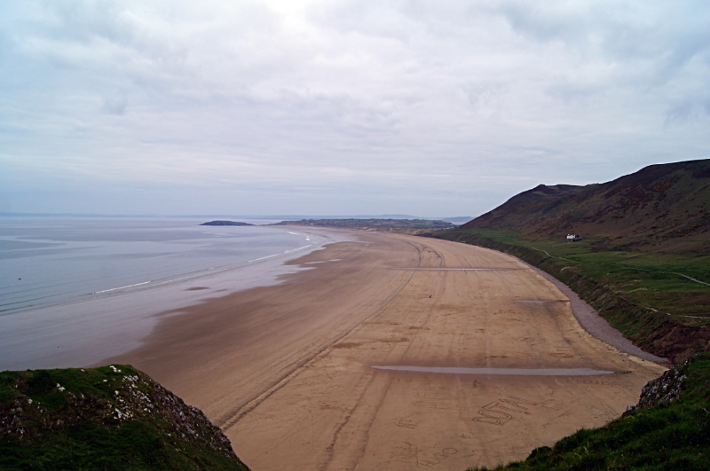
The Walk: The great sweep of Rhossili Bay - three miles of firm, golden sand scoured by Atlantic rollers - is a breathtaking sight for those who venture to the most westerly point of the Gower peninsula. This is one of the finest stretches of unspoiled beach in Britain, and it is now under the protection of the National Trust, which has a visitor centre near the car park at the start of the walk. The centre contains much information about Gower, past and present, and importantly it also displays the times of the tides. Which is essential as the beach in the bay and the link causeway to nearby Worm's Head can be covered at high water.
 Rhossili Bay
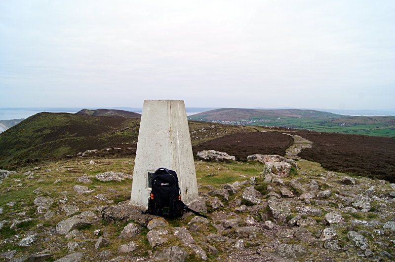 Rhossili Down
The walk begins from the car park in the remote village of Rhossili and heads straight down to the bay. Looking behind you, fine views of Worm's Head, a serpent like promontory, which is Gower's most westerly point, can be enjoyed. Worm's Head is a bird sanctuary, a haven for guillemot, razorbill and kittywake, as well as occasional migrants such as whimbrel, ring ouzel, grey wagtail and wryneck. Worm's Head can be reached on foot at low tide, see my walk of Worm's Head here.
Although Gower's climate is mild, powerful westerly gales have wrecked ships here in the past. The skeleton of the Helvetia, driven ashore in 1887, still shows above the sand. he most famous wreck was that of the South American 'Dollar Ship'. In 1807, and again in 1833, quantities of Peruvian dollars, dating from the reign of Philip IV, were uncovered by the tide. These were thought to be part of the dowry of a Portuguese princess. It is thought some of the treasure is still buried in the sands of Rhossili.
Turning inland at the dunes, the character of the walk changes completely. Sandy hummocks give way to open, grassy downlands and larks rather than gulls wheel through the sky overhead. On reaching the high ground of Rhossili Down, look out for two megalithic burial chambers known as Sweyne's Houses. Legend has it that this is the burial place of Sweyne, a Scandinavian sealord who may have given the name to Swansea around 4000 BC. Further on, Rhossili Hill Beacon, at 632 feet (190metres) the highest point in Gower, offers views to Lundy Island and even the Devon coastline on a clear day.
Acknowledgment: Text derived from the Out and Out Series; Discovering the Countryside on Foot. Pictures courtesy of Wikipedia.


