Tilberthwaite, Old Man of Coniston, Levers Hawse, Swirl How and Wetherlam
I have walked the Coniston Fells before, twice on a circular route from Coniston village, once with my brother Dave and once with my pal Steve. The walk with Steve is documented here. I have also walked on the other side of the Coniston Range, from Duddon to Dow Crag and the Old Man which included several more of Wainwright's Fells. All were exciting walks, the Coniston Range being one of my all time favourite places to walk. This time I wanted to start from a different place and in doing so I wanted to climb Wetherlam again as well as walking through Tilberthwaite. Why not start there I thought? And so I did. Here follows the story though my walk did not go exactly to plan. Hence the extra files for you to look over which are accurate records of my actual route. A case of haste over accuracy towards the end if the walk which added to the adventure.
Google Maps Open Source Maps| Statistics and Files | ||
|---|---|---|
| Start: Low Tilberthwaite | Distance: 10.0 miles (16.0 km) | Climbing: 1,308 meters |
| Grid Ref: NY 30632 01021 | Time: 5 hours | Rating: Hard |
| GPX Route File | Google Earth File | About the Old Man |
| Statistics | |
|---|---|
| Start: Low Tilberthwaite | Distance: 10.0 miles (16.0 km) |
| Climbing: 1,308 meters | Grid Ref: NY 30632 01021 |
| Time: 5 hours | Rating: Hard |
| GPX Route File | Google Earth File |
Ordnance Survey Explorer Map (1:25,000)
My GPS and Google Earth Files
My Actual Route (Open Topo Map)My Actual Route (GPX File)
My Actual Route (Google Earth File)
The Walk:
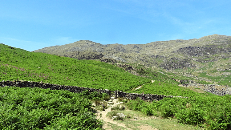
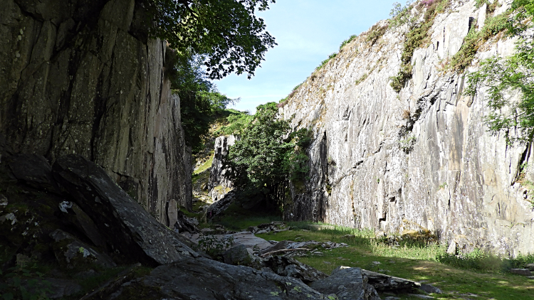 Low Tilberthwaite Slate Quarry
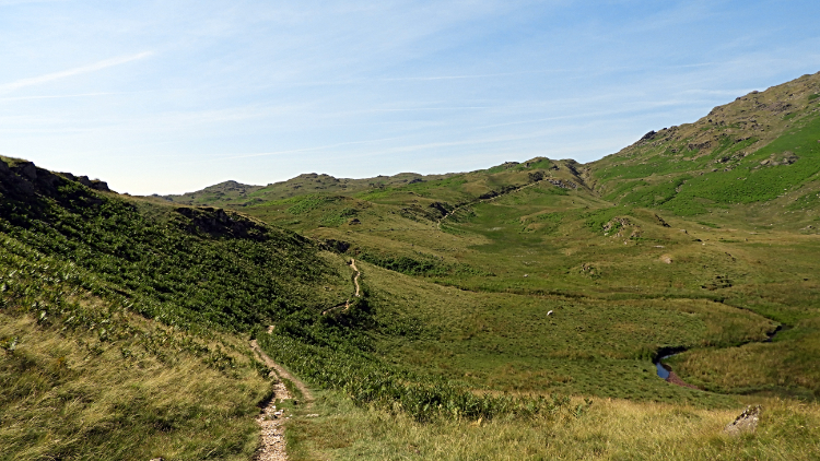 The path across Hole Rake
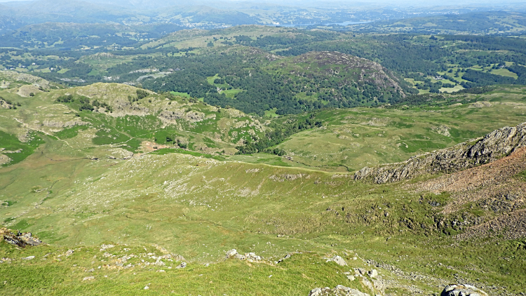
It was another of those wonderful Lakeland mornings which I woke too; the sun already beaming and climbing high into the midsummer sky when I opened the curtains of my room to imagine the day ahead. I was hasty to shower, dress, take breakfast and get on my way. Thirty minutes after breakfast and barely one hour after rising I was parking up in Tilberthwaite. Raring to go. I set out from Low Tilbertwaite, climbing the Tilberthwaite Ghyll path from the roadside car park beside the shoulder of Horse Crag to an extensive area of disused slate quarries. The path was stepped; a steep start and though it was early morning the summer equinox was just passed and the sunshine strong and stifling. I huffed and puffed up the steps past heaped hills of rejected slate, most of it looking good enough for roofing. I am no expert in slate quality control though so don't rely on me. I also left the path to explore the quarry works, long abandoned and being reclaimed by nature. Young trees, most of them healthy Ash, burst out from the sheer manmade cliffs. I was an half hour exploring the works, covering only a quarter mile before I rose out of Tilberthwaite Ghyll to the open spaces of the gorgeous high valley of Crook Beck. The Hole Rake path, a strong memory held from an earlier walk, invited me to follow it. I knew that once I had completed the walk along the rake the Old Man would be waiting.
 View to the Old Man from the top of Hole Rake
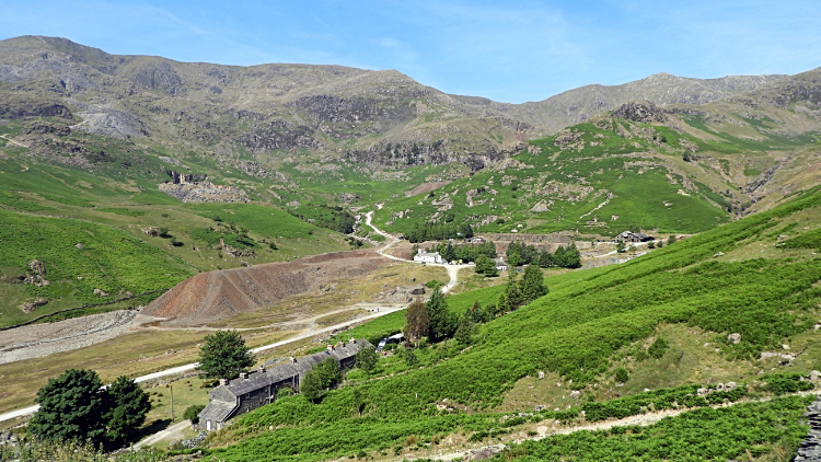 View across Coppermines Valley to the Old Man
I paced along the Hole Rake path quickly, able to do so for the first time after the steep ascent through Tilberthwaite Ghyll. It was a stupendous reveal at the summit of the rake with the Old Man of Coniston and its satellite mountains appearing in view with the amphitheater Coppermines valley of Levers Water Beck set down below me. I was so happy to be back and for a while I stood at the high point of Hole Rake taking it all in. Silent and unmoving I was in rapture. "This is awesome" I thought to myself. After my WOW moment of re-acquaintance with the view I sprung into action, descending carefully on the unmade, scree like and prone to slip track leading down from Hole Rake to Levers Water Beck. I knew to be wary and although I wanted to be down at the bottom in a hurry I took my time. Even so I slipped on the loose stone a few times. Not enough to fall but enough to keep my pace to a reasonable one. I got down to the valley floor safely but the mental and physical effort of breaking the pace of free walking had caused me to overheat a little. My feet were also over-warm from overusing the brakes so I stripped off my boots and socks and rather than find the Miners Bridge crossing of the beck I waded across. While naturally cooling my feet I also took a good drink of the fresh mountain water. It was delicious.
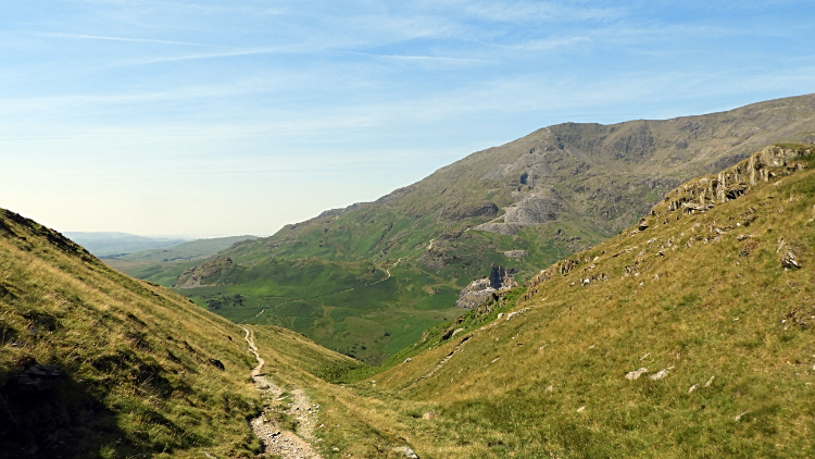
 Beginning the long climb from Church Beck
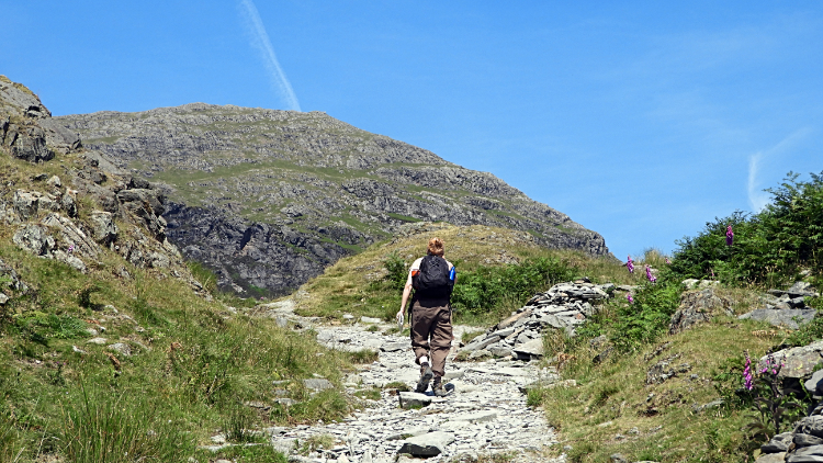 Climbing near Stubthwaite Crag
With boots back on I set off on the long climb from Levers Water Beck to the Old Man of Coniston. All of 630 meters climbing without a break. From experience I knew I was setting out on one of the toughest climbs in the Lake District but also one of the most rewarding. I thought to myself "It was hard when I was in my 30's and 40's. how about now I am in my 60's?". And then I thought "Still, I hope to be up here again in my 70's and with luck my 80's!". You never know. I knew to climb at a steady pace, especially as it was high summer, a very warm and sunny day, and yet to get hotter. So I did, meeting and greeting people on the way up. I had not seen anyone until Levers Water Beck. Now those walking out from Coniston village were on the same track. On the first section of walking up to Stubthwaite Crag some passed me but not all. I passed a couple a bit younger than me... as most were, who said they were going as far as Low Water. "You must go on to the top" I suggested and adding "It is just awesome". I had given them something to ponder. I continued my climb, stopping briefly at Stubthwaite Crag to sit for a minute and drink in the view south-east to Coniston village and Coniston Water.
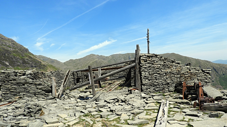 Redundant mine workings on the path to the Old Man
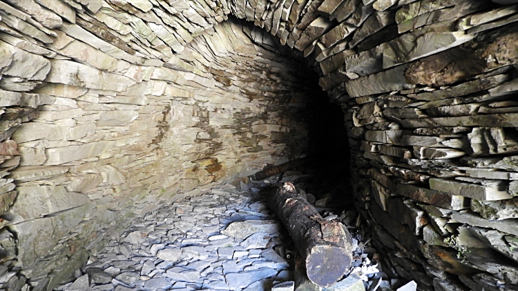 Quarry Tunnel near Low Water
From Stubthwaite Crag, 200 meters up from the valley and with over 400 meters of climbing still to go I resumed the climb. Again I met walkers on the ascent, some passing me and a few slowly caught up. Usually it was just a hi, hello or grunt as we fleetingly met on the trail but sometimes it was a chance meeting to stop and talk for a bit. And of course to catch our breath too. The climb is a bugger as you get older! On one of the brief chats with an American couple around my age they asked about a quarry near the path. "You can't miss it" I said reassuringly. "The path goes through the middle of it and there are workings, derelict buildings and old infrastructure to see". They were pleased, giving the impression the workings being the main objective of their walk. After another 20 minutes of effort I had climbed to the 500 meter level and the site of the quarries and levels. I looked down to the couple a short distance behind, pointing and waving to indicate the site. The chap waved back. I too was interested in the works and I took a good look around, even inspecting a tunnel in a remarkably good condition. The craftsmanship was good and especially admirable for the location. It was a lovely calm day but I could easily imagine the hostile conditions the workers here will have faced most of the time.
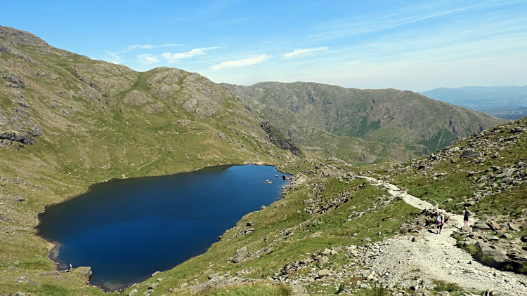 Low Water, north of the Old Man summit
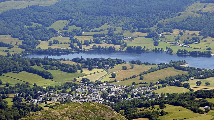 View from the Old Man to Coniston village and Water
Another fifty meters of ascent led me from the site of the quarries to a spot in the path where another path breaks off, leading down to Low Water. It is a popular mountain tarn and it was much in demand today. I was amazed to see as many people breaking off the Old Man path to go down to Low Water as there were climbing to the summit of the mountain. It was now approaching one o'clock in the afternoon with the sun high in the sky and there were a few dozen people down beside Low Water. A brave few were paddling in the water which despite the air conditions I guessed would be very cold. Brave souls. Still, perhaps not, I thought as I perspired my way on the continuing climb up the mountain. From Low Water the climb to the old Man is at its steepest. I was struggling now and pacing 50 steps at a time with breaks to catch my breath in between. A rhythm of a climb but a necessary one and it took me on and upwards to my immediate goal. Thirty minutes later and 240 meters higher saw me to the top. I had reached the Old Man of Coniston's revered cap once again. The view of the impressive summit cairn was a joy.
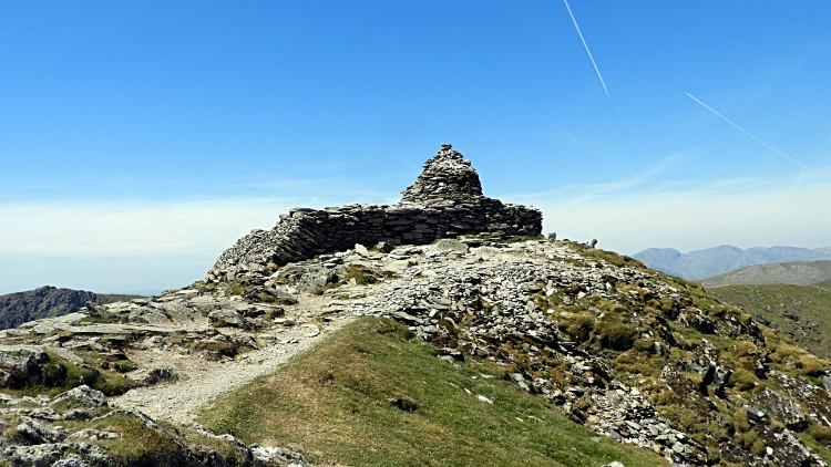 Summit of the Old Man of Coniston
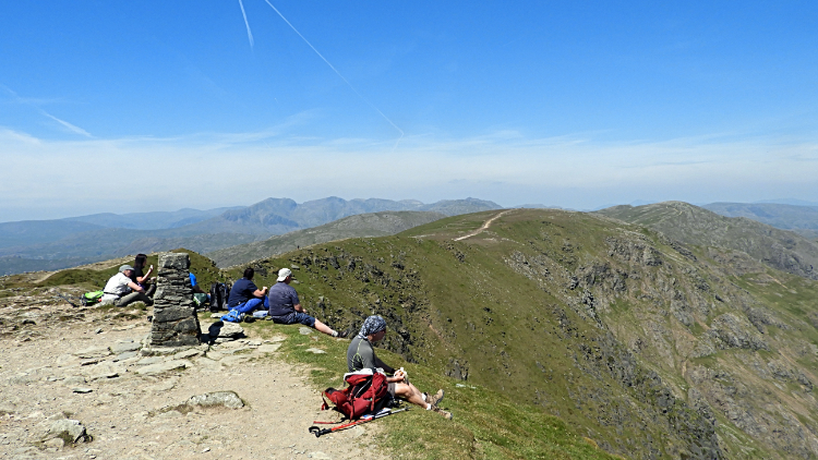 Lunchtime at 803 meters altitude
A group of about a dozen people were enjoying lunch at the summit and I joined them. There was no better place to sit down and enjoy a bite and a drink while reveling in the view of the Coniston Fells, especially of the path leading north on the high ridge for three kilometers to Swirl How. An enticing path, certainly one of favourite paths of all, ever exciting with mouthwatering views. Practically luminous. Due north to spot are the Langdale Pikes and if you cock the head a little from due north to the left there is a stupendous view of the big boys to be had. The Scafells and their friends, Bowfell and the Crinkles are there to see. It is a mountain spotters delight. After drinking all the views in the path from the Old Man of Coniston to Swirl How could not wait any longer, I packed up my snap, secured my backpack, stood up and went on my way.
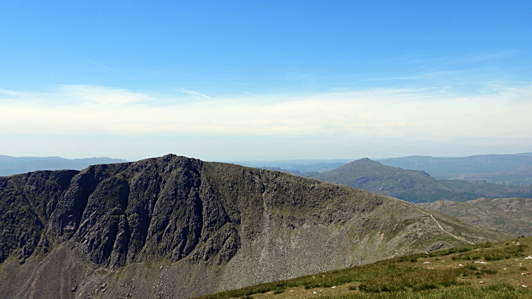 Dow Crag and Harter Fell
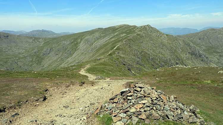 Path to Levers Hawse from Brim Fell Rake
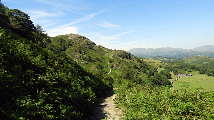
As I set off walking from the Old Man I looked left to Dow Crag and Harter Fell. Beyond them high cloud was settled over the Irish Sea. Inland the sky was nothing but blue. I ambled along this favourite path of mine, no rush at all to this part of the walk, joyful in the surroundings and enthralled by the views, as I stepped northwards first to Brim Fell Rake. Small cairns are regular spaced beside the upland path all the way but there was no need for their reassurance of being on the path today. It was as clear as could be. After the tough climb earlier the walk to Levers Hawse was most welcome, a steady descent before starting uphill again. I enjoyed it thoroughly.
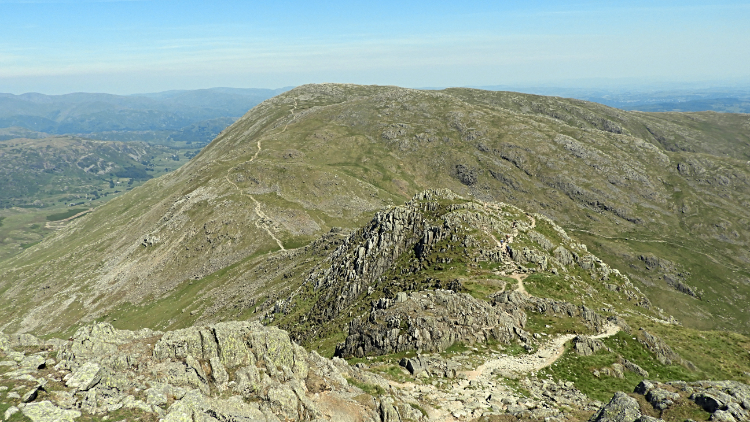
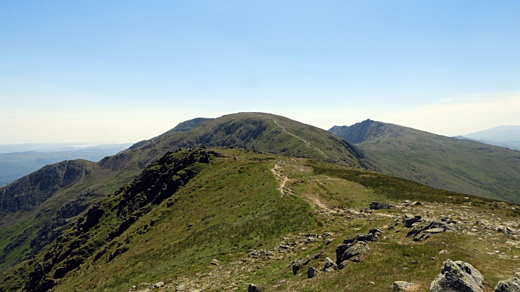 Swirl How and Wetherlam
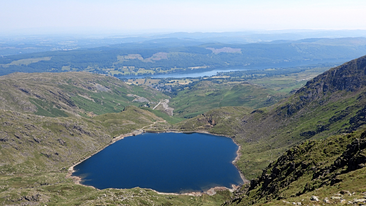 Levers Water and Coniston Water
At Levers Hawse I paused a while. I stepped right a little to the edge of the west ridge and took in the striking view of Levers Water directly below me. Directly beyond was another aspect view of Coniston village and Coniston Water. I could not get enough of a good thing. Enjoying the view for a minute or so I then turned to focus my attention to my next climb. Just a 100 meter one this time to Swirl How, nice and steady. The big cairn on Swirl How acted as a draw but my sight and thought of mind were often deflected to look to my left. The views to the Scafells were the best on the approach to and at the summit of Swirl How. I knew what was coming next, a dramatic up and down, but it could wait. I took in the Scafells for five minutes while sitting beside the cairn on Swirl How while enjoying a drink. "How many WOW moments can I take on a walk" I though, knowing there would be another when I stood up and turned my head.
 Prison Band and Wetherlam
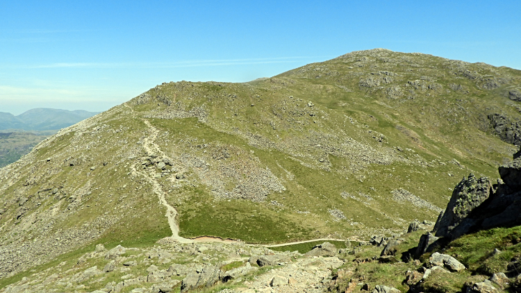 Swirl Hawse and Wetherlam
Prison Band is terrific. The first time I saw it I had though "Damn, that is a steep way down. I am not looking forward to this". It is a 170 meter steep descent from Swirl How to Swirl Hawse, the col between where I was standing and Wetherlam, my final mountain of the walk. Arduous it is. But thrilling too. A couple were gingerly descending the band ahead of me and making hard work of it. I stepped off the platform of Swirl How and set off on my way down after them. They were 100 meters ahead of me but not for long. I was careful but they were being positively trepidatious. Halfway down at the midway knoll to the col I passed them and just before reaching the col I passed another couple too. A few years left in me on the mountains yet" I imagined. I reached Swirl Hawse safely and without a break in my step I began the climb of Wetherlam.
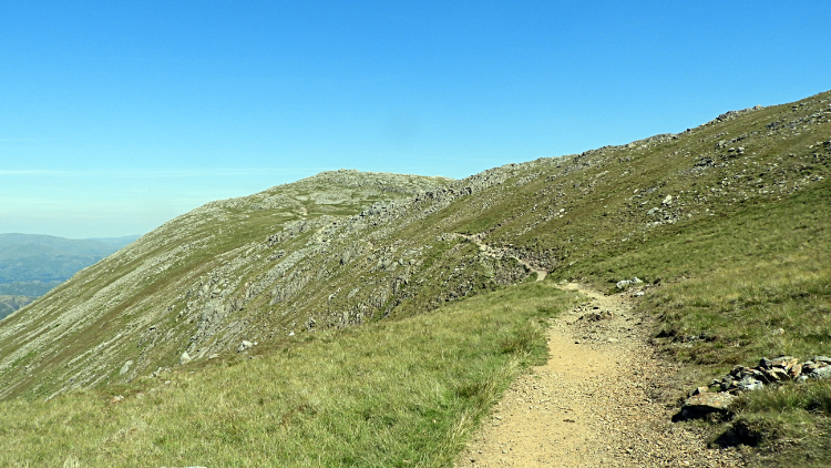 On the ascent of Wetherlam
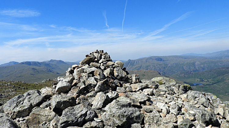 Summit Cairn, Wetherlam
Up I climbed, the final one of the walk, all of 120 meters by way of the Keld Gill Head path. Halfway up the path I got a great view across to the Old Man climb of earlier and a clear sight of the disused quarry line at 500 meters high as all the spoil slate heaps were of a lighter grey than the actual mountain face. It was quite a distinctive difference in shades and I was surprised at how noticeable it was from my viewpoint. From here I also had another good view of Levers Water and of the south half of Coniston Water. breaking from this latest reveal of the landscape I continued my climb amidst the shattered rock mountain which is the character of Wetherlam. Following my way on the path through the rock field I arrived at the summit of Wetherlam. I sat down by the summit cairn and took another short break for a bite to eat and a drink. This time the view which captured my attention was the one due north across Little Langdale and Great Langdale to the Langdale Pikes. Pike Of Stickle took my attention but not as much as the south cliff of Pavey Ark. I looked closely at the fault line running from bottom right to top left of the cliff which is the line of Jack's Rake. I have climbed it twice, possibly my greatest thrill of all in scrambling terms. Wainwright couldn't do it and my best friends have declined to try. Thanks Wetherlam for providing such a great high level view of Jack's Rake.
 Steel Edge
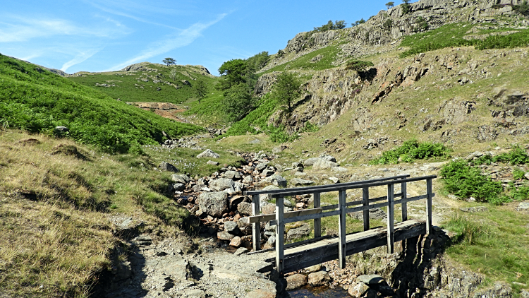 Footbridge over Henfoot Beck
How much more enjoyment and how many more thrilling views could I take in one walk. Perhaps the best of both were behind me as I descended Wetherlam and made for Tilbertwaite for the conclusion of my walk but my digressions and thoughts of what had gone before temporarily put my mind at rest. So much so that by daydreaming as I walked away from the summit of Wetherlam I completely forgot to concentrate on staying on the right path. My intended course of action was to leave the summit and head north-east off the mountain by Wetherlam Edge. I had done it before, a quiet steep descent but not a problem. Instead, forgetting the cardinal rule of ascertaining the line I followed a path south to Lower Hows. Before I knew it I was a kilometer in distance and 100 meters in height from the summit. Looking at my GPS, which I should have much sooner, I realised my error. "What to do?" I thought and hating the thought of tracking back, including the unnecessary 100 meter climb I looked down the mountain towards Tilberthwaite. The way across Lad Stones and Steel Edge looked manageable to me. Once committed to it I would not turn back so I had to be sure and I scanned it as attentively as I could. "No great problem" was my conclusion and so I decided to make my way down by that way. I started on my way, taking my time, meandering with the contours as required and finding my way down. A stream or two and the odd boggy ground were my hardest hurdles. To be honest it was easily achieved and I landed in Tilberthwaite without a hitch. "New ground" I thought. Only then did I put my foot in it! Clambering the last few steps over high grasses to the footpath leading to the footbridge over Henfoot Beck I stepped between two unseen stones, fell and grazed my arm while arresting the fall. No great problem, no foot injury, just a fall from grace. And a grazed arm. Blood oozed but it was soon wiped and staunched.
 Path parallel to Yewdale Beck
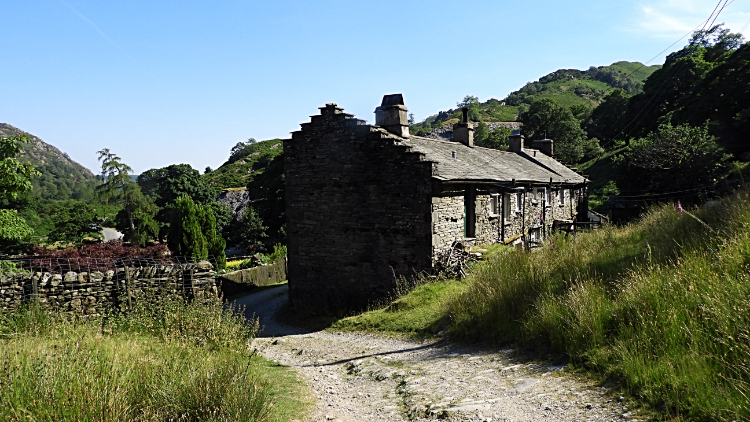 Low Tilberthwaite
Following my tough guy injury I reached the footpath and headed back into Tilberthwaite Ghyll, this time on the north-side of the gorge where Yewdale Beck flows from the mountains in a steepening descent through the ghyll. I could not see it hidden as it is by a thick cover of trees but I could certainly hear it cascading down in rapids and waterfalls. After falling into the Tilberthwaite vale Yewdale Beck turns southwards and heads into Coniston Water, its final course almost parallel to Levers Water Beck/ Church Beck as they spill like twin watercourses into the lake. Listening to it below me I ambled on my final steps of my scintillating walk back to Tilbertwaite, a scattering of isolated cottages and farmsteads. Tilbertwaite was my start and my conclusion of another memorable walk in the Coniston Fells. My final thought on my final steps of the walk were.. "I have to come back.


