The Great British Walk
A personal record of my three month walk of the full length of Great Britain from north to south with written journal and photographs. Tracklogs for GPS units and for use with Google Earth are available for download for each stage.
Stage 53: Nether Whitacre to Chadwick End
Google Maps Open Source Maps| Statistics and Files | ||
|---|---|---|
| Start: Nether Whitacre | Finish: Chadwick End | Distance: 17.5 miles (28.2 km) |
| Time: 7-8 hours | Climbing: 317 metres | Total Distance: 721.3 miles |
| GPX Route File | Google Earth File | About Meriden |
| Statistics | |
|---|---|
| Start: Nether Whitacre | Finish: Chadwick End |
| Distance: 17.5 miles (28.2 km) | Time: 7-8 hours |
| Climbing: 317 metres | Total Distance: 721.3 miles |
| GPX Route File | Google Earth File |
Ordnance Survey Explorer Map (1:25,000)
221 Coventry, Warwick, Royal Leamington Spa and Kenilworth
Summary
Stage 53 of the walk strictly follows the Heart of England Way footpath as it weaves its way south in the countryside corridor of Warwickshire between Birmingham and Coventry. Parts of the stage edge into the Metropolitan Borough of Solihull though one would never know it, the walk being rural in character from start to finish. Villages visited during this stage include Nether Whitacre, Eaves Green, Meriden, Berkswell and Chadwick End.(Note: My walk of the Midlands was a part of my Great British Walk from the north coast of Scotland to the south coast of England)
Stage Report
It had not rained for a week and it returned with a vengeance. Such a shame that its return coincided with the visit of Pip Weston, who I am sure John, Tim and Ken will concede, was the prettiest of all the guests who joined me for a stage of my long walk. As the boys had done, Pip had also followed my progress down the length of Great Britain by reading my blog reports. Being local to the area Steve and I were to walk today Pip had picked this stage as the one she would join us on. She had not picked the weather.
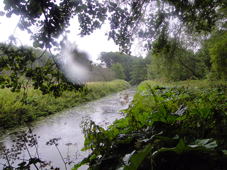 River Bourne near Shustoke
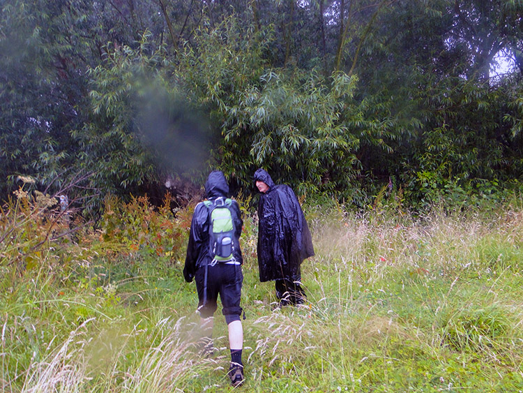 Nice day for a walk
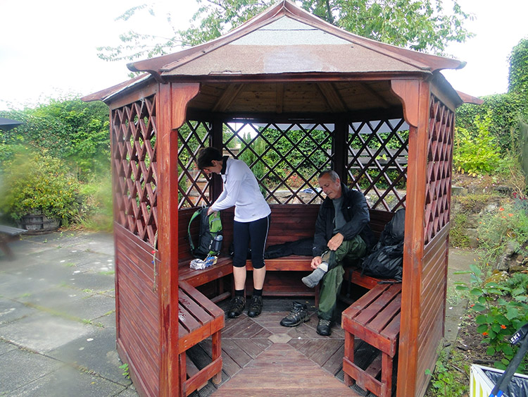
After Lil and Jan had dropped me and Steve off and after we had all made our greetings with Pip the three walkers of the group set off from the car park of the Gate Inn, Nether Whitacre. It was dry when we had set off down Reddings Lane but we could see the clouds were darkening fast. We did not get too far before the clouds burst, having made only a half mile of progress before we had to duck in under trees near the roadside to put on our full compliments of wet weather walking clothing. The rain did not come with a warning trickle, it erupted from the clouds. Having left road to follow the Heart of England Way to Shustoke Reservoir we passed through a bridge under the Birmingham to Peterborough Railway line to reach the River Bourne which was been plummeted on by heavy raindrops. Plenty were hitting us to. It was a deluge.
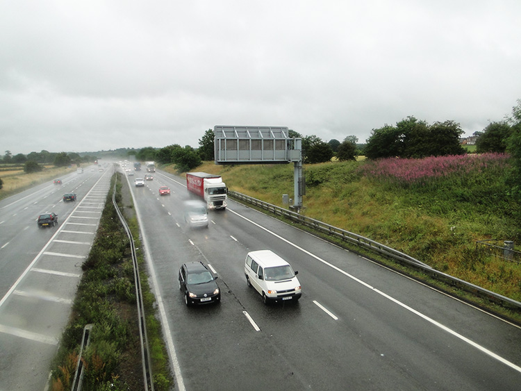 Crossing the M6
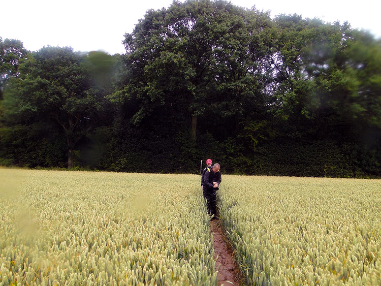 Path through the field
While walking and while breaking for spells of inactivity to remain under cover for breaks in the soaking Pip told us a little about herself. She worked in the nursing profession and was also a keen walker. She had joined us for the day as part of her preparation training for the Yorkshire Three Peaks Walk which she would be walking for charity later in the year. We were able to give her some local knowledge tips though we doubted she would need to do very much more than stay active. It was clear to us that Pip was already an accomplished walker.
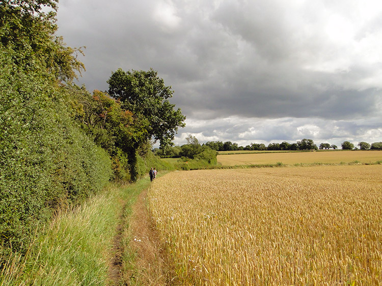
From Shustoke Reservoir we spent the next three hours following the Heart of England Way as it pierced the gap between Birmingham and Coventry. The path followed a mix of minor roads, access lanes, bridleways, wooded glades and fields. Mostly fields, some grass and some crops. All that crossed fields had clear and generous pathways made through them. Staffordshire Way take note, this is how to do it. All the way from Shustoke to where we crossed the M6 just west of Corley Moor we kept the wet gear on. In six miles it had never ceased. Looking back to the Met Office report for the day it says "There was a return to unsettled weather associated with an unusually deep area of low pressure tracking eastwards across the UK. This brought strong winds, rain and thundery showers to many places". We walked through the worse of it.
 Drying out at the Queen's Head
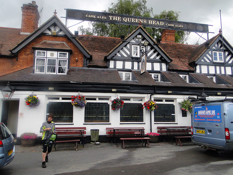 Queen's Head, Meriden
The saying goes "all good things come to an end". Therefore all bad things must come to an end too and after crossing over the M6 and after over three hours of walking the rain began to abate. We came to a road called Harvest Hill Lane. A sign greeted us with the words "Welcome to Solihull". We left the road by following the route of another sign here, one saying "Unclassified County Road". This meant it did not have A, B or C road status. It did not have tarmac either though it was at the point where the Heart of England Way was joined by the Coventry Way. It provided part of the course which led us on an ever drying walk past Eaves Green and over the A45 to approach the village of Meriden from the east side. We reached a pub and as the rain had abated we decided it was the suitable place to stop for lunch. It was 12.45pm and we had covered nine miles of wet weather walking. We availed ourselves of a garden area shelter at the Queen's Head in Meriden and while we had our own sandwiches we treated ourselves to cups of tea from the pub.
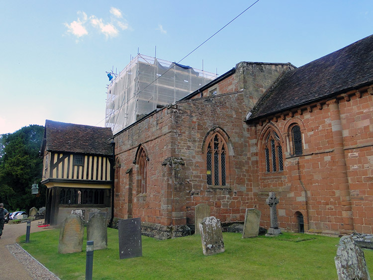
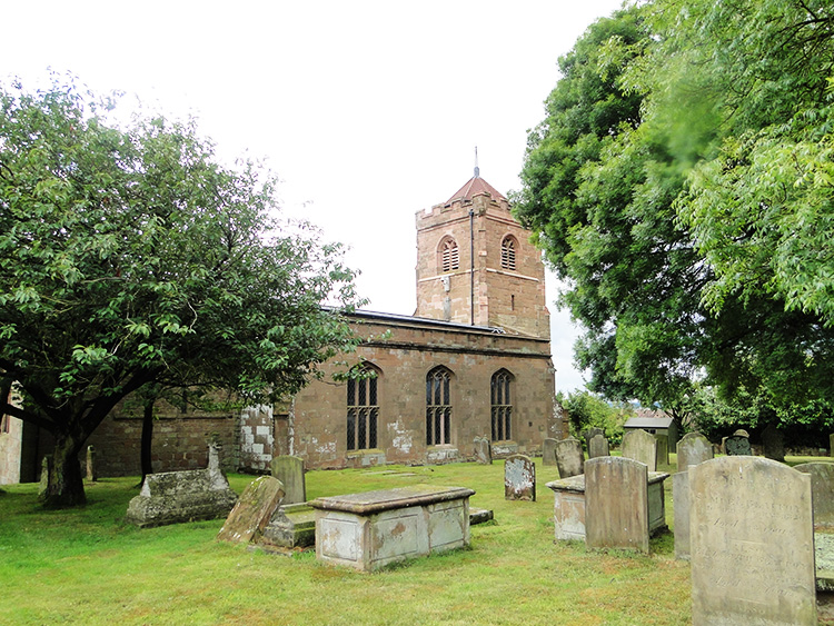 St Laurence Church, Meriden
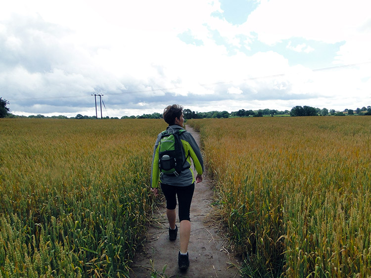 Pip leads the way
While walking from Eaves Green to Meriden we had come across a group of campaigners in a makeshift camp. Intrigued we inquired who they were and what their cause was. They told us they were a residents protest group campaigning against an illegal Gypsy site which had recently set established itself in the village. The local campaigners had named themselves Meriden Residents Against Inappropriate Development (RAID). We wished them success and we each signed their ballot of support.
Back on our way after lunch we were happy to be in the dry. After leaving Meriden which we did by passing St Laurence Church there was more rural walking, much like earlier in the day which kept the walk familiar though the rain did not join in this time. We followed more rural roads, lanes and crossed more fields. Invigorated by our lunches we strode out on our way with Pip often leading the way in training for her Yorkshire Three Peaks Walk.
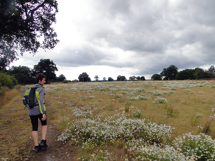 Daisy meadow
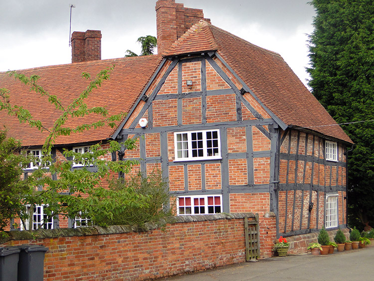 Warped timber frame house near Berkswell
It remained dry in the hour we took while walking between leaving Meriden and arriving in Berkswell. Between the two lovely Midlands villages we came to an information board which showed us we we about the half way point of the Heart of England Way. It said "The way starts at Milford Common on the edge of Cannock Chase and runs for 100 miles south to Bourton on the Water in the Cotswolds". We continued on by beginning walking the southern half of the way crossing more cereal crop fields to reach a Daisy Meadow which gave a welcome change of colour. Soon after we came to a series of fields which had scatterings of ponds in them. They reminded me of the fields around my home village when I was a boy which had ponds in them. Those are all gone now in the progressive of maximising farming yields. It was nice to see these still left for the native wildlife to enjoy. A rare sight these days.
 St John Baptist Church, Berkswell
 Beautiful house near Balsall Common
We arrived in the lovely village of Berkswell, passing the village church on our way through. A wedding was taking place, the red carpet laid out for the happy couple. We were happy too but soon we got a sharp reminder not to be complacent. Half a mile from leaving Berkswell we were hit by another sudden and heavy shower. It was heralded by a clap of thunder which gave us just enough time to cover up with the wet gear again. Only five minutes earlier the sun had been out. We hoped it would come out again before our day was done. Forgetting the rain what I had begun to notice in the area was the beauty of some of the houses. The ones which struck me were timber framed and as the wood had warped with time then so had the houses. They had such aesthetic charm which delighted me.
 An improving picture
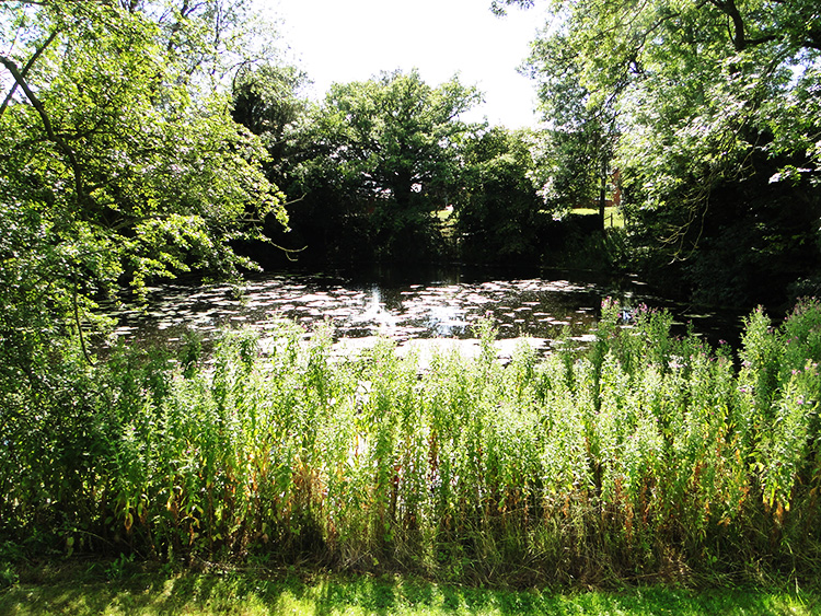 Pond at Balsall Lodge
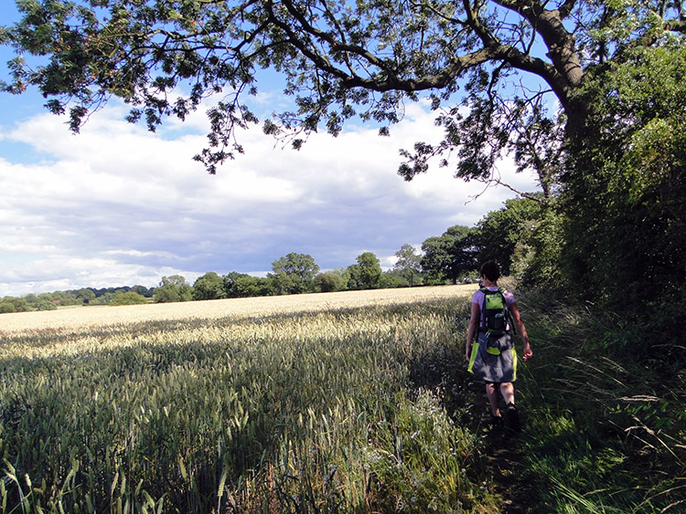
We arrived at Skew Bridge which helped us across the A452 near to Balsall Common. It was around 3.30 in the afternoon and the sun was breaking through big time now. Sun beamed down on us so we took off all our wet gear to walk the remainder of the walk as it ought to be on a high summer day. After following the edge of golden wheat fields we came to Balsall Lodge Farm which had one of those gorgeous small ponds we had become familiar with around here. Water Lilies in the pond and small managed broad leaf trees around the pond completed an idyllic scene. We sat by the pond for a short while warming ourselves in the warm sunshine.
 Just one more field
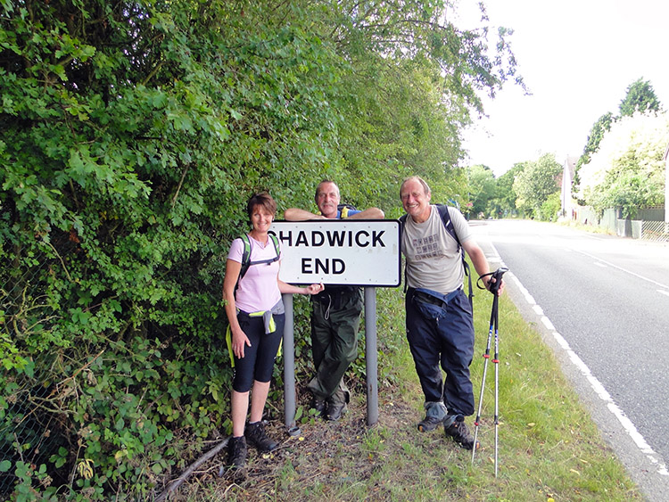 Days end at Chadwick End
After all the inclement weather threw at us during the first half of our day we walked the final stretch of the walk from Balsall Lodge Farm to Chadwick End in high spirits. It was now a lovely late afternoon, warm and with a blue sun filled sky. We ambled in to the village by walking down the road in the gap between Baddesley Clinton and Chadwick End. Conveniently for a group photo shot there was a local resident walking along the footpath just as we reached the village sign. Thank you sir. And after the snapshot we continued along the road to the Orange Tree Pub where Pip's husband was waiting. We met him and before we left the couple to enjoy the rest of their day we wished Pip all the best on her Yorkshire Three Peaks walk. As if she needed it. We knew she would be fine. She was certainly fine company.
Footnote: The Meriden Residents Against Inappropriate Development (RAID) group campaign against the illegal Gypsy site which had recently appeared in their village when we had walked past on my walk was ultimately a successful campaign. It was hard fought though, taking over 1,000 days to remove the site.


