The Great British Walk
A personal record of my three month walk of the full length of Great Britain from north to south with written journal and photographs. Tracklogs for GPS units and for use with Google Earth are available for download for each stage.
Stage 55: Stratford Upon Avon to Chipping Campden
Google Maps Open Source Maps| Statistics and Files | ||
|---|---|---|
| Start: Stratford Upon Avon | Finish: Chipping Campden | Distance: 13.4 miles (21.6 km) |
| Time: 6-7 hours | Climbing: 202 metres | Total Distance: 749.4 miles |
| GPX Route File | Google Earth File | About Stratford Upon Avon |
| Statistics | |
|---|---|
| Start: Stratford Upon Avon | Finish: Chipping Campden |
| Distance: 13.4 miles (21.6 km) | Time: 6-7 hours |
| Climbing: 202 metres | Total Distance: 749.4 miles |
| GPX Route File | Google Earth File |
Ordnance Survey Explorer Map (1:25,000)
Summary
This 55th stage of my walk was the last in the Midlands phase which led me from Warwickshire to Gloucestershire and into the Cotswolds region. From Stratford Upon Avon I followed the Monarch's Way and Avon Valley Footpath for a while along the River Avon before continuing on the Monarch's Way and the Greenway on the line of a disused railway line Long Marston. Here I met with the Heart of England Way as it shared the path with the Monarch's Way through the villages of Lower Quinton and Upper Quinton after which I stayed with the Heart of England Way to Mickleton and on to the finish of the stage in Chipping Campden.(Note: My walk of the Midlands was a part of my Great British Walk from the north coast of Scotland to the south coast of England)
Stage Report
I have to be honest, I just wanted to get this stage of my walk out of the way so I could begin my walk of the Cotswold Way National Trail which had been one of the first paths I plotted into my Great British Walk. I had wanted to walk it for some years and now the wish to do so was close to becoming a reality. Yet I had a good few miles to cover before I could start that adventure and I was determined to enjoy them. And so in the morning I wished my wife Lil a safe journey home as she headed north by car as I continued my ongoing journey to the southernmost tip of Great Britain on foot.
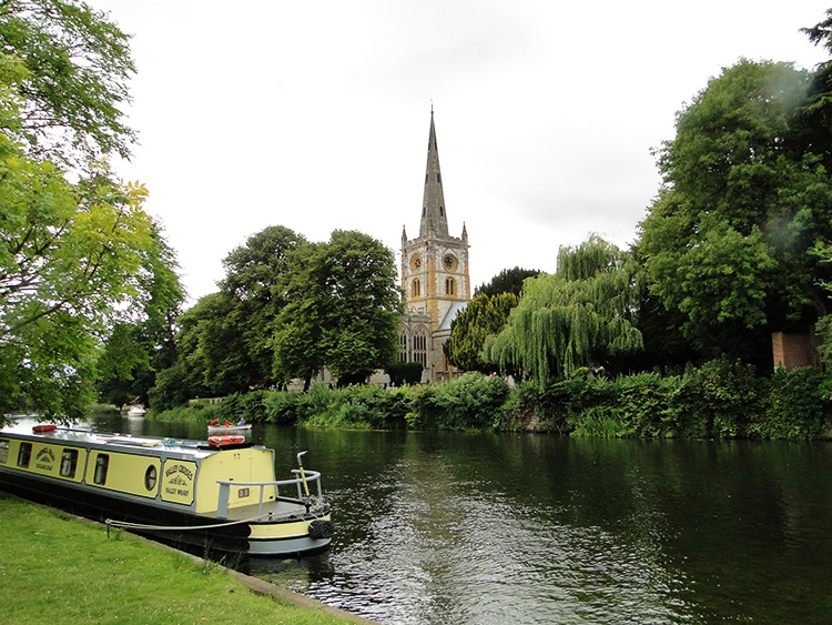 Stratford Upon Avon
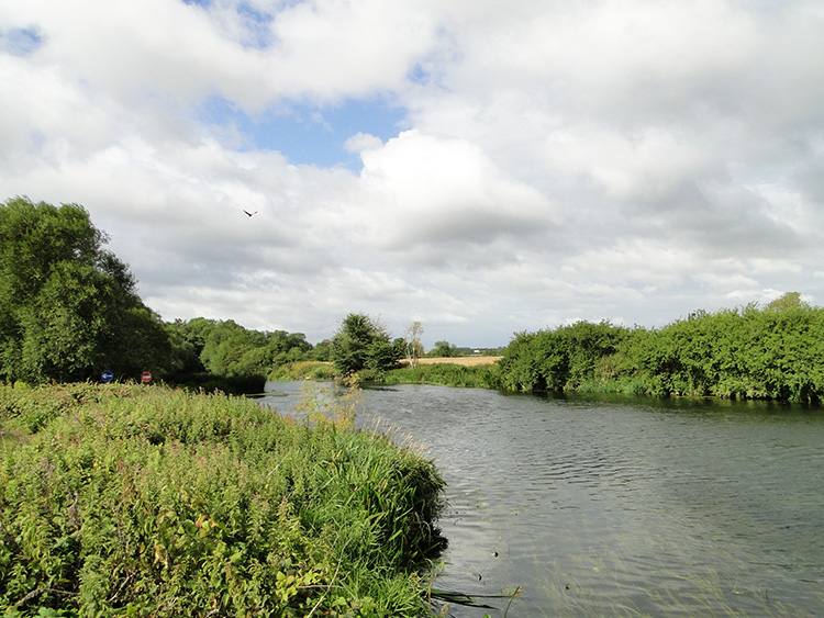 River Avon
We had not seen as much of Stratford Upon Avon as we had wished to last evening. Lil's toothache and my lethargy after a full days walking confined us to a couple of pubs local to our accommodation which was followed by a meal. We would have to save the Shakespeare experience and sightseeing tour for another occasion. I walked from Stratford Upon Avon by following the River Avon path through the Recreation Ground. The view across the river to Holy Trinity Church was especially stunning. A line of trees including Oak and Willow between the church which is home to Shakespeare's Grave and the River Avon made the picture perfect. It was a fitting final image of Stratford Upon Avon for me to take with me as I followed the river westwards and out of town.
I followed the River Avon past Lucy's Mill Bridge and under the A4390 road bridge which formed the definite barrier between town and country. I was soon drawn into the perfect sense of a rural summer morning. Birdsong in the bushes and trees straddling the river were intermingled with the flow of water and the nearby drones of insect life. Butterflies fluttered silently by, not wishing to play to the tune. A host of Ladybirds were exploring Thistle Flowers. It was a elegantly serene walking on the river path.
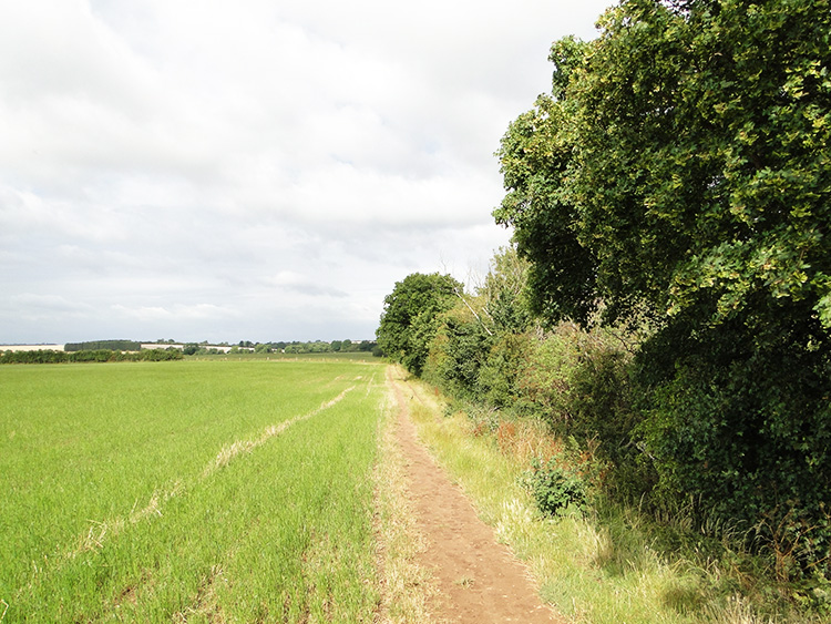 Following fields near Luddington
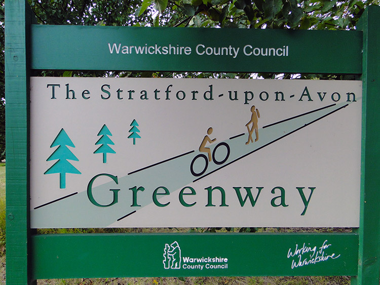 Stratford Upon Avon Greenway
It was a lovely morning, warm and dry. I left the riverside after just short of two miles of pleasurable walking to follow the Monarch's Way footpath across fields near to the village of Luddington. I did not stick to the footpath in one of the fields though as a herd of Cows and a watchful Bull rested in it. Rather than spook them, or cause them to stir in any manner I edged to the side of the field and climbed over a fence into the adjoining field. I returned to my true path after that field was cleared. No problem, no consternation. Soon after I crossed the final field of this stretch of the walk to reach a disused railway line. I had arrived at the Stratford Upon Avon Greenway.
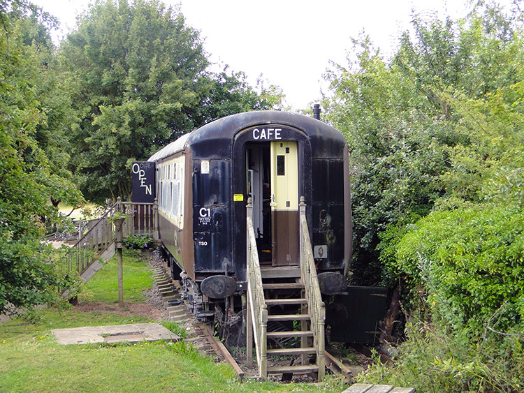 Carriages 5344 cafe
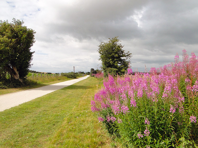 Colour on the Greenway
The Stratford Upon Avon Greenway is a five mile long leisure route linking Stratford and Long Marston. It is a surfaced path suitable for cyclists, walkers and wheelchair users which utilises the line of a disused railway. As I began my walk along it I soon began the process of meeting and greeting walkers and cyclists. The ones on foot were mostly dog walkers, the ones on bikes mostly leisure riders, either solo or with young children. All my meetings with pedestrians and peddlers were pleasant.
Halfway along my walk of the Greenway I came across a railway carriage set on rails next to the path. I had arrived at Carriages 5344 cafe in the Greenway Picnic Park. Though I had only been walking for 80 minutes and a little over three miles I decided to call in for a cup of tea. The lady serving tea was lovely to meet as were a couple of mature gentlemen who I chatted with during my unexpected break. It was a pleasant break at the cafe and perfect to set me off on the rest of my walk. I bounded along what remained of my Greenway experience towards Long Marston.
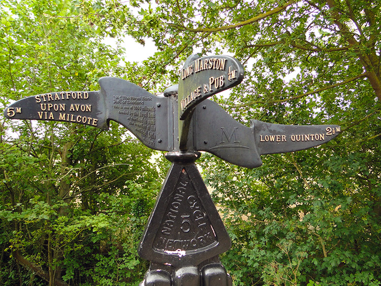 Elaborate Greenway Milepost
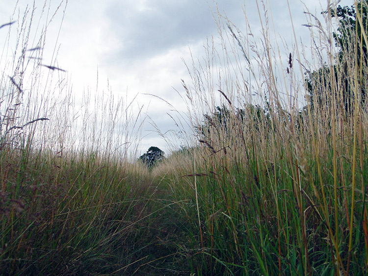 Crossing hayfields near Lower Quinton
After just short of four miles of walking along the Greenway which was interrupted just once by the stop at Carriages 5344 cafe I came to an elaborate milepost which pointed my way on towards Lower Quinton. Another direction pointer said "Long Marston Village and Pub" at a quarter mile distance. Another pointed back to Stratford Upon Avon at five miles away. I worked out I had less than 10 miles to Chipping Campden. It was 11.10 in the morning so despite my unplanned break I was making time. I left the Greenway by making a ninety degree turn left. I crossed fields just south of Long Marston Airfield, high grass fields of hay and cereal which kept me pinned firmly to the path. I tried looking across to the airfield was a Royal Air Force base between 1941 and 1954 and which is now used for Drag Racing, Clay Pigeon Shooting, leisure events and local festivals. Thick hedgerows and trees separating the fields made sure I did not see anything of it.
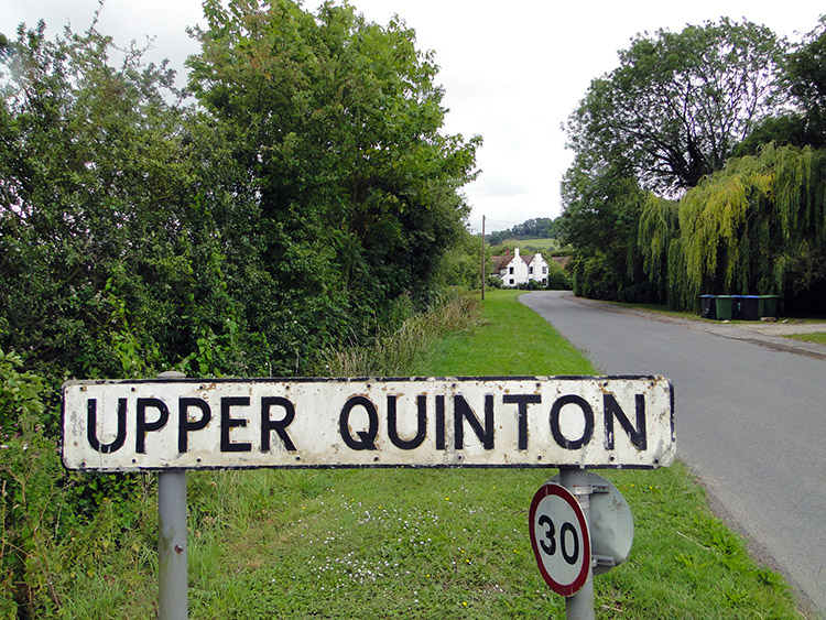 Upper Quinton
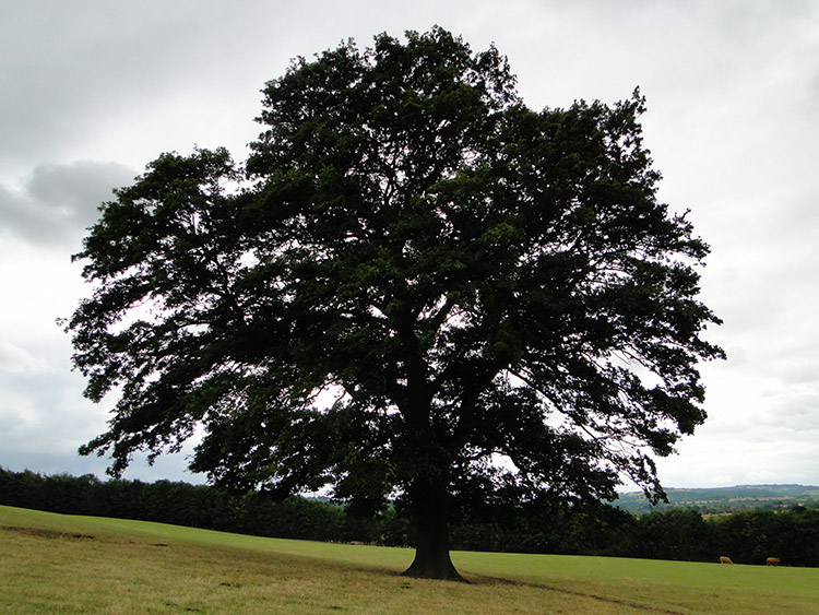 Magnificent Oak on Meon Hill
I arrived in Lower Quinton a little disappointed at having seen nothing of the airfield. I was left a little disappointed with Lower Quinton too though I know I missed the best bit of the old village where the church and a super row of whitewashed and thatched cottages are to be found. The newer bit of the village I walked though had nothing of such character. I found Upper Quinton much nicer and sat on a bench by the green in the village for a short breather before setting off on my first climb of the day, just a small one of around 25 metres up and around the west side of Meon Hill. There is the site of an Iron Age hillfort at the top of Meon Hill which I was initially drawn to climb to. But as I started to climb I was diverted to follow the Heart of England Path around the rim of the field by a series of information signs.
Intrigued at what the signs were I approached the first one. It read "More to a meadow than meets the eye: It may look like just grass but close up you see it can be a mix of different types of grasses as well as herb and wild flowers. This is why in summer a meadow is often teeming with wildlife. Farmers take special care of old meadows and create new ones". Each sign was accompanied with images, this first one having Butterflies and a Hare. Each sign was erected in the fields on Meon Hill by LEAF (Linking Environment And Farming). The next one I read headlined "Cows in fields and your safety". It gave sound advice and had an image of walkers and a cow with calf.
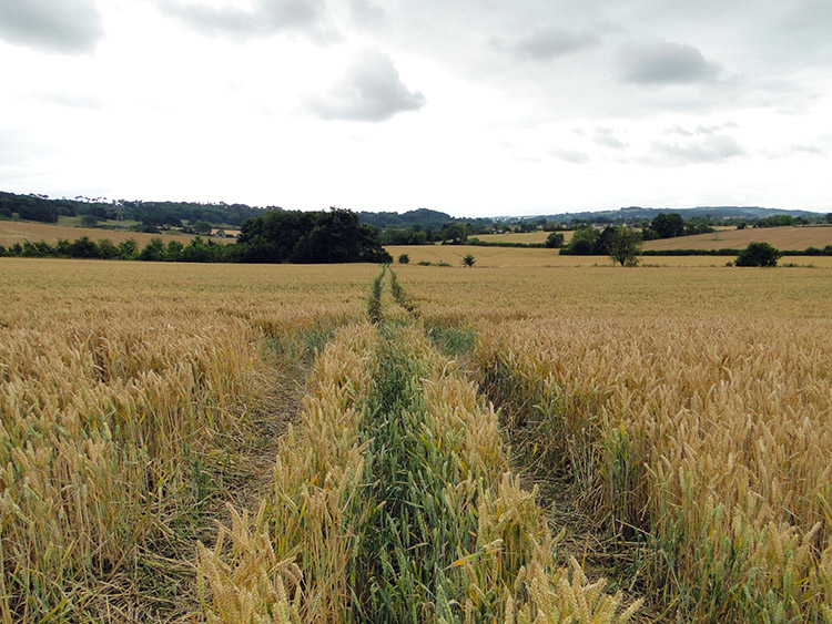 Massive field crossing to Mickleton
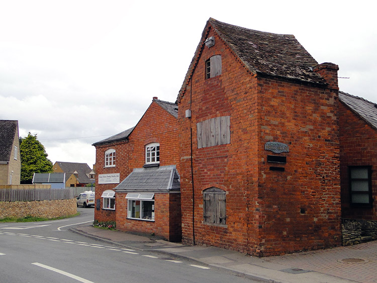 Old and new in Mickleton
A word on Meon Hill before I leave it behind. Apart from the Iron Age hillfort it was the scene of the so-called 'witchcraft' murder of Charles Walton in 1945. And aside from black arts Meon Hill is said to have provided inspiration for Tolkien's 'Weathertop' from The Lord of the Rings. Finally and according to legend, Meon Hill was formed by the Devil. He intended to throw a clod of earth at Evesham Abbey, but missed, and the earth formed the hill.
Thankfully I passed over the edge of Meon Hill unscathed. Afterwards I crossed some big country fields towards the village of Mickleton. One wheat field seemed endless but of course it was not. It was just humdrum, wearisome, unvaried. I was happy to get to the other side of it. I left the field behind and in doing so Warwickshire too. Walking on entered Mickleton the northernmost village in Gloucestershire. I was summarily struck by its charm.
 Beautiful Mickleton houses
 Decay
DecayI took my final break of the day in Mickleton, sitting on a bench on a green in heart of the village beside the village fountain. Sumptuous houses of pink Cotswold stone were spread around the village but not uniquely so. Fine bricked buildings and terraces of timber framed and white wash paneled thatched roof cottages complemented the village too. Mickleton was a fine introduction to my walk through Gloucestershire. Continuing south and east from the village I made my big climb of the day, all of 80 metres ascent to Baker's Hill a preamble to the Cotswold Hills I could see in the not so distant south once I had crested the hill.
 Mickleton Hills
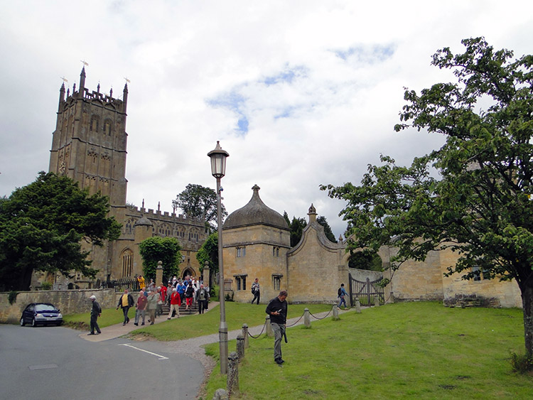 St James Church, Chipping Campden
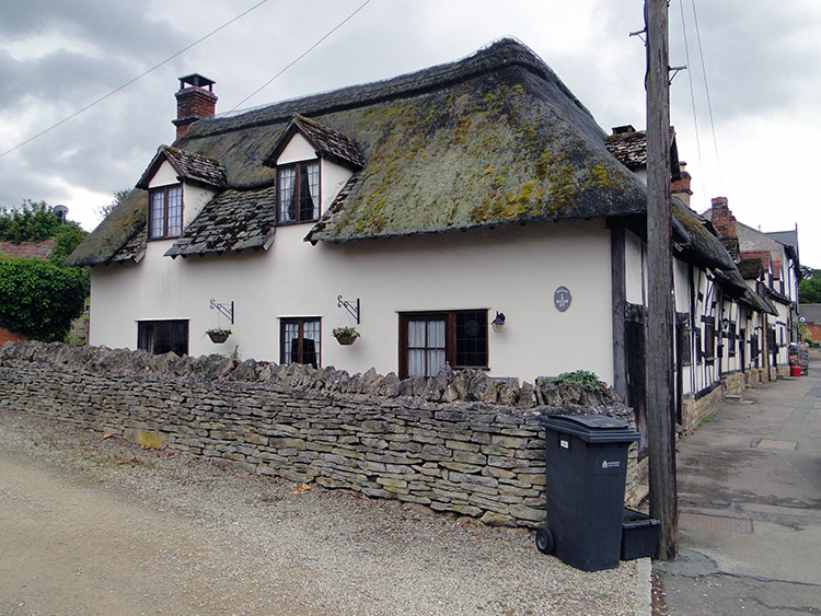
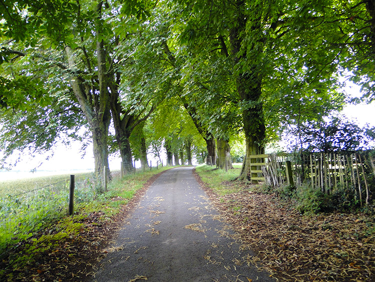
From Baker's Hill I continued walking due south on a high ridge path and then along a road on the ebbing ridge top to reach Furze Lane which I followed westwards for around 100 metres before turning south from the road to follow a long avenue approach to Mickleton Hills Farm. From the farm the Heart of England Way which I had stayed with was rejoined by the Monarch's Way which I had parted with at Upper Quinton because it avoided Mickleton. Thus I followed both distinguished paths along the side of a couple of fields into Chipping Campden. Every building was golden yellow, the natural colour of the Middle-Jurassic oolitic limestone found in the Cotswolds. It was warm and inviting me into the loveliest of Gloucestershire towns. From the start of my walk in the town I encountered crowds, the first host of them leaving from a visit to St James Church.
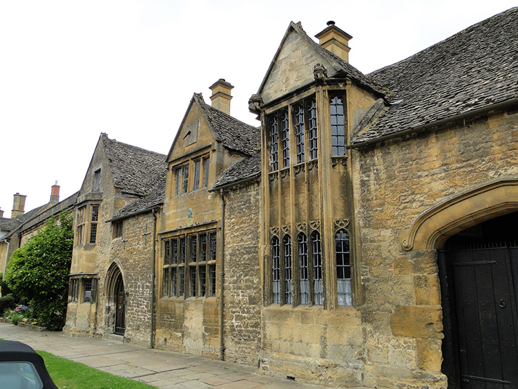 Sublime Cotswold Stone Building
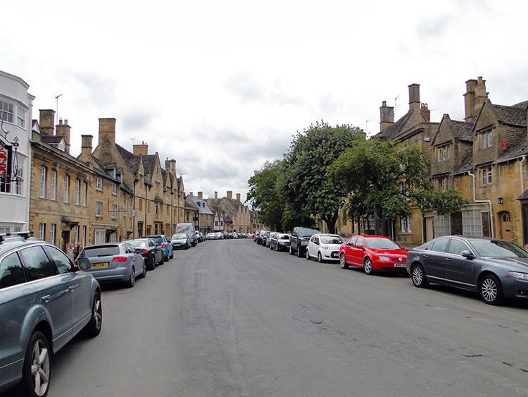 Chipping Campden High Street
My first impressions of Chipping Campden were everything I had expected them to be. Extraordinarily beautiful. The only downside to the pastoral image in my minds eye was the rows of modern day cars lined on either side of the high street. If only the street could be pedestrianised then the scene would fall straight into a period drama. The facades, window frames and doorways of the Cotswold stone houses were largely exquisitely carved. Nothing too fancy and nothing too plain. About dead right in my opinion. I looked around the town for a while before popping into one of the tea shops for after walk refreshments. It had been a good day.
Footnote: And so ended my six day walk through the Midlands which began in Eaton Dovedale, Derbyshire. During the Midlands phase I walked from Derbyshire and through two counties entirely to reach a third. Staffordshire and Warwickshire are now behind me. When I began my Midlands trek I was far north of Birmingham and now I am well south of England's second city. Much enjoyment was had on the way and apart from some of the disgraceful obstacles put upon the Staffordshire Way there were many highlights. These include Abbots Bromley, the Trent and Mersey Canal, Cannock Chase, Gentleshaw Common, Lichfield, Brockhurst Lane, Birmingham and Fazeley Canal, Kingsbury Water Park, Meriden, Berkswell, Baddesley Clinton, Yarningale Common, Langley, Welcombe Hills Country Park, Stratford Upon Avon, The Greenway, Meon Hill and Mickleton. Not a bad list of highlights at all.


