Blorenge, Monmouthshire and Brecon Canal, Llanfoist and Govilon
From a mountain, down to a canal towpath and then back up again
Google Maps Open Source Maps| Statistics and Files | ||
|---|---|---|
| Start: Car Park | Distance: 8.2 miles (13.1 km) | Climbing: 566 metres |
| Grid Ref: SO 28468 10906 | Time: 4 hours | Rating: Hard |
| GPX Route File | Google Earth File | About Blorenge |
| Statistics | |
|---|---|
| Start: Car Park | Distance: 8.2 miles (13.1 km) |
| Climbing: 566 metres | Grid Ref: SO 28468 10906 |
| Time: 4 hours | Rating: Hard |
| GPX Route File | Google Earth File |
Ordnance Survey Explorer Map (1:25,000)
The Walk: This is a route which combines a hill walk thats offers truly spectacular views with an intriguing look at transport routes of over two centuries ago. Even from the start, at the car park, there is an indication of the spectacular views of the Usk valley and the surrounding countryside that are to be enjoyed from the slopes of Blorenge. For the first part of the walk, however, the view is closed by trees that overhang the footpath and later the road, during the steep descent to the Monmouthshire and Brecon Canal.
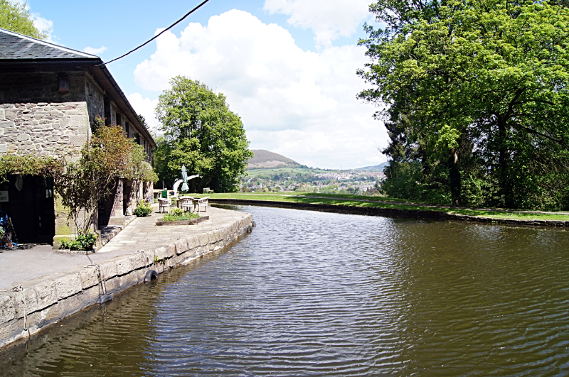 Monmouthshire and Brecon Canal
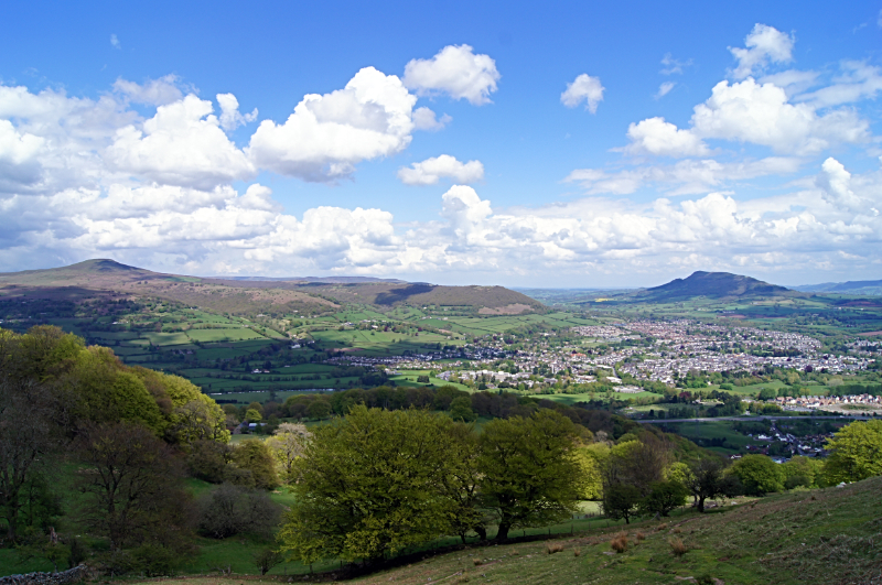 Sugar Loaf, Abergavenny and Skirrid Mountain
This canal, which was begun in 1793, links Brecon to Pontypool and is the most beautiful waterway running through the Brecon Beacons National Park. It runs on a narrow ledge cut into the hillside, following the natural contours of the land. The hillside above the canal is heavily wooded, with mature trees leaning over the canal, and is home to a variety of woodland birds and grey squirrels. The water of the canal itself is full of fish, and shoals of roach and large carp are often to be seen. Below the canal, the hillside drops away steeply to the Usk valley. The canal was for many years derelict, but in 1964 restoration work was begun and pleasure boats now travel on the waterway.
The most interesting place visited on the walk along the canal is the village of Llanfoist. It is here that trucks were lowered down the steep hill loaded with pig iron from the works at Blaenavon and stored in the workhouse under the canal. Along the way, there are places where the canal narrows. Here a section of canal could be isolated by dropping planks into grooves or by swinging a gate across the gap. This enabled workmen to drain that section of the canal so that maintenance work could be carried out. The next big wharf is at Govilon. Here working boats of up to 55 feet long could be turned around in the 'winding hole'.
Two hundred and fifty years ago, canals were to the world of industry what motorways and railways are today - the major routes for moving large amounts of goods. A single horse pulling a cart along roads could move no more than a two ton load; the same horse hauling a boat along the canal could shift as much as 50 tons. Today, walking along the tree shaded towpath; it is hard to see this as a vital link in a transport system serving major industrial complexes, but this is just what it was. It carried stone from quarries in the hills, coal from the local mines, iron from the foundries and even wool and stock from the local farming communities. It linked with other canals directly to the docks in Cardiff.
On leaving the canal, the walk briefly joins the trackway of a disused railway. This was the Merthyr, Tredegar and Abergavenny Railway, begun in 1859. This railway, with other improved transportation routes in the area started the process of decline for the canal. Next, making the steep climb up from Govilan is rewarded with a level walk with superb views. This flat grassy track was once a tramway, an early form of railway where horses pulled carts on rails. It was along this track that the trucks came to be lowered down to Llanfoist. From here are the best views of the entire walk, down to the town of Abergavenny with its old castle, right up to the valley of the River Usk and to the hills of mid Wales. Prominent hills closer to hand are Abergavenny's favourites, first Sugar Loaf and second Skirrid Mountain, both being beautiful shapely hills and both of which are rights of passage to climb for local people. Finally on the walk there is one more fine view to be enjoyed, on the Blorenge itself. This is the Punchbowl, a natural amphitheater where the slopes are heavily wooded with a little lake nestling in the bowl.
Acknowledgment: Text derived from the Out and Out Series; Discovering the Countryside on Foot. Pictures courtesy of Wikipedia.


