The Great British Walk
A personal record of my three month walk of the full length of Great Britain from north to south with written journal and photographs. Tracklogs for GPS units and for use with Google Earth are available for download for each stage.
Stage 28: Dalserf to Lanark
Google Maps Open Source Maps| Statistics and Files | ||
|---|---|---|
| Start: Dalserf | Finish: Lanark | Distance: 10.0 miles (16.0 km) |
| Time: 4-5 hours | Climbing: 425 metres | Total Distance: 348.7 miles |
| GPX Route File | Google Earth File | About the Clyde Walkway |
| Statistics | |
|---|---|
| Start: Dalserf | Finish: Lanark |
| Distance: 10.0 miles (16.0 km) | Time: 4-5 hours |
| Climbing: 425 metres | Total Distance: 348.7 miles |
| GPX Route File | Google Earth File |
Ordnance Survey Explorer Map (1:25,000)
Summary
It was such a delight to be out of the city after three days of urban walking. Almost immediately after the start of this lovely stage I was walking in serenity along the banks of the river Clyde, following the walkway path all the way to Lanark. Only on brief sections did I have to leave the side of the river, some necessities of the trail and only the final detour was a forced detour which should not be necessary for contemporary walkers of the Clyde Walkway.(Note: My walk of Glasgow and South Scotland was a part of my Great British Walk from the north coast of Scotland to the south coast of England)
Stage Report
After 10 days of invaluable support from my darling wife Lil it was time for her to drop me off at the start of my walk one final time for the time being and return home. After arriving at Cardies Bridge we said our farewells, hugged each other and parted. As she drove off I looked at the heavy backpack beside the road and thought "You're back". I heaved the 16 kilo weight onto my back for the first time since arriving as a physical wreck in Fort William and I began walking.
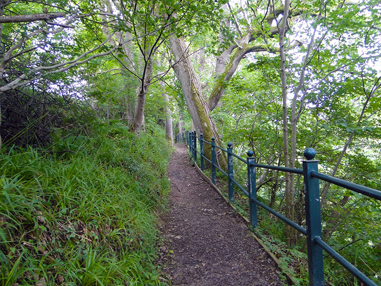
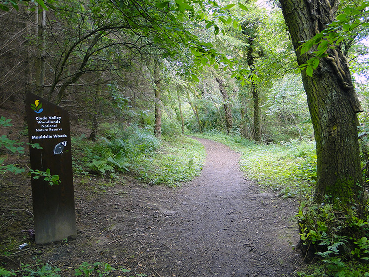 Mauldslie Woods
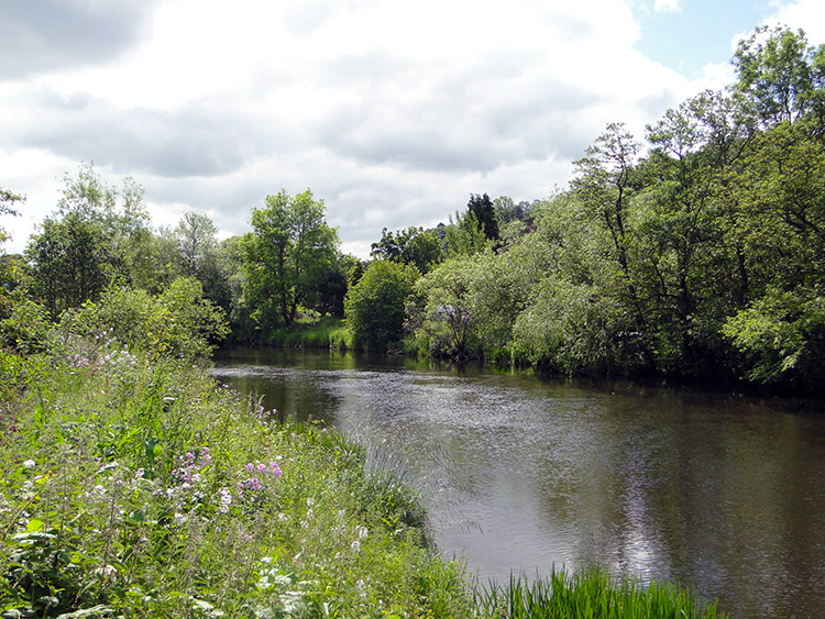 River Clyde near Dalserf
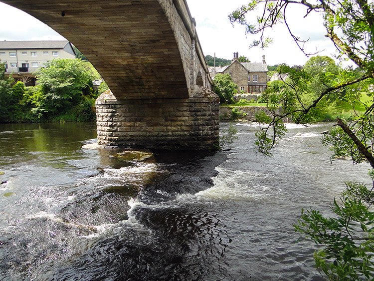
After a few steps along the B7011 I turned right to follow the Clyde Walkway into Mauldslie Woods. It was a fantastic feeling to be once again entering the wild and unknown and I thoroughly enjoyed walking through the woods. The path led me through the woodland to the bank of the River Clyde near Garrion Farm which I followed south.
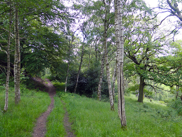 Woodland trail beside the Clyde
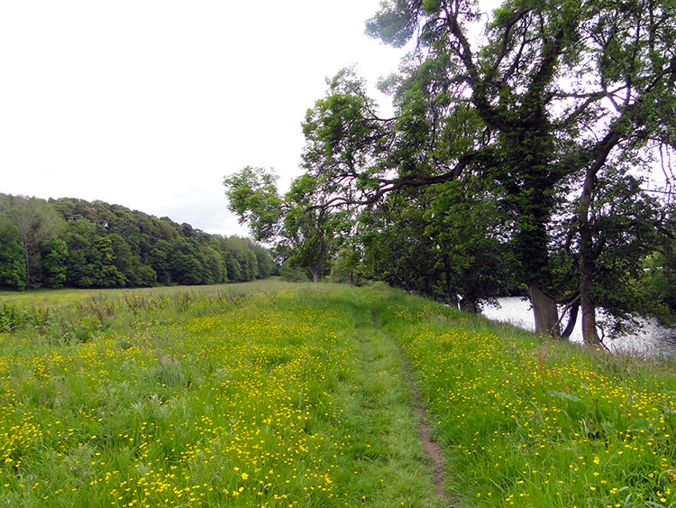 Buttercup meadow near Crossford
At a bend in the river near Milton-Lockhart Farm the path took me from the riverside up a small hill and through a small copse before allowing me to drop to waterside again soon afterwards. It was the first test of climbing with the heavy backpack again and it reminded me of the extra effort required when climbing with weight. I imagined how trainee soldiers feel when laden with packs full of rocks. Tough souls they are. Back by the river I then enjoyed a nice stroll along fields of pretty buttercups. It was a delight to walk and even though I was still close to the city of Glasgow I was now completely alone. Except for the wildlife that is; I saw Ducks galore and a Heron fly low following the river upstream. I was to see another later; or perhaps the same one. The path continued true beside the river towards Crossford.
 Crossford Bridge
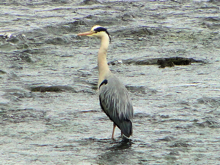 Heron at the Clyde at Crossford
Despite carrying the weight of the backpack again I was feeling no ill effects of the recent injury and I reached Crossford in good form. I had no reason to halt my course along the Clyde Walkway which would have taken me straight past Crossford but I chose to leave the path for a while which I did by climbing some steps by the road bridge on the B7056. I crossed the bridge, found a bench in the village and sat down for a rest. Near the bench a lady was tending her garden and we chatted for five minutes. Telling her of my walk she wished me well on the remainder of the journey. After the chat and a drink I walked across the bridge once again and resumed my walk along the river. Soon afterwards I stopped dead in my tracks when I spotted a Heron resting in the middle of the river. It seemed uninterested in my presence which was a surprise as they normally bolt when I see them. Perhaps here seeing a walker was a novel experience for the bird and it was just as curious as me. I have learned one of the novelties of walking in less trodden places is that the wildlife are more tolerant of us.
 Track past Valley International Park, Crossford
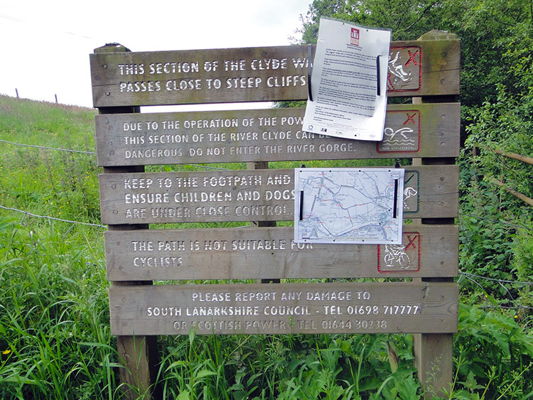 Path blocked
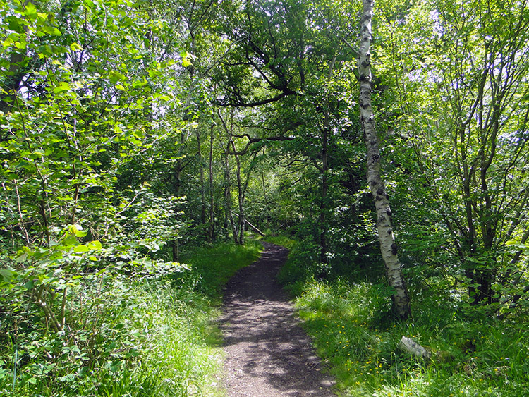
It was turning out to be a lovely day and it had just passed noon into early afternoon when I walked by the grounds of Valley International Park and then the Clyde Valley Parrot and Pet Centre. The path around here and through a large wood perfectly called Big Wood was rich with Rhododendron in spring colour which complemented the light green foliage of trees and shrubs in early season. After leaving Big Wood behind I followed the path beside a series of fields as I continued my walk south towards Lanark. After a while I could see a sign in front of me with an instruction. It was not good news.
 The path I wanted to follow
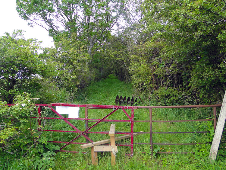 The path I had to follow
The sign promised a walk along the path, which albeit safe, would provide views of steep cliffs and a view of Stonebyres Falls. I had been looking forward to this part of today's walk but I was to be denied. Repair works were being carried out to the bridge crossing the Clyde into Lanark and from here my progress was prohibited. I was gutted and left to imagine what might have been. Disappointed I followed the detour which took me steeply uphill across a field to a stile which I crossed to follow a green lane to the hamlet of Nemphlar.
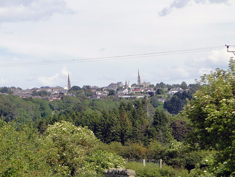 View over Lanark from Nemphlar
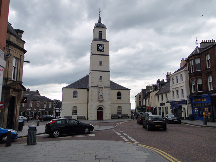 Lanark Main Street
The steep climb of 70 metres was a test I had not expected but once in the extremely quiet and pretty village of Nemphlar I was compensated with gorgeous views of the rooftops of Lanark. However after passing East Nemphlar I lost the lofty views as I followed a lane downhill. I reached West Nemphlar Road and continued on my downhill course to Mousemill Bridge from where I faced another steep climb to Lanark. My finale to the day was a tough 100 metre ascent into the town centre. I heaved myself up the hill and reached the town quite shattered. Though it had only been a ten mile walk with the first eight a doddle the final two which involved the detour up and down hill and with the final steep ascent into Lanark had told on me. Especially after over 100 miles of carrying a light pack.
I retired into a cafe, clumsily took off the backpack without damaging any of the furnishings and rested while I enjoyed a large coffee an a bun. Afterwards I found my accommodation which I have to say was superb and in the evening I took myself off to Wetherspoon's for a beer and something to eat. Never so much have I enjoyed a Wetherspoon's Chilli con Carne!


