The Great British Walk
A personal record of my three month walk of the full length of Great Britain from north to south with written journal and photographs. Tracklogs for GPS units and for use with Google Earth are available for download for each stage.
Stage 33: Over Phawhope to Langholm
Google Maps Open Source Maps| Statistics and Files | ||
|---|---|---|
| Start: Over Phawhope | Finish: Langholm | Distance: 25.7 miles (41.4 km) |
| Time: 11-13 hours | Climbing: 959 metres | Total Distance: 418.1 miles |
| GPX Route File | Google Earth File | About the Southern Uplands |
| Statistics | |
|---|---|
| Start: Over Phawhope | Finish: Langholm |
| Distance: 25.7 miles (41.4 km) | Time: 11-13 hours |
| Climbing: 959 metres | Total Distance: 418.1 miles |
| GPX Route File | Google Earth File |
Ordnance Survey Explorer Map (1:25,000)
Summary
My final day in the Scottish Southern Uplands was an anticlimax following the glory of the first two. It was miserable from the start and remained miserable throughout. The going was as tough as the harsh weather with much of the walking on forest access roads or vehicular tarmac roads. My problem was there were no viable alternatives to the route plan. At least there were one or two brights moments on a thoroughly dismal day. Just one or two mind you.(Note: My walk of Glasgow and South Scotland was a part of my Great British Walk from the north coast of Scotland to the south coast of England)
Stage Report
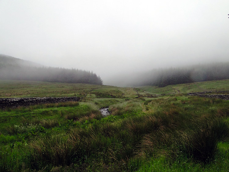
I had closed the door of my personal bothy last night to shut out a very agreeable evening which was pleasantly calm and warm. Birdsong had greeted the twilight and only fell silent as dusk had turned to dark. Morning had not brought the same song of joy. I opened the bothy door to see why this was so and saw a fog of grey. The clouds had descended to ground level. Though rain was not following particularly heavily a heavy moisture hung in the air. I had not dressed for walking and the inner clothes I had on were soon feeling the claustrophobic damp. I retreated back into the dry of the bothy and made breakfast. I finished breakfast and then placed all my bedding, clothing and equipment into the backpack in the same orderly fashion I always do. Methodology through repetition was imprinted in my mind now. The last thing was boots on. Then I stepped into the elements.
 Miserable morning in Ettrick
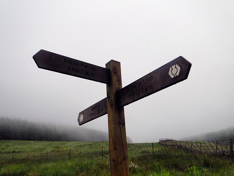 Way to go
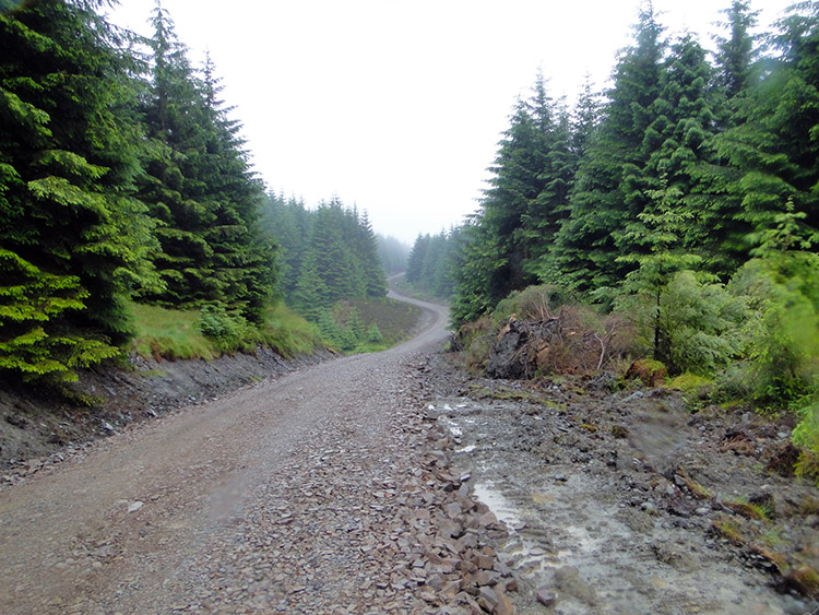
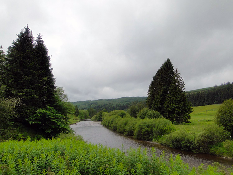
My plan was to walk to Eskdalemuir twelve miles in the distance and find a suitable place to camp. With the weather as it was I hoped it would stop raining before I did so. But the misery of drizzle continued to dog me as I walked away from Over Phawhope Bothy. I turned and gave the bothy a final affection look before it disappeared into the mist. Then I walked on a track bisecting Middle Hill Plantation to Ettrick Head. I kept my head down for there was not much to look at and I wanted to avoid a succession of water droplets running from forehead to nose and carrying on down my bridge to result in an irritating itchy drip. No thank you.
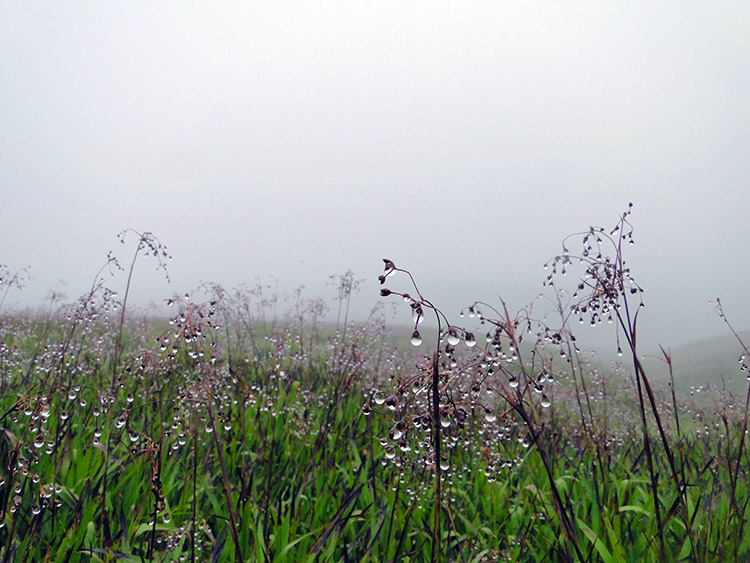 Water droplets on upland meadow grass
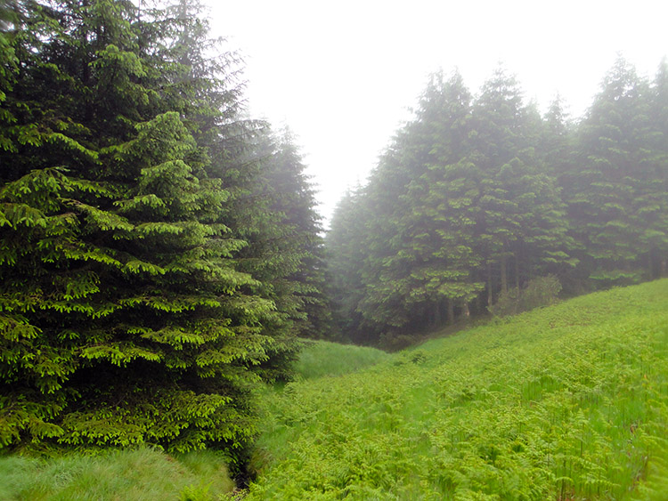 Lochfell Bosom
From Ettrick Head I walked across an upland meadow to the high point at Park's Well. Grass in the meadow were heavy with water droplets such as those I was avoiding to form my nose. A much prettier picture they made. I then descended just a little to enter a plantation on Birch Hill. I came to affectionately named Lochfell Bosom at which point I parted company with the Southern Upland Way. It continued west while I turned east. Scotland allows liberal rights to walk anywhere as long as damage is not caused through the Scottish Outdoor Access Code. With this in mind I had designed a track from Lochfell Bosom to South Loch Fell which would get me on to a track which would lead me through the huge expanse of Eskdalemuir Forest. I followed the line on my GPS device which took me on a lung busting steep climb up Little Knuckle Gill. More white knuckle I thought when I gasped at the top though it got me directly to where I needed to be. I entered Eskdalemuir Forest and soon found the track I wanted.
 Eskdalemuir Forest
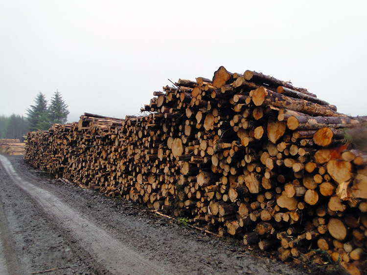 Natural resources
It was quite fitting for such a miserable day. There was not a great deal of scenery to be seen as most of the surrounding hills were blocked from view by densely packed rows of conifers all growing high to the sky in as straight a line as possible. Just as the foresters prescribed and consumers craved. It did not make things pretty. As I plodded on through the forest I looked at the scale of the farming of wood in Eskdalemuir Forest. Apparently forestry produces three times the economic output of farming before subsidy and forestry’s spending in the local economy is double that of farming. So forestry wins and I accept that. It loses every time in aesthetics though. It is so uniform by nature it can never be pretty. Sheep grazing on an open fell wins on that scale every time. I suppose the stacks of felled timber I passed made a picture because they made me stop my march through the forest and look them over. It continued to drizzle.
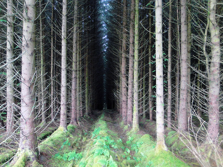 Uniform parallel rows
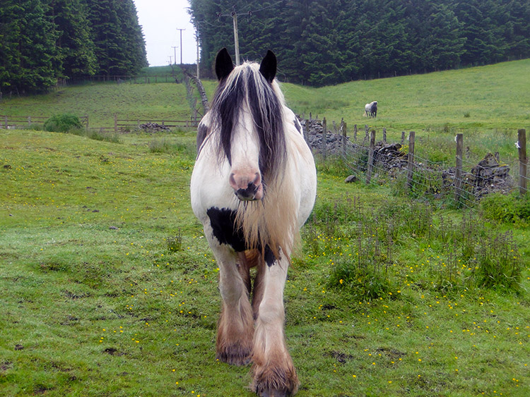 Hello there
My walk through Eskdalemuir Forest was over five miles long. Practically all of it was uninteresting dirge. The weather did not help but even a sunny sky could not have alleviated this bit of bore on my Great British Walk. There was no alternative though, no tracks or trails on the map. This quadrant of Ordnance Survey had very little dashed green line. And thick forests such as the one I had just exited made planning direct courses difficult. After emerging from Eskdalemuir Forest I came to tarmac road. As soon as I reached the road I met a friendly horse which had walked all the way across its field to greet me. We had a friendly meeting for a minute before I had to go. Then I walked into Tibet.
 Kagyu Samye Ling Monastery and Tibetan Centre
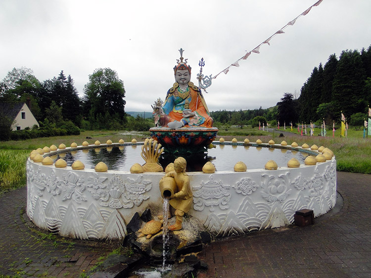 Tibet in Eskdalemuir
I was drenched, I was miserable and I was in need of refreshment. Remarkably and seemingly out of nowhere my desire was satiated. I saw a sign to Tibetan Tea Rooms. In my planning I had noticed I would walk past somewhere called Samye Ling Tibetan Centre. I did not know it would be so welcoming to outsiders. I did not need a second to think. I left the road and walked into the grounds and to the tea rooms. As I walked the short distance down the drive a group of about a half dozen cyclists passed me. They headed to the tea rooms too. As they had beaten me to the door I queued while they were served. Others were in the tea rooms. It was busy and the ambiance was good. Eventually I got served by a pleasant lady monk. Is that the right term? I went outside to some benches in an area roofed from the rain. The drink, sandwich and scone were all lovely.
After refreshments I took a leisurely walk around the grounds of the Tibetan Centre. Gardens were well tended, areas of meditation were interspersed with the grounds and some of them had small groups sitting in silence. As I continued exploring a man dressed in monks robes approached me. He greeted me with a Glaswegian accent. He asked of my journey and approved of my reasons and methods for my walk. I asked him of his reasons for being in the centre. He said "I was a bad man in Glasgow" and after a further bit of dialogue into the circumstances he went on to say "I am not a bad man here". He smiled, put his hands together and bowed to me. I said thank you and then we turned our separate ways and parted. I left to continue my journey.
 Eskdalemuir
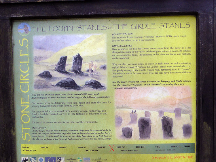 Loupin' Stanes
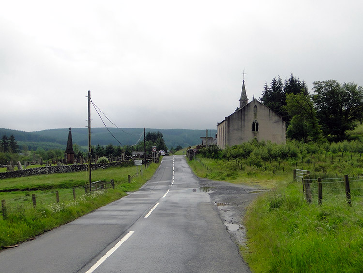
I walked into the hamlet of Eskdalemuir. It was silent and with no sight of a shop or cafe I was pleased I had refreshed myself with food and drink in the Tibetan Centre. I came to a staggered crossroads and an impressive bridge spanning the White Esk. A small group of people were stood at the crossroads and I wondered why. Nothing seemed to be happening. Then I heard the drone of a vehicle approaching. A car appeared from the junction to my right. It turned right and headed south. Another quickly followed and then another. The small group of people cheered each one. I had come to witness a vintage sports car rally. The cars were not going my way but this short piece of road in Eskdalemuir was the only piece of road where we could meet. I was in the right place at the right time. I then realised it was Saturday lunchtime. I often lose sight of time and day of the week on a long distance walk. No such precision is needed if plans have been made.
I left the line of the car rally by turning left at the staggered junction and crossing the bridge over the White Esk. It was still miserable weather though the drizzle had temporarily ceased. It was around 1.00pm and I had reached the locality where I had planned to stop and camp. I was feeling OK to go on though and with it being too early to stop I decided to keep going. Outwardly I said to myself "Keep going for a while and reconsider the options". My innermost thoughts had decided "Langholm or bust". There were 13.5 miles between me and Langholm. And nearly every step would be on tarmac.
 River Esk at Enzieholm Bridge
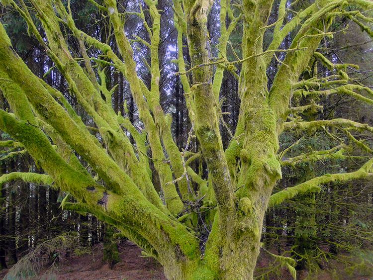 Mossy tree
It started well. I was feeling in good form and my feet had not suffered any recurrence of the impact damage I had suffered on the Cape Wrath Trail. That was two weeks past now. I marched on along the road. One mile passed until I reached the intriguingly named Loupin' Stanes. I viewed the small stone circle in a field. I marched on along the road once more and another mile passed. And then another mile passed. at a little over 15 miles into my day I reached a crest on the road to Langholm at Toothope Hill. I clambered from the road to a felled tree stump which I used as a seat and took a short break. I did not stop for too long. It started to rain again.
Who knows if it had not rained. I had felt really good before I had stopped for my mini break but the rain caused me to put my foot down and accelerate. And I should have known better. Acceleration on unforgiving tarmac with over 16 kilos strapped to my back was not good for my feet. They were heating up with every step I took. It was looking like The Cluanie Inn to Invergarry/ Invergarry to Strone effect all over again. Stubborn nit. After two and half miles I reached Enzieholm Bridge. I had ten miles to go. It started pouring down.
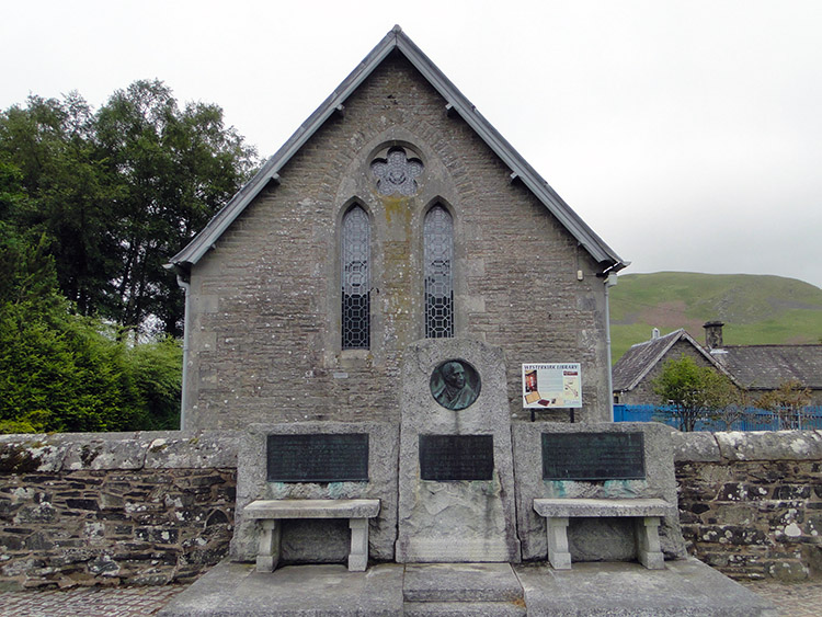 Westerkirk Library is the oldest in Scotland
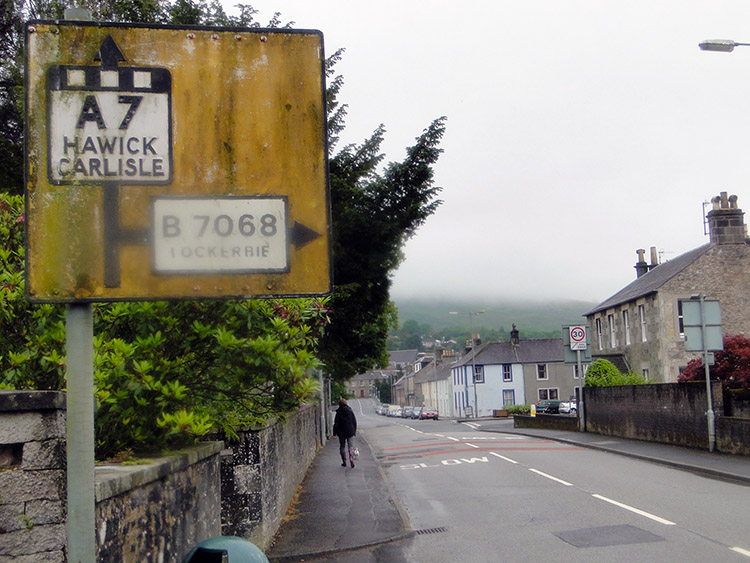 Langholm
I soldiered on, still not feeling any ill effects. Two and a half miles further I reached Bentpath and walked into the village looking for a shop. There was no shop but I did come across Westerkirk Library which is famous as the oldest library in Scotland, dating back to 1791. There is a memorial to Thomas Telford outside the library who left £1,000 to it in his will. Good man. Disappointed at not finding a shop I took another break to eat the provisions I had left. I hid in a patch of thick woodland from the rain which still poured. During my break it stopped. No ray of sunshine but at least a cessation from the attack of precipitation from the clouds above. I took the release from the stranglehold of rain as an incentive to keep going.
The final eight miles from Bentpath to Langholm were no fun at all. Though I walked good for the first five miles the final three were conducted at a slowing pace. My feet had overheated and though I did not fell anyway as bad as I had towards the end of the Cape Wrath Trail I knew I had overdone it once more. But I had stubbornly continued for a reason and as I marched into Langholm I felt pleased with myself. While walking from Eskdalemuir I had used my mobile phone which I had thought I had lost yesterday and booked an extra night at my hotel I had already booked for tomorrow. I could have a day off. A Sunday to read the papers, watch some sport and await the arrival of my best friend
Strolling Steve was on his way. The next stage of the walk would see me walk out of Scotland after 33 stages and 411 miles of walking to begin my transit of England. Steve had agreed to join me on that journey down England, all 600 and a bit miles of it. My aching feet felt the better for that. And so, after today's stage I was not stuck in a tent on a damp patch in Eskdalemuir. I was in Langholm in a cosy bed in a cosy room. It was such a lovely feeling.


