The Great British Walk
A personal record of my three month walk of the full length of Great Britain from north to south with written journal and photographs. Tracklogs for GPS units and for use with Google Earth are available for download for each stage.
Stage 29: Lanark to Biggar
Google Maps Open Source Maps| Statistics and Files | ||
|---|---|---|
| Start: Lanark | Finish: Biggar | Distance: 12.4 miles (20.0 km) |
| Time: 5-6 hours | Climbing: 284 metres | Total Distance: 361.1 miles |
| GPX Route File | Google Earth File | About Lanark |
| Statistics | |
|---|---|
| Start: Lanark | Finish: Biggar |
| Distance: 12.4 miles (20.0 km) | Time: 5-6 hours |
| Climbing: 284 metres | Total Distance: 361.1 miles |
| GPX Route File | Google Earth File |
Ordnance Survey Explorer Map (1:25,000)
Summary
Another of the days a long distance walker puts up with as a case of getting from one place to another. There was little option but to use the road network on this stage though I will always regret not completing the Clyde Walkway to New Lanark and the Falls of Clyde. Had the weather being better and my spirits higher then I would have done so but the dismal morning in which I found myself determined my decision to cut my losses, keep the route as short as possible and get to Biggar as quickly as possible so I could spend part of the day out of the rain.(Note: My walk of Glasgow and South Scotland was a part of my Great British Walk from the north coast of Scotland to the south coast of England)
Stage Report
Following yesterdays delightful walk in sunshine along the River Clyde from Glasgow to Lanark I found myself looking at dismal clag after opening the door of my overnight accommodation. Backpack loaded onto my back I set off up the hill from my digs to town, only to realise after I had made the climb that I had left my walking poles in the bedroom. "Drat" I exclaimed under my breath and walked down the hill. He was a kindly elderly gentleman with whom I had enjoyed a lovely chat over breakfast and we had a chuckle about my oversight. I waved him goodbye for a second time and climbed the hill into town for a second time.
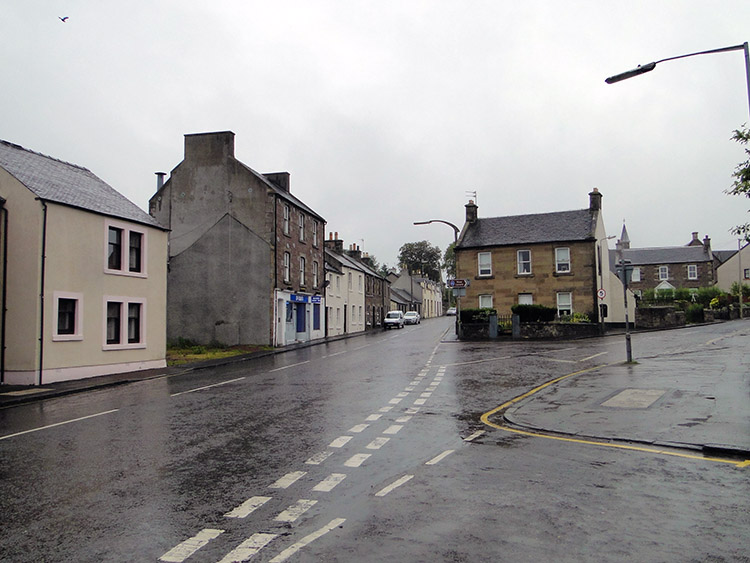 Leaving Lanark on a dreary morning
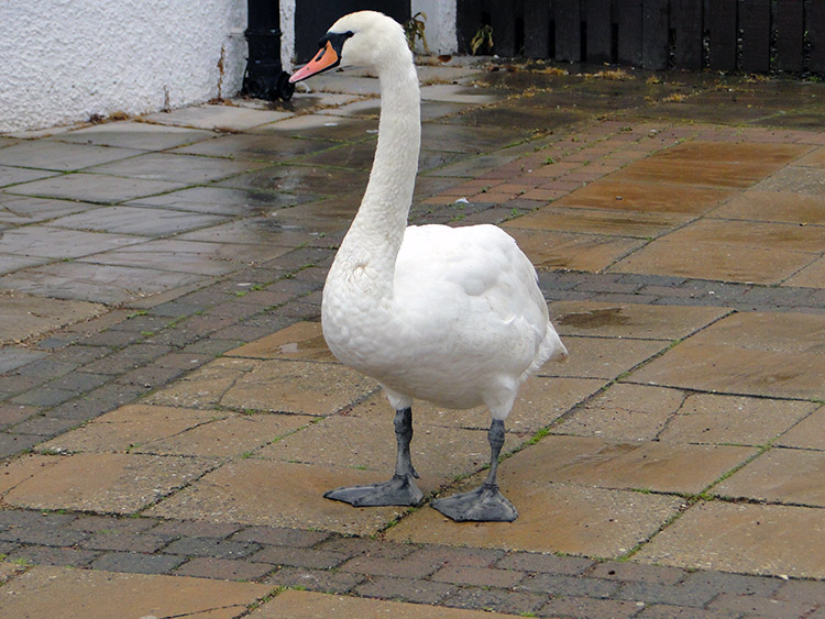 The Swan says "fine weather for ducks"
I trudged with head down out of town following the A73 Hyndford Road past the last houses of Lanark. I had not got far before I stopped, resting my backpack against the low front garden wall of one property and getting out the all in one rain-cover, the one resembling a bin-liner. It was that bad with the rain pelting down that I had decided the wet weather walking coat needed some more protection. I passed Lanark Hospital on the edge of town and came to a park. A Swan stood on the footpath, untroubled by my arrival as if to say "Take a break, it is fine weather for ducks is it not?".
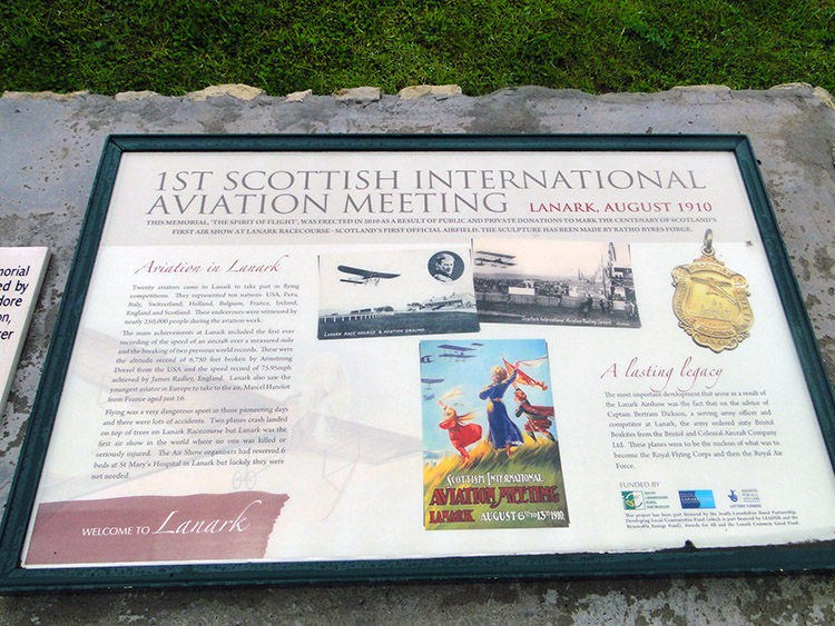 Site of the first Scottish Aviation meeting
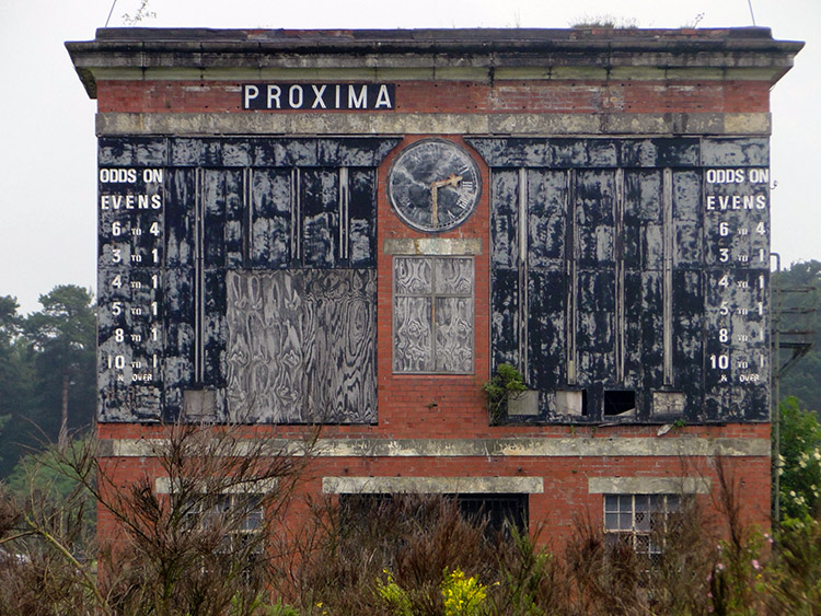 Site of Lanark Racecourse
The Swan was meandering on the footpath at the entrance to the site of the first Scottish International Airshow, held in Lanark in 1910. I had just missed it by 101 years and today it was solemnly quiet not like that day when 17 aviators from seven countries entertained the crowds with their aeronautic prowess in competition for a prize fund of over £8,000 - quite a sum in those days. Over a quarter million people attended that day, today it was just me and the Swan. Following the road south-east out of town I reached the site of Lanark Racecourse. The racing results board clock was stopped at 2.30.
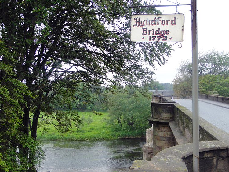 Hyndford Bridge
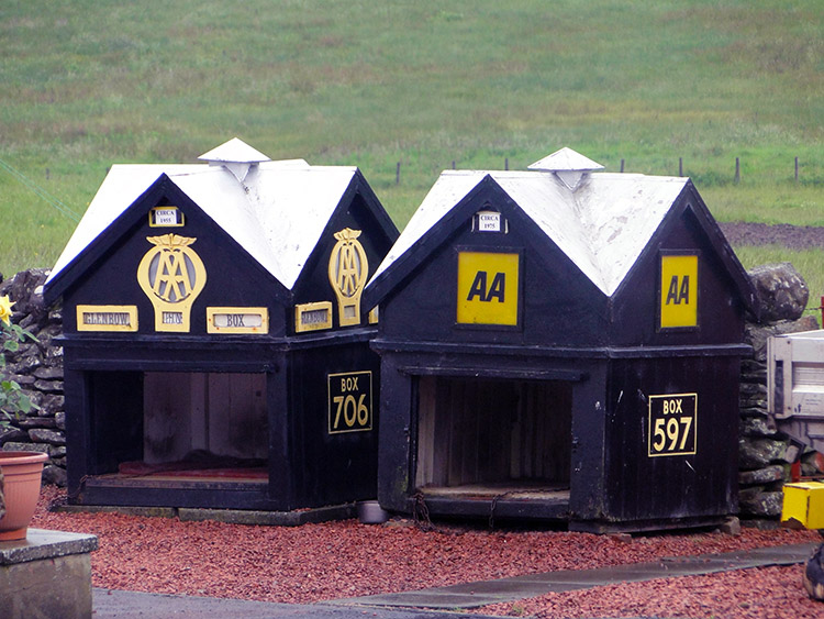 Collection of Automobile Association boxes
I continued on a south-east course by the roadside to a junction near the site of disused Winston Barracks. Everything seemed to be disused on this road, all seemingly abandoned, though the barracks had a least being resurrected into housing. There was scant traffic on the road either, a blessing I suppose while I walked along in the miserable rain. From the road junction though the traffic got busier as I was now also following the A70. I walked downhill to where both the A73 and the A70 crossed Hyndford Bridge, after the bridge the roads parted and I continued walking along the A73. Apart from the bend at Carmichael Boat it was dead straight so I was well warned of any heavy traffic and could easily step off onto the good verge. Eventually after passing a bungalow which had the garden full of old AA road rescue boxes I left the side of the A73 and walked up a lane to a B road which took me around Chester Hill. There was no traffic at all to bother me now.
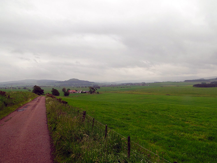 Quiet road to Thankerton
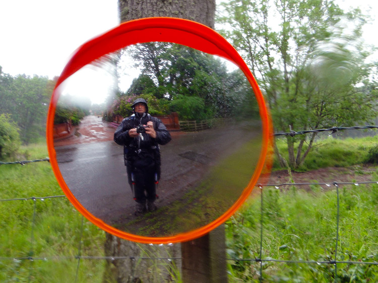
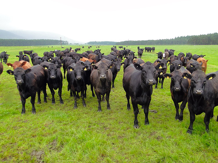 A bit of excitement
I could have been in the most remote of upland wilderness now, there was just me and the elements. I stopped by a wall with a little tree cover to shelter me from the persistent rainfall and took lunch before following the road from Chester Hill along Perryflats Road to Thankerton. As I passed a field full of young Bullocks they ran over to the field side and sniffed as I walked by. Probably the only person apart from the farmer they saw all day, a little bit of excitement from their boring day in the field.
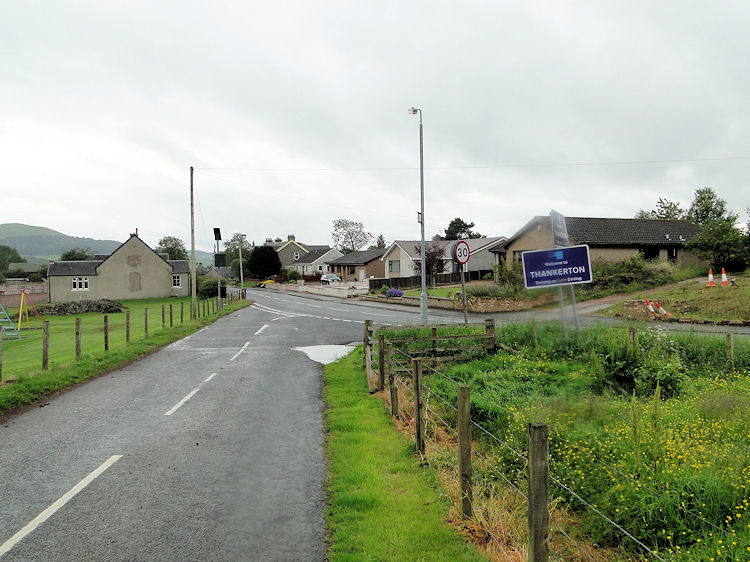 Thankerton
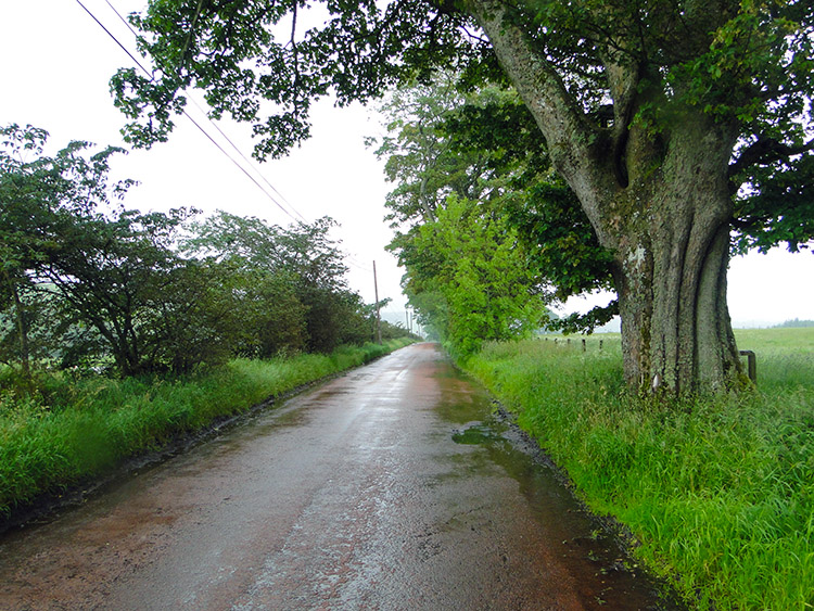 Where is everyone?
I reached Thankerton and I never saw anything or anyone stir while I walked through the village. I had hoped for a shop as I had fancied a bar of Chocolate to alleviate my mood while walking on a boring stage on a bad weather day - though putting the two together is a good thing; I would rather have the bad days when there is not much to be enjoyed. After Thankerton I thought there are always good things though. Around here the series of small rounded hills like Chester Hill I had just passed and oddly named Quothquan Law were reminders that I was approaching the Southern Uplands. And through gaps in the gloom I could see them for the first time as I walked from Thankerton along the traffic free roads to Biggar. Still it never stopped raining.
 On reflection I was wet through
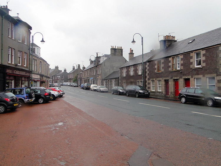 Biggar Main Street
I arrived in Biggar soaked through to the skin. To confound my spirits on this almost forgettable day I was told the booking at the inn I had made had not been confirmed and that no room was available. At least they pointed me in the direction of accommodation next door which was very acceptable and cheaper too. A silver lining out of the cloud. Even though I was continuing the walk tomorrow I was to stay in Biggar for two days so my cheaper accommodation worked out well. Would tomorrow's stage?


