Offa's Dyke Path National Trail
A personal record of my walk of Offa's Dyke Path National Trail with written journal and photographs. Tracklogs for GPS units and for use with Google Earth are available for download for each stage.
Journal, Photographs and Download Files
Stage 2: Bodfari to Bwlch Penbarra
Google Maps Open Source Maps| Statistics and Files | ||
|---|---|---|
| Start: Bodfari | Finish: Bwlch Penbarra | Distance: 10.5 miles (16.9 km) |
| Time: 5-6 hours | Climbing: 1,061 metres | Rating: Hard |
| GPX Route File | Google Earth File | About Offa's Dyke |
| Statistics | |
|---|---|
| Start: Bodfari | Finish: Bwlch Penbarra |
| Distance: 10.5 miles (16.9 km) | Time: 5-6 hours |
| Climbing: 1,061 metres | Rating: Hard |
| GPX Route File | Google Earth File |
Ordnance Survey Explorer Map (1:25,000)
The Walk:
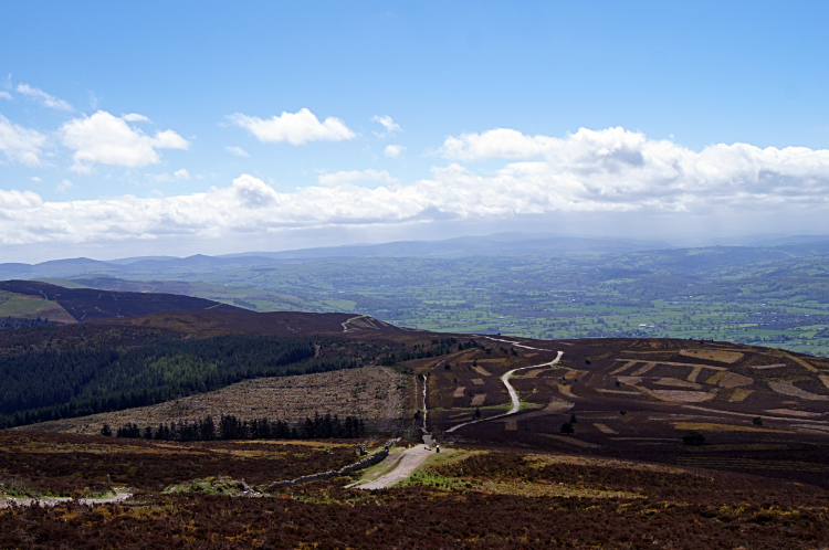
 Climbing to the Clwydian Range
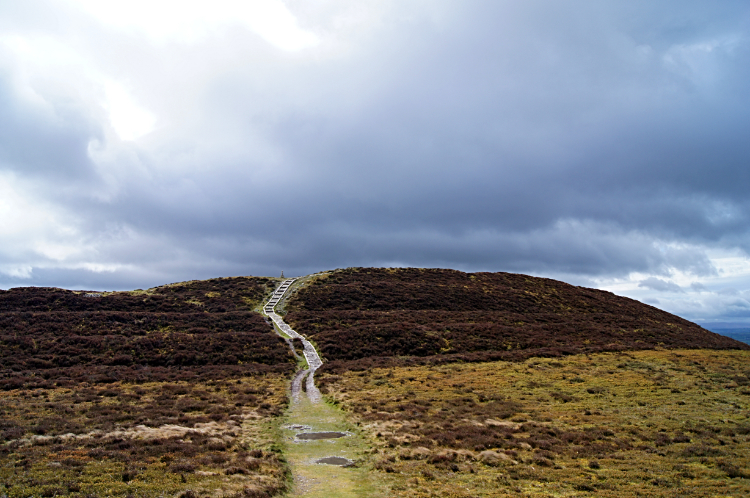 Penycloddiau
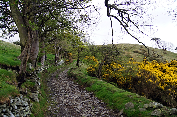
After a relaxing night's sleep and a hearty breakfast at Llety'r Eos Ucha I was ready for a good day walking on stage two of my Offa's Dyke journey. Not that I had seen any sign of a dyke yet which I did not expect to see over the next couple of days on the high paths of the Clwydian Hills. I would get to see the dyke eventually but before that I could enjoy my crossing of this exciting range of hills for the very first time. First and foremost though was a short spell of lowland walking from Bodfari across the valley of the River Wheeler which I crossed by way of a footbridge soon after crossing the unbusy A541. "Where is everyone?" I thought. Just as I had experienced on the path yesterday it was eerily quiet. Nothing stirred. And then, soon after the river crossing, I was startled by this large four legged figure running across the field I had just entered. It had spotted me before i had spotted it and was on the run to shelter. Just in time I noticed it scrambling into the cover of thick gorse. I had no doubt I had seen my first solitary adult boar Badger. It was not in a group. Nor was it near a Sett. The Badger was soon gone but the thrill had woken me up for my immediate climb to the hills directly ahead of me. First I climbed by way of a farm access track to derelict buildings long abandoned and decaying and then by way of a bridleway track to the south outlier of Moel Y Parc, on to Aifft and the to Penycloddiau.
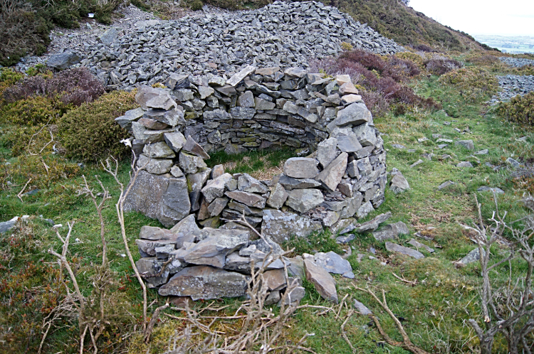
 Penycloddiau Fort
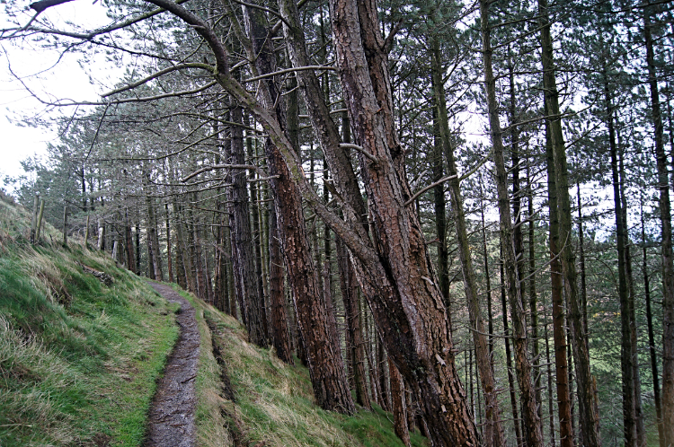 Woodland near Llangwyfan
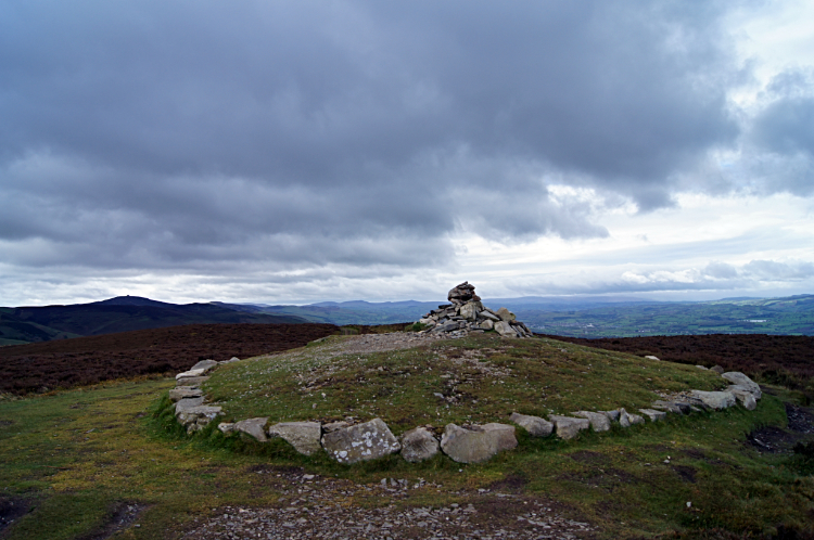
It continued to be eerily quiet as I climbed Penycloddiau but this would not have been the case in the Bronze Age. During those ancient times a 26 hectares (64 acres) hillfort was occupied on Penycloddiau making it one of the largest hillforts in Wales. Indeed there are hillforts from that era situated on neighbouring hills too which I were to visit before todays walk was done. For now the site of Penycloddiau Fort was symbolised by a neatly arranged stone circle and central cairn on the summit. An engraved slate tablet set in the ground at the site read "Penycloddiau Bronze Age Burial Mound Reconstructed 2010". From the site of the hillfort I continued heading south-east to woodland near to Llangwyfan which also heralded my entrance to Moel Famau Country Park. My entry to the Area of Outstanding Beauty was rewarded with a short sharp climb to Moel Arthur.
 Shelter below Moel Arthur
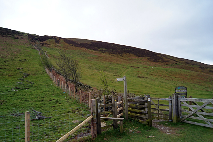 Climbing Moel Llys-y-coed
Moel Arthur was the site of the second hillfort of my days walk though the evidence on the hill and at the summit was less elaborate than on Penycloddiau. All to be seen were scattered stones and an untidy low cairn. Apparently the hillfort enclosed an area of 1.8 hectares (4.4 acres), a much smaller area of cover than on Penycloddiau. From the ruinous summit I scampered down the steep south side of Moel Arthur to a car parking area and near where I found a man size shelter of stone to take refreshments. It was just 11.00am but I was half way into my day walk, having set off three hours earlier. The shelter kept out the cool wind and kept my snug. After my break I was warmed again by a steep 100 metre ascent of the north side of Moel Llys-y-coed. I was also heartened by the sight of blue sky. The thick cloud of the day so far was beginning to break up.
 Looking down on the Vale of Clwyd
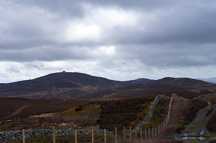 Looking up to Moel Famau
When up to the high point on the west shoulder of Moel Llys-y-coed I paused to catch my breath and took in a WOW moment. The blue which was appearing in the sky above me had already had an illuminating effect on the Vale of Clwyd a thousand feet down to my right and it beamed a ribbon of shimmering light. The patchwork fields, all shades of green with spring budding woodlands and with small towns and villages sprinkled here and there made for an enchanting view. Directly ahead of me were the dark browns of upland heathers yet to show new season growth and lines of skinhead haircut where the heather had been burned to ground level, a sure sign of Grouse Moor management. Not only for shoots though, I was mighty pleased to see the Clwydian Range and Moel Famau Country Park being the site of a Black Grouse reintroduction scheme. Wonderful.
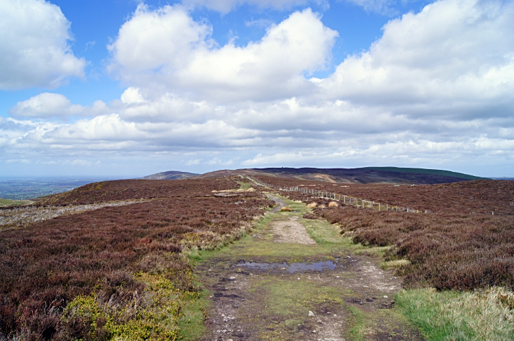 High path across the Clwydian Range
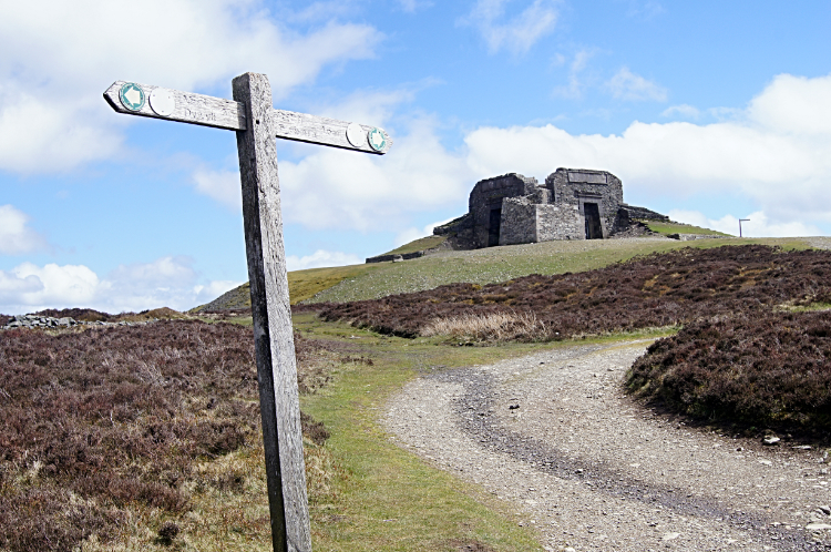 Reaching the summit of Moel Famau
I walked with a spring in my step across the tops of the Clwydian Hills with the increasingly blue sky delighting me further still. I was in my element as I walked and gambolled on the good wide Offa's Dyke pathway to Moel Dywyll and from there towards Moel Famau. Hill walking, cannot beat it and especially along a long defined spine. I had fallen for these hills. Can't change that. Approaching Moel Famau and just as I started the definite climb to the summit I met my first fellow Offa's Dyke walker. A lady walking in the opposite direction and only one more day from her finish chatted with me for a while. She said she had seen very few full trail travellers. Perhaps we were still a little early in the long distance walkers season? Waving her goodbye I set out on my final climb to the summit of Moel Famau and to an unexpected conversation with a man in a yellow hi-viz jacket on the top of the hill.
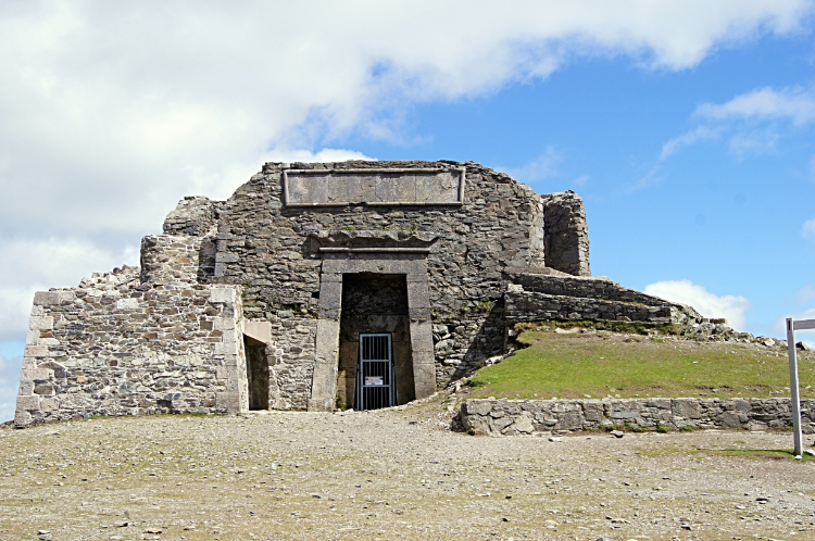 The Jubilee Tower at the summit of Moel Famau
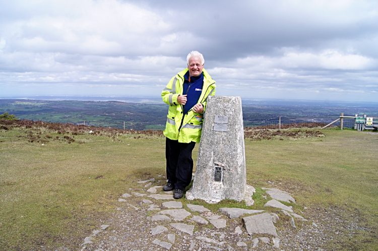 Proud as can be on Moel Famau
I reached the summit of Moel Famau where at last I was reunited with the human race. A few at least, around a dozen people. A significant structure sits on the summit ground. While at the structure I wrote a Facebook post which reads "The Jubilee Tower has the most striking vantage point. There are sweeping views north, east, south and west. Information plaques on each cardinal point show what you can see and with todays excellent visibility I could see all indicated including Liverpool beyond the Dee Estuary, Snowdonia's finest including Cadair Idris and much more which I shall share in time. It was magical and the tower itself has an interesting history to look up". While there enjoying the superlative views I also met a gentleman recently retired from the Ordnance Survey who was with his daughter. He told me he had been the Ordnance Survey Inspector who had managed all the trig points on the Clwydian Hills for his working lifetime. He was up here for the last time in the company of his daughter and to touch the trig pillar for the last time. I told him I thought one of my previous jobs as a Water Officer in rural West Harrogate had been a lifelong delight and privilege. As was his work legacy. we shook hands and parted.
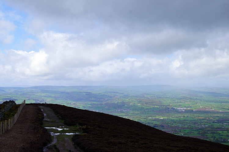
 The view from Moel Famau south-west
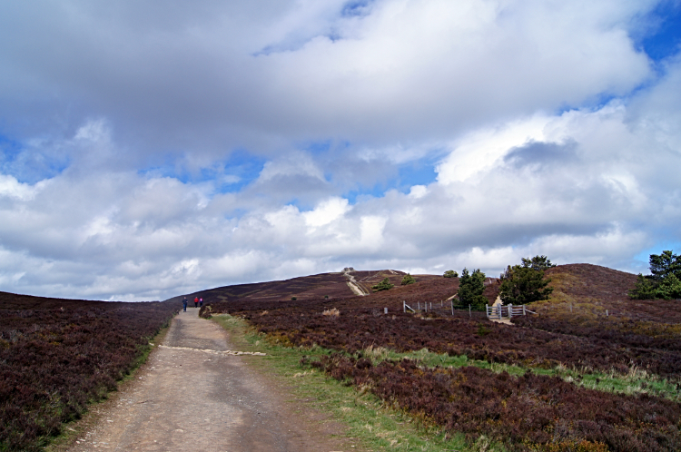 Approaching Bwlch Penbarra
I left the top of Moel Famau and headed south-west along the Offa's Dyke Path route. I passed a few more people making their way to the summit to enjoy their mid to late afternoon views and I passed a few stragglers heading down too. My end point of the stage at Bwlch Penbarra was almost reached and by 2.00pm I was there. At the finish of my Offa's Dyke Path Stage Two and for the purposes of the attached downloadable maps and route files all done. But I still had three miles of off-tracking to do as my accommodation was in the pretty market town of Ruthin. It was enjoyable, all lazily done on a downhill course into the vale. The only snag was being hit by a heavy rainstorm as I entered the town. All wet on arrival but nothing could dampen my spirit after a great day walking the Clwydian Hills of North Wales. Ruthin is a fine town, I enjoyed my stay in good accommodation at the Star and my drinks and dinner in the best Wetherspoons I have ever visited was a bonus too. All was good with my world.


