Offa's Dyke Path National Trail
A personal record of my walk of Offa's Dyke Path National Trail with written journal and photographs. Tracklogs for GPS units and for use with Google Earth are available for download for each stage.
Journal, Photographs and Download Files
Stage 7: Newcastle to Kington
Google Maps Open Source Maps| Statistics and Files | ||
|---|---|---|
| Start: Newcastle | Finish: Kington | Distance: 21.1 miles (34.0 km) |
| Time: 9-11 hours | Climbing: 1,323 metres | Rating: Strenuous |
| GPX Route File | Google Earth File | About Offa's Dyke |
| Statistics | |
|---|---|
| Start: Newcastle | Finish: Kington |
| Distance: 21.1 miles (34.0 km) | Time: 9-11 hours |
| Climbing: 1,323 metres | Rating: Strenuous |
| GPX Route File | Google Earth File |
Ordnance Survey Explorer Map (1:25,000)
The Walk: From my early morning Facebook post, 10th May 2015: Good from Offa's Dyke. I set off from Newcastle on Clun at 5.30am this morning and I have already covered five miles. Approaching Knighton now having crossed Llanfair Hill. It's a cool windy morning but sun is trying to break through the cloud. Still 16 miles over the Clun Hills today but first priority is breakfast in Knighton. Looking forward to that.
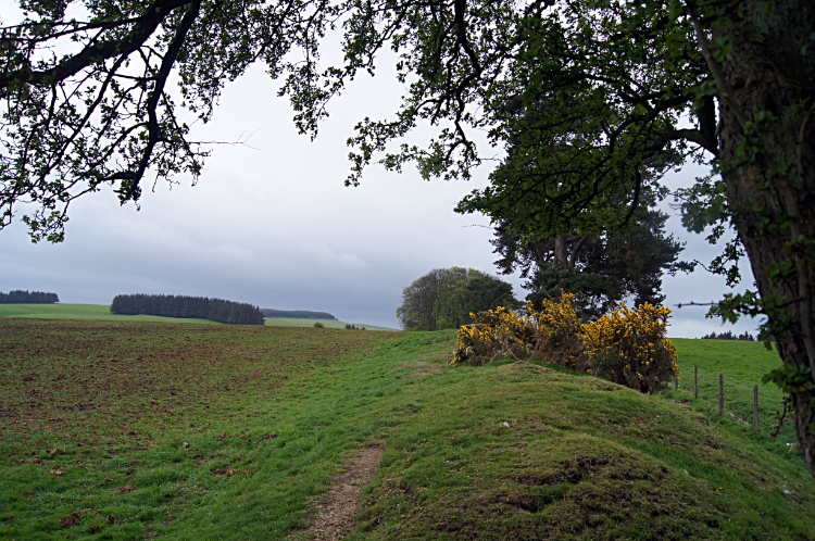
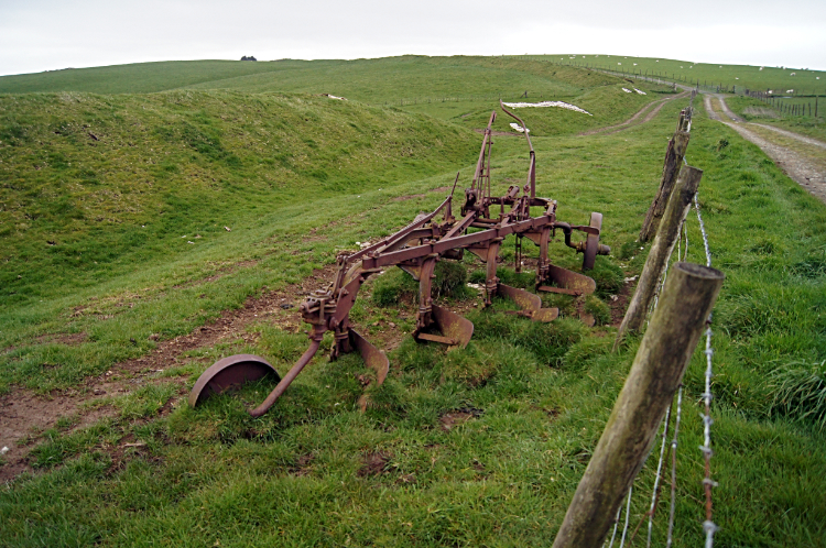 Plough and Dyke at Llanfair Hill
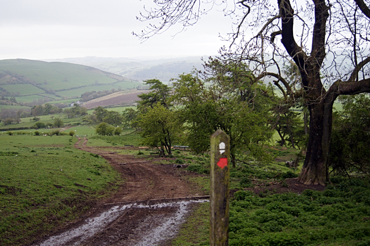 View to Cwm-Sanaham Hill
A day of border crossings ahead of me; England to Wales and back into England again. Offa's Dyke meanders between the two nations. Also a day of climbing and descending with five appreciable climbs; to Llanfair Hill, Cwm-sanaham Hill, Hawthorn Hill, Evenjobb Hill and Herrock Hill. Over 1,300 meters of climbing in a little over 21 miles of walking. Good job it was not day one. A week into the task I was at least warmed to the task ahead. Still, I made sure of an early start. As my accommodation only did breakfast later than I wanted I opted out and left to set off walking at 4.45am. It was just getting light when I climbed from the Clun valley to Llanfair Hill, a walk of two and a half miles. It was still fifteen minutes to six in the morning as I passed the crest of the hill. I was following a well made ridgeway bridleway across the Clun Hills and as well as following Offa's Dyke Path I was also follow Jack Mytton Way, a long distance footpath I had recently followed during some Shropshire Hill walks, including the Long Mynd. Offa's Dyke earthwork was often in my sight as I walked the bridleway from north to south, close by in the field to my left. In some places sandbags were arranged on the embankment to repair erosion of the dyke. It was a muggy overcast morning but at least it was not raining. Just in case it did when it got to six in the morning I stopped for a cold drink and chocolate bar in the shelter of a corrugated iron sheet barn. (where I wrote my Facebook post) It was just me and the quiet of morning with the only noise the distant baa of sheep waking up to their day in the neighbouring fields. After my break I descended from Llanfair Hill to a scattering of homesteads at Garbutt Hall and from there I made my second climb of the morning to Cwm-Sanaham Hill.
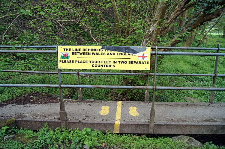 The Border Line at Knighton
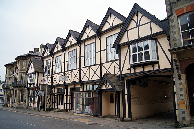 Knighton Hotel
After crossing Cwm-Sanaham Hill an information sign welcomed into the hamlet of Skyborry and from there I set my sights on the town of Knighton. A town at last! Surely I could get food. Perhaps some hot food in a cafe even. It was just before 8.00am but I had covered seven miles in three and a half hours. Not the quickest pace but I had taken a break and I had paced myself for the task in hand. I still had a long way to go today. Coming into Knighton by walking alongside the River Teme I passed some early morning dog walkers. I noticed most were ladies, the lads must be at work. On the fringe of town a sign welcomed me to Wales, I was leaving England again. Then a concrete and iron bridge over a beck confirmed the border line. It had a yellow line painted at the half way point on the bridge with two feet painted in yellow straddling the line; one either side. There was a board beside the markings with the claim "The line behind is the border line between Wales and England. Please place your feet in two separate countries". Of course I did so. Then I walked into Knighton, passing Offa's Dyke Centre while walking to the town centre. Knighton had an impressive clock tower in the middle of town and the Knighton Hotel looked busy with guests enjoying breakfast. I was tempted to ask if they served visitors. Instead I looked in vain for an independent cafe of which there were none open. It was early Sunday morning after all. I did find the local convenience store though so I stocked up on drinks, sandwiches, pasties, jumbo sausage roll and confectionery. A drink and the jumbo sausage roll did not last long.
 Ffridd
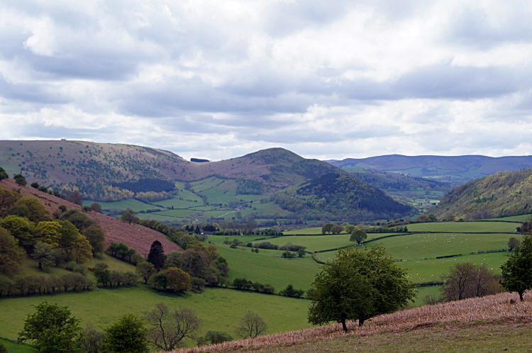
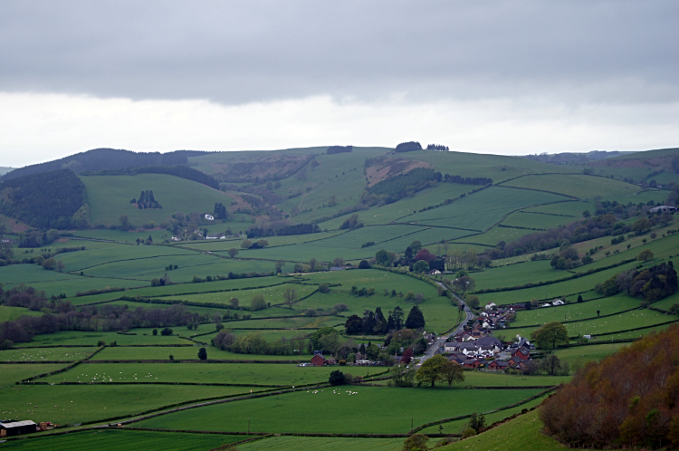 View from Furrow Hill to the Lugg Valley
Filled up with food and drink I left the comfort of Knighton and continued on my Offa's Dyke Path walk. A signpost at the walk information centre had told me I had just 80 miles to go, having already completed 97. I was pleased with my knowledge of that. The knowing did not help with the climb out of Knighton though, a brutal steep climb to Ffridd. I had been at 170 meters altitude when walking beside the River Teme. By heaving myself out of Knighton, first beside steep suburban back gardens and then through Great Ffryd Wood I quickly ascended by 160 meters. I was puffed by the time I had passed the towns golf course and levelled on the way to Rhos-y-meirch. The climbing carried on steadily for a further two miles until I topped out at 407 meters on Hawthorn Hill. On the way I had passed a hilltop monument to Sir Richard Green Price (18 October 1803 – 11 August 1887), a Welsh Liberal politician who brought railways to the area and who dedicated his career to improving working conditions for the poor. I thought that if he was worth a monument he was worth a mention. Hawthorn Hill extended on a wide ridge to Furrow Hill from where I descended into the Lugg Valley. The views were immense up here and though it was a dry overcast scene I could sense improvement in the weather. Yet I knew all too well it could go the other way.
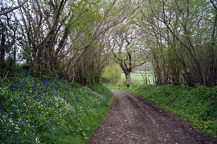 Flowers in springtime
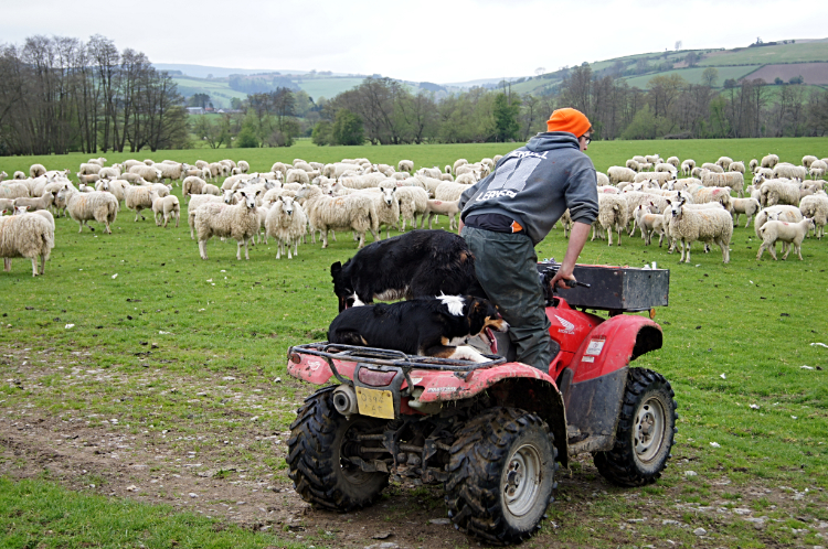 Driving the sheep at Dolley Green
I arrived in the valley of the River Lugg at Dolley Green, a quiet village where the only excitement was watching a young lad from one of the local farms mustering a flock of around 200 sheep. Funnily he was doing all the work on his quad bike while two sheepdogs did nothing but sit on the quad bike with him. I guess when it came to it they would spring into action. After the fun of the farm and the crossing of the valley it was another steep climb, this time on a mix of lanes, copses and bridleways to Evenjobb Hill. Sunshine even glimpsed through the cloud for the first time in the day which lit up the bright yellow Oilseed Rape fields neat to Lower Harpton which was my next point of call after Evenjobb Hill. The countryside around here in May was so pretty. With the colour of the Bluebells thriving in all the native woodlands and much so at the side of the lanes I walked and with the young green shoots of Mature Oaks trees softening the country scene it was just lovely.
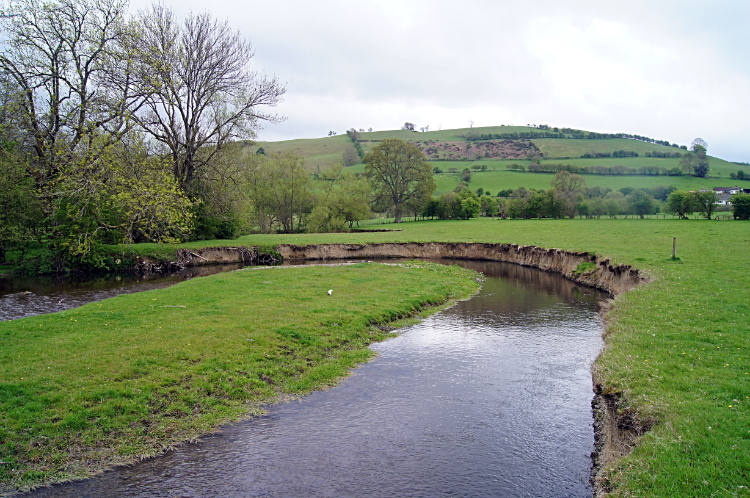 Ox-Bow forming in the River Lugg
 Fieldside path skirting around Herrock Hill
When I reached the bottom of the 4th descent of five and having completed 17 miles of walking and over 1,000 meters of climbing I could have felt tired, jiggered even and a little low. But I did not feel anything but wellness. Looking to the heights of Herrock Hill from Ditchyeld Bridge which I had to skirt around to ascend to Rushock Hill did not daunt me at all. I was full of fuel for my long distance walking thrills now. The climb was another of the 200 meter ups I had being doing all day, this being the fifth of five. As I climbed from Lower Harpton Farm around the east fringe of Herrock Hill to Herrock Cottage the sun came out once more shining a bright light on my last climb. Continuing uphill I reached an old gentleman on the trail. He was from Herrock Cottage and he told me he walks up the hill everyday he can. "Whenever possible. As long as I can lad" he said with a smile. "To be called a lad is a real treat" I replied "I'm sixty next birthday but thanks all the same". We had a good laugh. Waving him goodbye I continued around Herrock Hill to Rushock Hill. My final climb of the day was done when I reached the top.
 View from Bradnor Hill
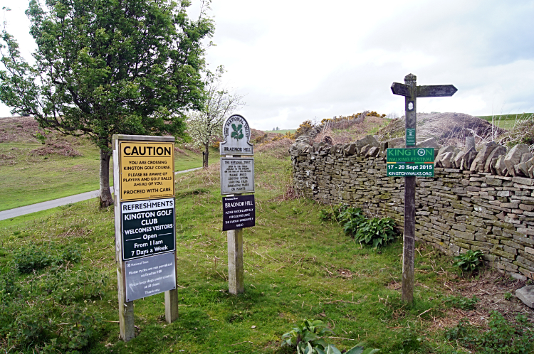 Plenty of advice on Bradnor Side
From Rushock Hill I headed south over high countryside around the 300 meter level to Bradnor Hill from where I glimpsed the Herefordshire market town of Kington way down below. My destination for the night was in sight. I did not rush down to the town though, instead stopping and sitting on Bradnor Hill for a while. It was 2.30 in the afternoon so I could afford to relax now. Rather enjoy the views up high than sidle into town too early. I watched a few groups of golfers from the local club walk to the nearest tee and drive their golf balls off down the fairway. I was chilled. Cloud still dominated the sky but blue breaks afforded glimpses of the suns rays now and then. It was rather nice. What is more I knew the weather forecast for my days ahead were promising. "I may get a tan after all" I thought amusingly. I had enjoyed not a lot of sun and plenty of rain in the first week. After my break on the hill I slipped down in Kington. It was a steep descent. A sign at the edge of town said "Welcome to Kington. The centre for walking".


