Offa's Dyke Path National Trail
A personal record of my walk of Offa's Dyke Path National Trail with written journal and photographs. Tracklogs for GPS units and for use with Google Earth are available for download for each stage.
Journal, Photographs and Download Files
Stage 10: Pandy to Monmouth
Google Maps Open Source Maps| Statistics and Files | ||
|---|---|---|
| Start: Pandy | Finish: Monmouth | Distance: 15.8 miles (25.4 km) |
| Time: 7-8 hours | Climbing: 519 metres | Rating: Hard |
| GPX Route File | Google Earth File | About Offa's Dyke |
| Statistics | |
|---|---|
| Start: Pandy | Finish: Monmouth |
| Distance: 15.8 miles (25.4 km) | Time: 7-8 hours |
| Climbing: 519 metres | Rating: Hard |
| GPX Route File | Google Earth File |
Ordnance Survey Explorer Map (1:25,000)
The Walk: From my early morning Facebook post, 13th May 2015: Good morning from Offa's Dyke. It is the highest stage of the walk today as I cross the Black Mountains. The height will reach over 600 metres but unlike the Clwydian Hills and Clun Hills which were energy sapping ups and downs it looks like I enjoy one thrilling rolling ridgeline for around 11 miles. As the stage is 15 miles from Hay on Wye to Pandy that means I will spend most of the day looking at great views. I should see my old favourite Sugar Loaf near Abergavenny and more mountains I crossed in my Welsh Coast to Coast two years ago. I hope it's fine up there. It is raining as I write.
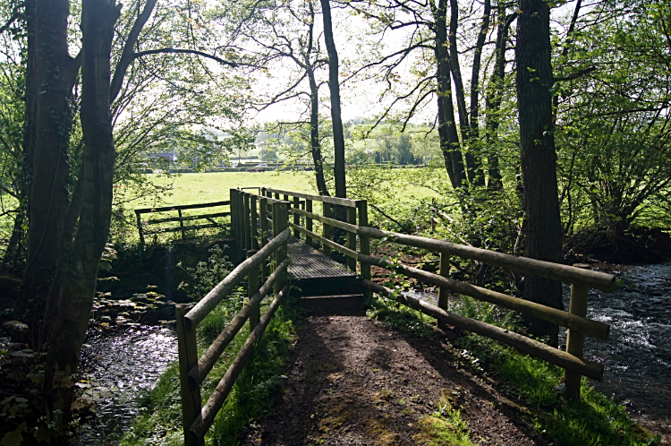 Afon Honddu
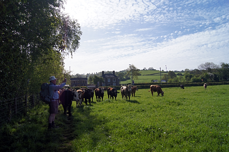 Curious Cattle
I did not get out last night, my accommodation at Brynhonddu Country House a little too long a walk to the pub and back in Pandy for my liking. So having snacked in the evening and having had a hearty full breakfast for a change this morning I was fit and raring to go today. On a walk of 16 miles without any notable hills to climb. Though it was not going to be pan flat either with over 500 meters of accumulated climbing. I had a rendezvous on the way too which we will come to. From Brynhonddu Country House, a splendid accommodation, I picked up Offa's Dyke Path and headed south-east to cross Afon Honddu just before reaching Pandy. Between the river and Pandy i had just one field to cross which was stocked with a herd of cattle. They were a curious bunch and I watched them congregate for a group photograph which a fellow early morning walker obligingly took. He was heading onto the Black Mountains and I wished him as good a day up there as I had enjoyed yesterday. Then I crossed the field myself, the cows following, mistaking me for the Pied Piper. After the field I crossed the A465 and headed on a quite steep ascent across fields towards Llangattock Lingoed.
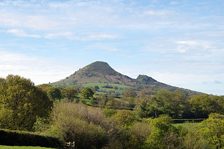 Ysgyryd Fawr
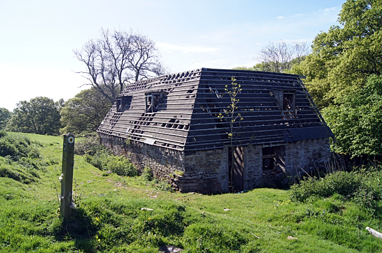 Dutch Barn near Llangattock Lingoed
As I crossed the fields, climbing from 100 meters to the high point of my day at Llanerch at 220 meters, I regularly turned my head to the right to view the Skirrid Mountain. Also known as Ysgyryd Fawr this aspect view to the north side of the Skirrid best showed the landslip on the west side of the mountain. Turning around and looking back from the heights near to Llanerch also provided me with an excellent view of the Black Mountains I had crossed yesterday. It was a beautiful morning, my best on the walk so far, all calm, warm and settled. I really enjoyed my early morning walk across this stunning piece of Monmouthshire countryside. Much of the walking was on lanes, across fields and on crossings of babbling brooks. It was so peaceful. I kept some pace up though and an eye on the time. I had a meeting planned with Sue.
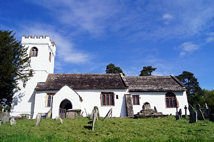 St Cadoc's Church, Llangattock Lingoed
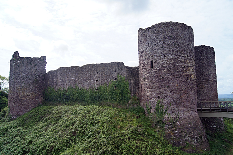 White Castle
I arrived in Llangattock Lingoed at 9.10am, one hour and ten minutes after setting off on todays stage of the walk. I had covered two and a quarter miles and climbed around 200 meters of the 500 in the stage. Not bad, but still i was ten minutes late. Sue was waiting patiently for me at St Cadoc's Church in Llangattock Lingoed where we eventually met up, introducing ourselves to each other. Sue, local to the area, had been following my progress blogs on the walk and she was so kind to join me for a few miles of the walk. I was pleased to meet here and grateful for her to share some of the local features I would be walking past. First up was the church. St Cadoc's is a very pretty whitewashed church dating back to the medieval period. From Llangattock Lingoed Sue and I walked to Cwm Farm Cider Mill and then to Old Court, a very old place, a grade 2 listed medieval house built around 1600. We continued together, chatting while walking south to Little Pool Hall, a neglected place with a poem dedicated to it. After telling me more stories about the cider farm and the buildings Sue left and returned to Llangattock Lingoed; wishing me well on my way as she did so. I thanked her for her time, her company, her insights and her charm. Next point of call for me was White Castle, a stunning Norman fortification which I just had to explore at length. Having the appropriate membership to explore the castle I did just that for three quarters of an hour. It was nice doing so without the rucksack on my back, it being safely deposited at the admission reception office.
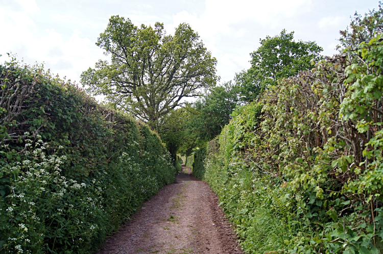 Lane walking near Llantilio Crossenny
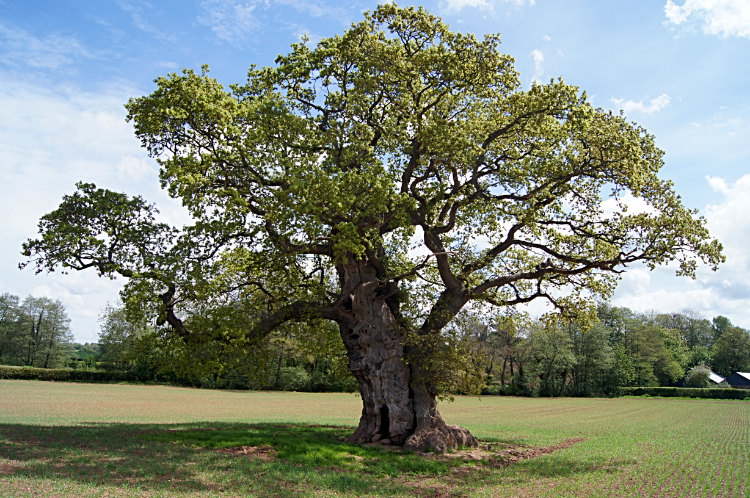 Grand Oak Tree at Llantilio Crossenny
After my adventure into history I resumed my walk on the balmiest of days. Ambling the Offa's Dyke Path lanes and tracks from White Castle to Llantilio Crossenny I then continued in much the same manner to arrive beside the River Trothy. It was just about noon when I reached the riverside so I found a cosy grassed bank beside the water and sat down for lunch. It was the perfect picnic spot. After my lunch break and while following the course of the river I arrived at the site of Grace Dieu Abbey. I could not make out where the abbey had stood at all. Soon after looking for the site of the abbey I left the course of the Trothy and turned westwards towards King's Wood.
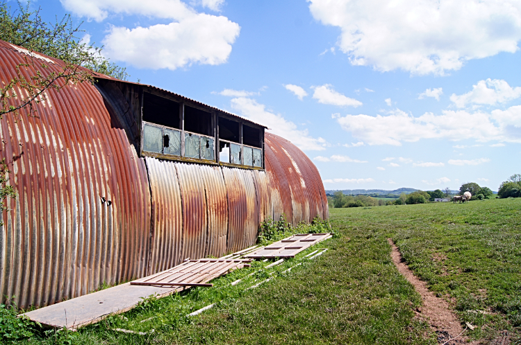 Rust in the countryside
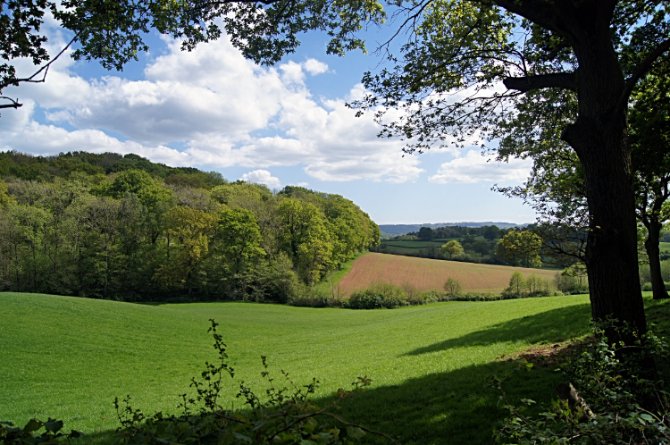 Approaching King's Wood
I was now on the home run into Monmouth with just a little more countryside to cross and then the walk on the dividing line between Great Garrow Wood to the north and King's Wood to the south. The walk was pleasant if not the prettiest woodland walk I have ever done. When I was in the woods I had no problem but often the path came out of the wood to skirt the edge of arable fields, most of them a boring cover of silage grasses or grains. Good for farming but not good for walking. I would have preferred walking in the midst of the Bluebells which I could see in the woodland to my left. Oh well, cannot have all the cream all of the time I suppose. The walking by King's Wood was not bad. At least it was not tarmac. After the woods I followed a water course to Watery Lane which led me into the prestigious town of Monmouth.
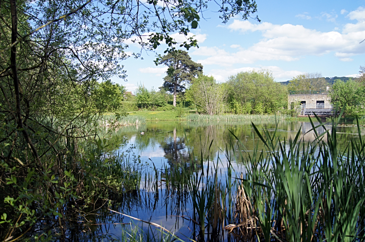 Water Park in Monmouth
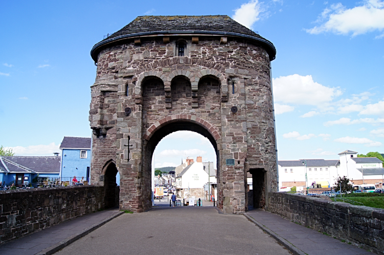 Monnow Bridge
Walking into Monmouth I passed a finger-post sign showing 'Pandy 16 milltir'. I easily guessed corrected that milltir translated to miles from Welsh. Continuing towards the town on Watery Lane I passed a children's skate park and then a pretty water park before arriving at Monnow Bridge, the last remaining gated bridge in Wales. The bridge crosses the River Monnow just before the waters of the river flow into the River Wye. Told you I would see it again. Not until tomorrow though. Now I walked across the bridge over the River Morrow into the town center. I sought out my accommodation, great it was. Then I cleaned myself up and went out for a drink and curry in the evening, in the company of my stepson John. He lives in nearby Usk and joined me for a good night. I enjoyed it, happy in the thought I had now just two days to go. My only reservation was that the great weather of the last two days was not predicted to last. Tomorrow's forecast was not good.
From my evening Facebook post, 13th May 2015: Seventeen more miles done on Offa's Dyke including a mile in lovely company. Thank you Sue. The theme on the section of Offa's Dyke Path from Pandy to Monmouth was walking in pastoral countryside. I also enjoyed a visit to White Castle. Only twenty and a bit miles to go now over two stages so I am treating myself to a night out in Monmouth. And looking at the morning forecast I may not set off on the 10 mile leg to Brockweir until the afternoon.


