St Cuthbert's Way
A personal record of my St Cuthbert's Way walk with a written journal and with photographs. Tracklogs for GPS units and for use with Google Earth are available for download for each stage.
Journal, Photographs and Download Files
Stage 2: Jedburgh to Town Yetholm
Google Maps Open Source Maps| Statistics and Files | ||
|---|---|---|
| Start: Jedburgh | Finish: Town Yetholm | Distance: 16.1 miles (25.9 km) |
| Time: 7-8 hours | Climbing: 732 metres | Rating: Hard |
| GPX Route File | Google Earth File | About St Cuthbert's Way |
| Statistics | |
|---|---|
| Start: Jedburgh | Finish: Town Yetholm |
| Distance: 16.1 miles (25.9 km) | Time: 7-8 hours |
| Climbing: 732 metres | Rating: Hard |
| GPX Route File | Google Earth File |
Ordnance Survey Explorer Map (1:25,000)
The Walk:
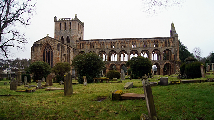 Jedburgh Abbey
 Safe and secure Caravan at Brownrigg
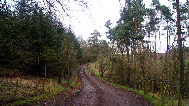
While yesterday's stage of twenty miles began with a climb over Eildon Hill, followed by sixteen miles of undulating walking along the rivers and across the plains of Roxburghshire, today's sixteen miler was the opposite with a flat first half of the walk followed by a climb into the Cheviot Hills for the conclusion. I looked forward to that, I had never walked in the Cheviots before. First things first though, after taking a look around Jedburgh and after visiting the abbey I followed the Borders Abbeys Way back to where I had left St Cuthbert's Way last evening. Thereafter I walked briskly through Chestercleuch Plantation and then I followed roads, crossing Oxnam Water on the way, to reach Littledeans where I was woken from any lingering lethargy by a stiff little 110 meter climb of an anonymous hill to Blindwells Plantation. More roads, farm access tracks and plantations followed. To be honest it was not the most exciting walking. The plantations were pretty boring straight-line spruce and the like, the fields long and sameish, all prepared for growing but not growing anything yet, the roads were hard on my feet and the tracks were muddy. Perhaps it was my mood. I wanted to get to the hills. A caravan perched up on a haystack cheered me up. And encounters with animals including cows, sheep, chickens and spooked pheasant kept me entertained.
 Long Plantation
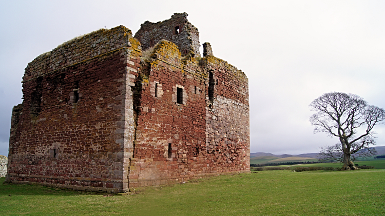 Cessford Castle
I came to Long Plantation, another boring forestry track transiting me through it. These industrial arrangements of trees for quick growth and available timber do not encourage much wildlife. Dark inside and laid deep with needles there is nothing much for animals in the dark interiors. It was quiet, the only noise a whistling of wind across the treetops. It was an overcast day but fair without rain. I soldiered on through Long Plantation and along more farming lanes across Cessford Moor. On the moor my mood perked up. I spotted an imposing building to the east. Looking on the map I noticed it was Cessford Castle and I smiled when I saw St Cuthbert's Way would lead me right to it. Before the castle I passed a couple of rows of terraced cottages which constitute the hamlet of Cessford. Drying laundry wafted like sails from backyard washing lines as I passed the terraces. Then after crossing Cessford Burn I made my way up to the castle. Built for defence in the 15th century the castle has walls 13 feet thick. Attacks and sieges are part of Cessford Castle's history ad the walls are littered with pock holes from artillery fire. I stayed half an hour looking around the site of the castle and while there I talked with one of the inhabitants of Cessford who was out walking her dog. "Not much happens here" she said. I guess it doesn't.
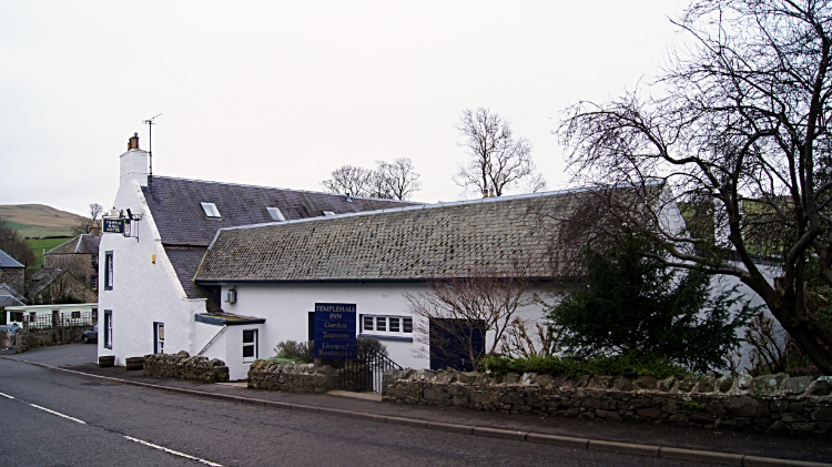 Templehall Hotel, Morebattle
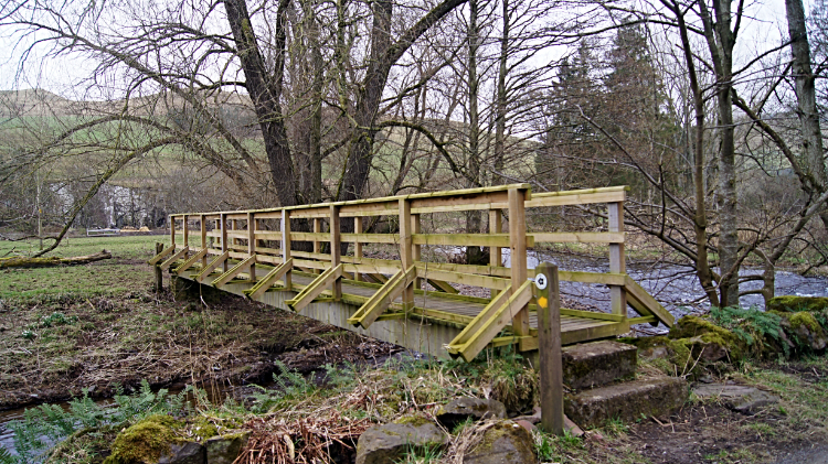 Footbridge across Kale Water
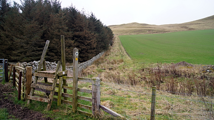
From Cessford Castle I followed tarmac road for over two miles to the village of Morebattle. I was glad to get there, ten miles of not the most exciting long distance walking behind me. And in the knowledge the next six miles to Town Yetholm would see me back up in the hills I stopped for a short break in the village. Before sitting down for a break I passed the primary school and then I passed a street sign which read "Teapot Street leading to Teapot Bank and Thimble Row". I loved that street sign. Then I came to a tree guarded by a metal grill with a dedication reading This tree was planted by Dickson Robb and Charles McDonald on 13th July, 1947 to commemorate the first meeting between the Kelso Laddie and Jethart Calland and their followers. Another information board told of the village and its history including items on the Worm of Linton (a mythical beast), the Morebattle Games and Morebattle Hill Fort. After my break, from Morebattle I avoided the monstrous worm and skirted around the east side of Morebattle Hill Fort by following more tarmac road to where I gratefully left the tarmac on an unmade track to cross Kale Water by a footbridge. Once I had crossed Kale Water my attention was piqued by the thought of climbing into the North Cheviot Hills.
 Climbing to the Cheviot Hills
 Grubbit Law
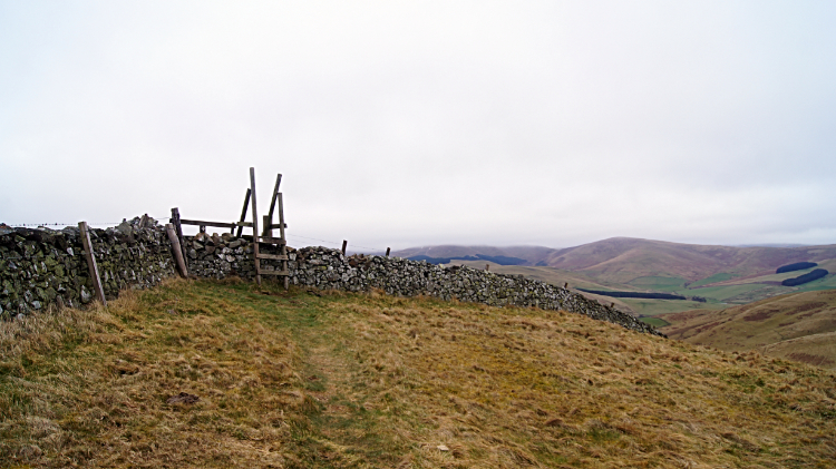
My first ever climb into the Cheviot Hills started by following St Cuthbert's Way to the summit of Grubbit Law. It was hard going, climbing over 200 meters to the summit of Grubbit Law at 326 meters in less than a mile of walking. Arduous as it was I thoroughly enjoyed being back in the hills again after over 25 miles of walking on the levels since crossing Eildon Hill at the very start of my St Cuthbert's Way journey. It was thrilling to be back in the hills and even more so to at last be up in the Cheviots. I thought to myself "Phew, I have got to this lovely hills at last and just before my 60th birthday". From Grubbit Law I enjoyed the most brilliant long distance view north-west to Eildon Hill. It was sixteen miles as the crow flies between the two summits and the land I crossed between the two over yesterday and so far today was all there in plain sight. The Peniel Heugh Waterloo Monument was also clearly in view.
 Crossing the Northern Cheviots
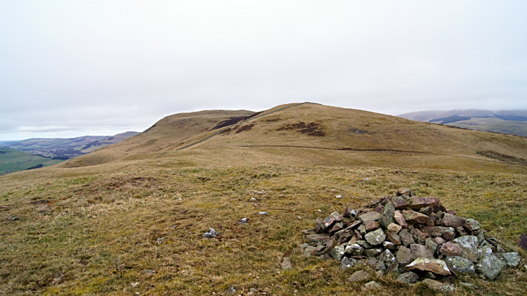 Wideopen Hill
My first thought of the Cheviot Hills was how much they resembled the Howgill Fells. At least these first ones I was walking across, a series of round topped small outliers of the main range, all stacked neatly against each other with rolling contours of ups and downs between one and the other. The ground below my feet was grassy and spongy without being too giving. Perfect for walking in fact. I was in my element walking from Grubbit Law to the next hill of name on my route, the evocatively named Wideopen Hill which topped out at 368 meters. A sign by the summit read "St Cuthbert's Way - Wideopen Hill. 1207ft/368m. This is the highest point of the Way and also the halfway point between Melrose and Lindisfarne". I was pleased being halfway also marked a high point though I was not yet the end of my second day and I did not relish the thought of finishing my long distance walk just yet. Still, being halfway was an achievement in itself so I could slow down a little bit from now on. Not immediately though. Bouncing up and down on the spongy ground was a delight. Being in the hills was a delight. Walking a long distance path was a delight. I could not have been happier.. maybe a little sunshine perhaps. I looked beyond my immediate range of hills to higher Cheviots in the east including the Schil at 601 meters and the daddy of them all up here, the Cheviot at 815 meters. They still had plenty of patches of snow covering their upper slopes. Here, at around 350 meters all signs of snow were gone.
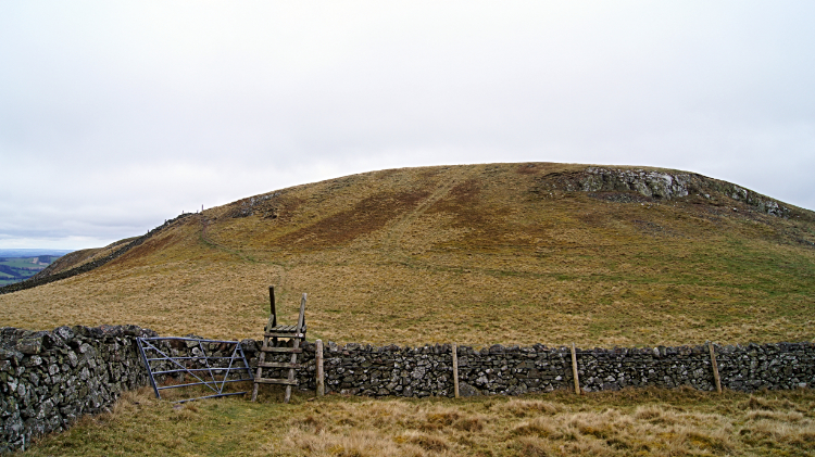 Crookedshaws Hill
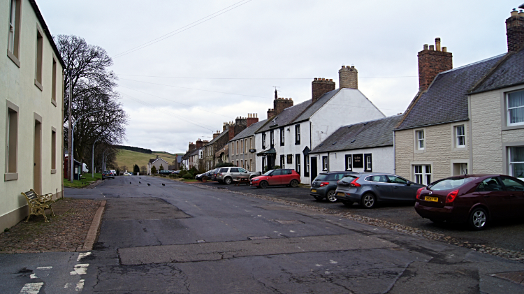 Town Yetholm
The third and last named hill on my first Cheviot Hills walk was Crookedshaws Hill at a little over 300 meters high which I crossed to begin my descent into Town Yetholm. The descent was delicious, a long sloping ridge line down from wild hill to pasture field and from pasture field to a dead ending road running alongside Bowmont Water. I was not following the road to its dead end in the south but northwards to the junction of the B6401 leading to Town Yetholm. My accommodation was there waiting for me but in no hurry I ambled along the road while being entertained by a flock of curious Swaledale sheep. They walked with me for a while, parted only by a hedge. I think they thought I was the farmer bringing hay for them. "Sorry". Just before Town Yetholm I passed a St Cuthbert's Way sign for "Town Yetholm/ Kirk Yetholm Local Services". the sign had a row of images which I translated, reading from left to right, as Post Office, Garage, Cafe, Accommodation, Shopping, Telephone, Suitable for Disabled, Man and Woman stood together - didn't get that one, Caravan Site, Camp Site, Information, Food. Pretty much everything one needs then. I was booked into the Plough Hotel and I checked in at just before 6.00pm after a eight hour walk.
From my post walk Facebook post, 18th March 2016: While I cannot say today's stage of my St Cuthbert's Way walk was as good as yesterday's opener there were, as there always is on a walk, some highlights. From Jedburgh back to get on the path was a chore and then from the long section along Dere Street to Crailinghall a trudge. Then the signage which had been great disappeared and the official way through Crailinghall Wood blocked off. I got through though and then to Morebattle muddy fields and roads were the way. The only highlight on this section was Cessford Castle (pictured) home of the Kers family. They were Borders Reivers who withstood English attack and seige before abandoning the castle. It's setting is magnificent. From Morebattle the walk changed much for the better as I climbed to over 300 metres elevation and crossed Grubbit Law (326m), Wideopen Hill (368m) and Crookedshaws Hill (306m). Views were magnificent, especially to the north west. The Eildon Hills stood out and I could see almost all of the route of the walk in had done so far. Finally I descended to Town Yetholm while looking at the final miles of the Pennine Way. I walk those miles tomorrow as St Cuthbert's Way twins with the Pennine Way before I cut off east.
See you then.


