The Great British Walk
A personal record of my three month walk of the full length of Great Britain from north to south with written journal and photographs. Tracklogs for GPS units and for use with Google Earth are available for download for each stage.
Stage 68: Wellington to Tiverton
Google Maps Open Source Maps| Statistics and Files | ||
|---|---|---|
| Start: Wellington | Finish: Tiverton | Distance: 16.4 miles (26.4 km) |
| Time: 7-8 hours | Climbing: 247 metres | Total Distance: 943.2 miles |
| GPX Route File | Google Earth File | About Wellington |
| Statistics | |
|---|---|
| Start: Wellington | Finish: Tiverton |
| Distance: 16.4 miles (26.4 km) | Time: 7-8 hours |
| Climbing: 247 metres | Total Distance: 943.2 miles |
| GPX Route File | Google Earth File |
Ordnance Survey Explorer Map (1:25,000)
128 Taunton, Blackdown Hills, Wellington and Ilminster
Summary
The 68th stage of my Great British Walk was a wonderful walk of over 16 miles which saw me walk from the county of Somerset and into the county of Devon. The first part of the walk after leaving Wellington was in the Tone Valley before Steve and I climbed to the plus 100 metre height of working Grand Western Canal at Beacon Hill. We then enjoyed a canal side walk to Tiverton except for a diversion into the lovely village of Halberton. It was a cracking day.(Note: My walk of the County of Somerset is a part of my Great British Walk from the north coast of Scotland to the south coast of England)
Stage Report
It was a good morning. The late night live music in the beer garden of the Nags Head had not kept us awake and so after a good nights sleep we were raring to go on our walk today from Somerset to Devon. First we had to prepare ourselves for the walk which we did as usual with a hearty breakfast. I had found as the walk from north Scotland had progressed that a good breakfast would keep me going for much of the day. Though Steve and I would break for lunch while on the walk that often meant having a drink and perhaps a chocolate bar snack while resting. My eating habits had definitely changed during the walk with a meal early and a meal late being all I really wanted. And all that I needed. Burning fat did the rest.
 Grand Western Canal near Tone
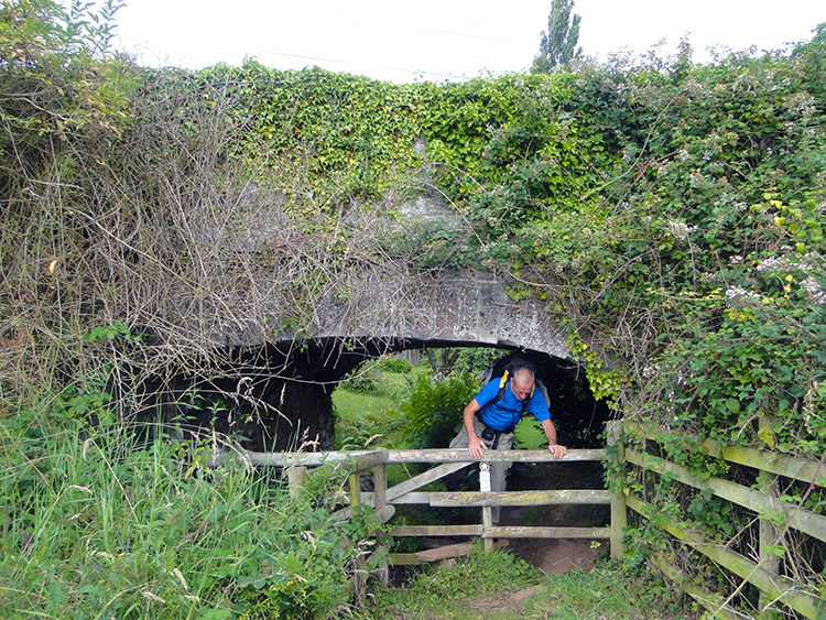 Harpford Bridge
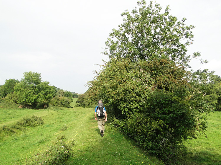
Suitably charged for the day we set off walking from Wellington by following North Road through the town towards Tone. We passed Wellington Methodist Chapel and then North Road morphed into Milverton Road before we left the streets and headed westwards into the quiet rural environment of the Tone valley. As we had done yesterday we followed the line of the River Tone upstream but this time there was a distinct difference to yesterday in the environs of the Tone. The map showed we were on the line of the disused Grand Western Canal and we could clearly see that on the ground as we walked on the original raised bank of the towpath and sometimes on the centre line of the filled in canal along lanes, paths through avenues of trees and even across open fields. It was easy to follow the redundant canal line all the way to Harpford Bridge which provided a fun moment. The bridge which the boats of the canal once flowed through was now so built up with earth that we had to duck underneath it. When we straightened ourselves up on the other side we were in a private garden.
 Near Cothay Manor
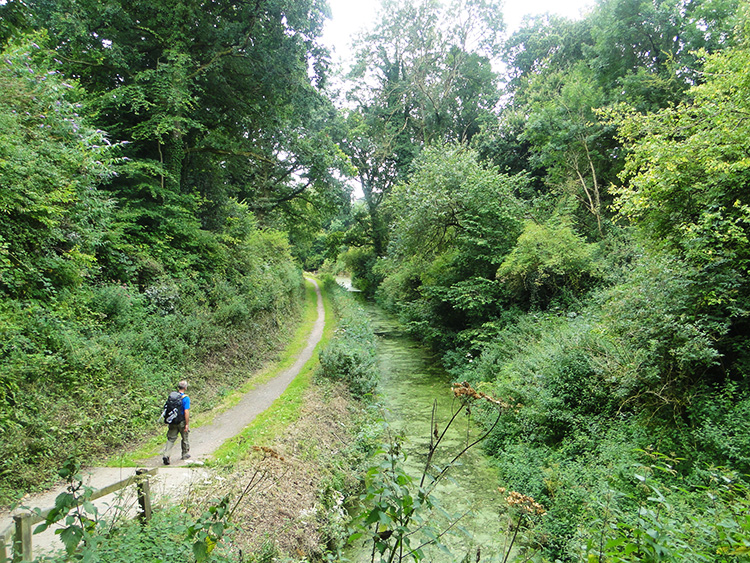 Grand Western Canal
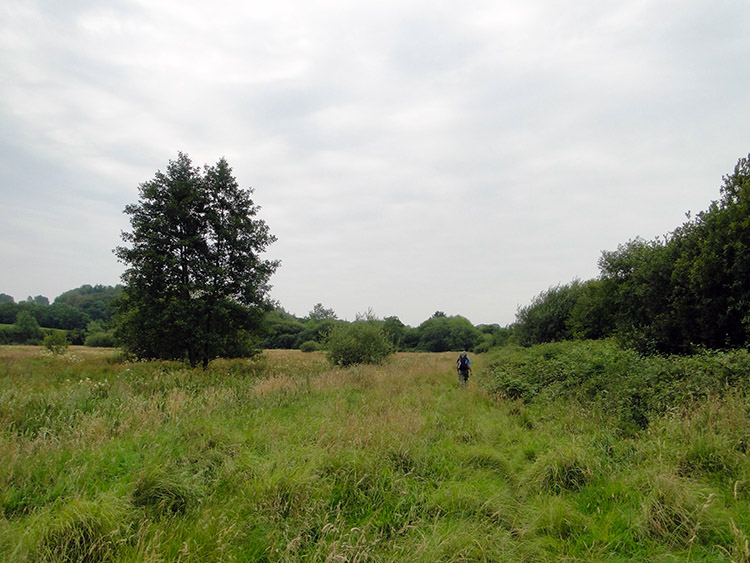
The walk so far had been great on a warm set fair day. Though the sun was shrouded by high cloud it was balmy and warm. From Harpford Bridge the next few miles of walking on the dry line of the once watery canal were brilliant. We actual climbed from beside the River Tone to Higher Wellisford by continuing to follow the line of the canal. There must have been locks on the canal around here. These easy climbing miles were the last miles of the walk through Somerset and a fitting tribute to the county as we approached the county of Devon. The fields we crossed near to Cothay Manor and beyond to Greenham were lush with deep green colours. I saw lots of Butterflies in the shrubs and on the flowers surrounding the lanes and on the field edges. It was a gorgeous goodbye to Somerset.
Devon welcomed us with a loud hello. It happened when we reached a sign which greeted us to Great Western Canal Country Park. Just beyond the sign we descended some steps to Lowdswell Lock and to waterside. We had reached where the Grand Western Canal was still filled with water. The canal was narrow at Lowdswell Lock and continued to be so as we walked alongside it to Waytown Tunnel. The Moorhens we saw in the canal water which was covered in pond weed loved it that way. They were happy to be undisturbed in this unnavigable stretch of water. Trees and shrubs edged close to the water and almost crossed the gap to touch each other. It was a lovely stretch of canal walking.
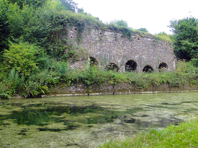 Waytown Limekilns
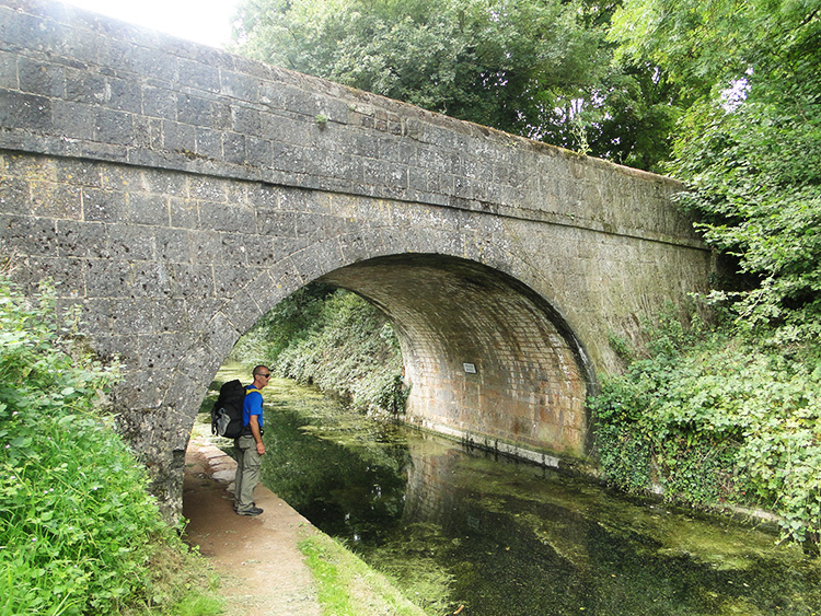 Fenacre Bridge
We were obliged to climb from the canal at Waytown Bridge and cross by road to the other side. Once we had stepped back down to the canal side my attention was captured by a brick structure on the other side of the canal. Waytown Limekilns are a row of five limekilns built in the early 1800's when lime was just one of the commodities that kept the canal in business. In the canal water in and around the limes kilns were lots of fish enjoying the calm and peaceful surroundings of the water without disturbance from boats. Through pond weed and other algae covered most of the water between Waytown Bridge and Whipcott Bridge which we came to next the canal had started to seem wider. Whether it was or not I don't know but the encroaching trees and shrubbery seemed to be thinning out as we walked. Perhaps the extra light discourages the weeds and algae from dominating too much. By the time we reached Fenacre Bridge the canal looked almost navigable.
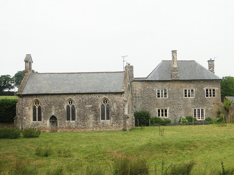 Ayshford Chapel
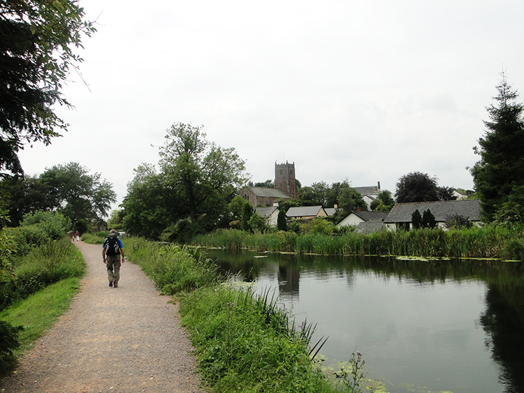 Sampford Peverell
From Fenacre Bridge we passed through Fossend Bridge, Black Bridge, Ebear Bridge and Westcott Bridge before arriving at the marvellous sight of an old building on the far bank of the canal. We had reached Ayshford Chapel which was a private place of worship and is now managed by a trust called the Friends of Friendless Churches. I do hope they keep it well as it added to the aesthetic beauty of the surroundings. As does the village of Sampford Peverell which we reached soon after on our continuing canal walk. The rooftops of the village were a splendid sight to behold as we kept to the canal towpath and this avoiding the village. It would have been best to avoid Sampford Peverell in the past, it having a notorious event of poltergeist activity on record, the cause of which led to the death of a citizen of the village. What we did see at Sampford Peverell though were boats. We had now reached the navigable section of the canal.
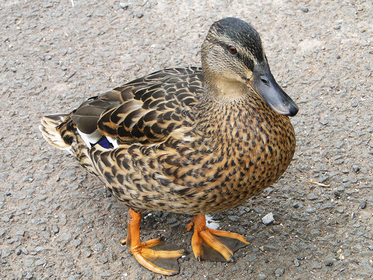 Friendly Duck
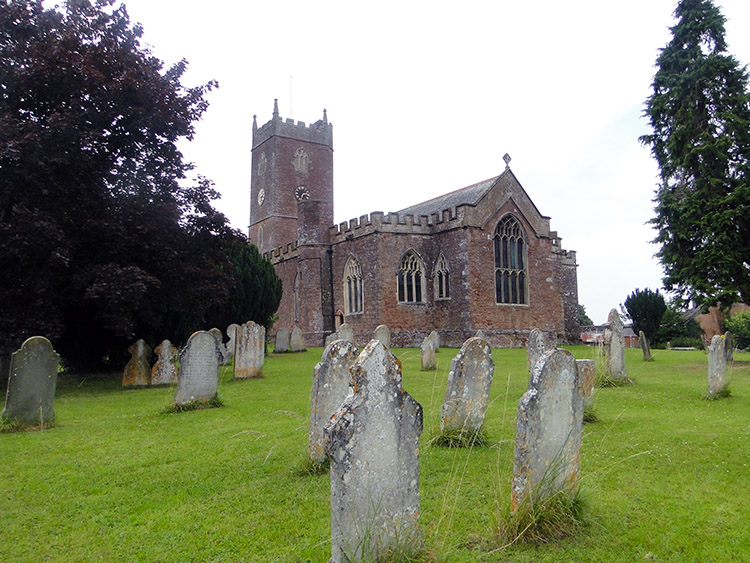 Halberton Church
We continued on past Sampford Peverell and reached an information board which told us all about the Dragonflies to be seen along the canal. They included Damselflies, Demoiselles, Hawkers, Skimmers & Chasers and Darters. We had indeed seen a few as we had walked the towpath, some skimming over the water and some darting away. Others had hovered to show off their iridescent beauty but identifying which was which was beyond both Steve and I. The board did give us clues though and the drawings helped. I was sure one that I had seen must have been a Male Emperor with a green upper body and long blue tail.
For a change from the canal walk we left the towpath to walk into the village of Halberton. It was just after 2.00pm on a lovely Sunday afternoon as we arrived in the lovely quiet Devon village. People were scattered around the village, all seemingly enjoying themselves. There were family groups and there were social groups. There were couples and the odd individual enjoying their own peace. Some were lazing the Sunday afternoon away in the beer garden of the local inn while others relaxed around the village ponds. Some ambled while others walked briskly and there were cyclists pedalling through the village too. Ducks waddled about the area of the village pond and church and in and around our feet as we sat on a bench near to the pond while taking a break. They were very friendly.
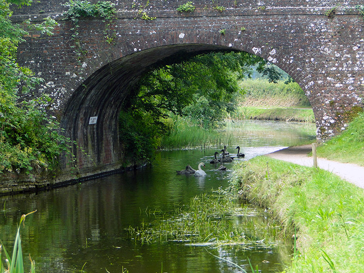 East Manley Bridge
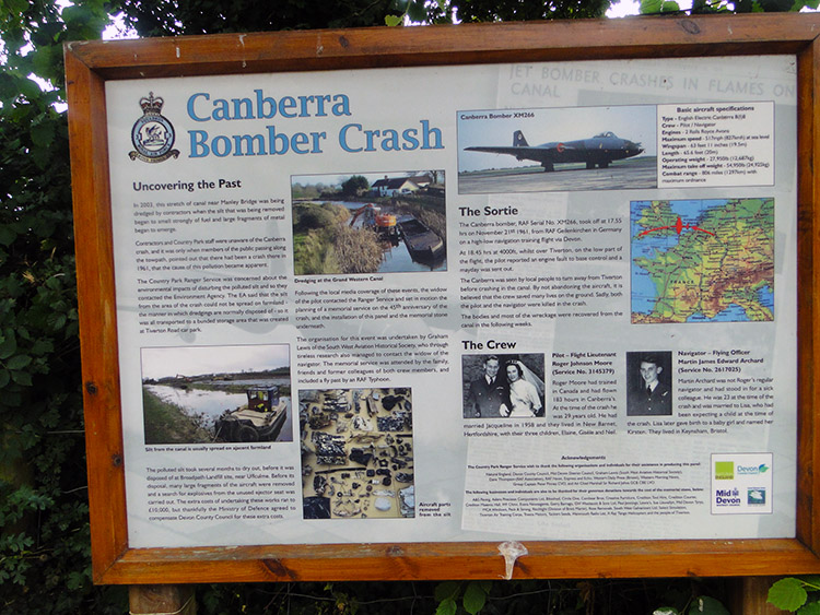 Canberra Bomber Canal Crash Site
It had been a lovely break in Halberton and following it we walked down a road from the village to Crownhill Bridge which led us back down to the canal towpath. Almost immediately we came to a board telling us we were standing on an aqueduct designed by Isambard Kingdom Brunel. Underneath the aqueduct the Willand to Tiverton branch of the Bristol and Exeter Railway used to run. Like so many the line is now long gone. Significantly on the Tiverton side of the aqueduct we noticed cruisers and narrow-boats moored on the canal. While sparse since we had first seen one at Sampford Peverell they were becoming a commoner sight now. We continued on past a line of eight boats, one cruiser and seven narrow-boats, to reach East Manley Bridge where a family of Swans led us through. Soon after East Manley Bridge we reached Manley Bridge. We were startled to find a board on the far side of the bridge pointing out that we had reached the site of an air crash.
The board told us the story: On a cold November night in 1961, two brave RAF servicemen sacrificed their lives to save people in Tiverton. Pilot Flight Lieutenant Roger Moore and navigator Flying Officer Martin Archard were on a routine night-time training flight in a Canberra light bomber plane when they experienced a sudden engine failure. Instead of deploying the ejector seats available to them, the crew directed the crashing plane away from Tiverton and into the Grand Western Canal, ensuring that no people were hurt. The bodies of the servicemen and the majority of the plane wreckage were removed from the canal in the days following the crash, and the tragedy was gradually forgotten. But in 2003, work began to dredge the Manley Bridge section of the canal and workers pulled up metal fragments. The country park staff were confused over this mystery until passing members of the public who remembered the crash explained the source of the remains. The plane fragments were removed and identified by the South West Aviation Historical Society, and are now housed in the Tiverton Museum. The wreckage is evidence of the horror of the fatal crash; metal edges are ripped and folded as if they were made of paper. As a reminder of the ultimate sacrifice the airmen made, one of the unused Martin-Baker ejector seats had remained completely intact and even the parachute cord has survived decades in the canal water.
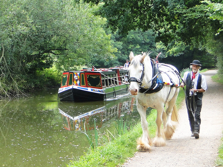 Draught Horse Powered Boat
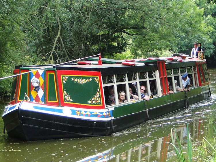 Cruising on the canal
From a scene of sadness we walked to a scene of happiness in just a few short steps. The beauty of walking in new places is that you simply do not know what is around the next corner and while we knew there would there would be more canal and more towpath we did not know what else would be there. So it was a joy when I saw a handsome Shire Horse walking towards me. It was pulling a horse-drawn barge along the Canal from Tiverton towards Halberton and the sight of it plying its trade was perfect. The barge was full of people enjoying the experience of being pulled by such an age old method. Many of the pleasure cruisers smiled and waved at me and Steve as we walked on past. Naturally we waved back.
The walk was turning out to be an excellent one and with it being a Sunday of settled warm weather there were lots of people around to share it with us. A sign reminded us we were still on the route of the Two Counties Way which we had met for the first time yesterday near to its eastern end at Norton Fitzwarren. We had actually followed the Two Counties Way for all the day today. Sadly soon after the sign we came to the Tiverton end of the Grand Western Canal. That particular part of my walk was over and it was a shame. The walk along the canal had been exceptional, even on the filled in bits near to Wellington. I shall always remember it with fondness. For the fact it led me into Devon on my Great British Walk and in fact in its own right as a new found favourite canal of mine. Being abandoned and filled in at one end, being a wildlife reserve in the mid part and being a working leisure canal at the other end makes the Grand Western Canal great.
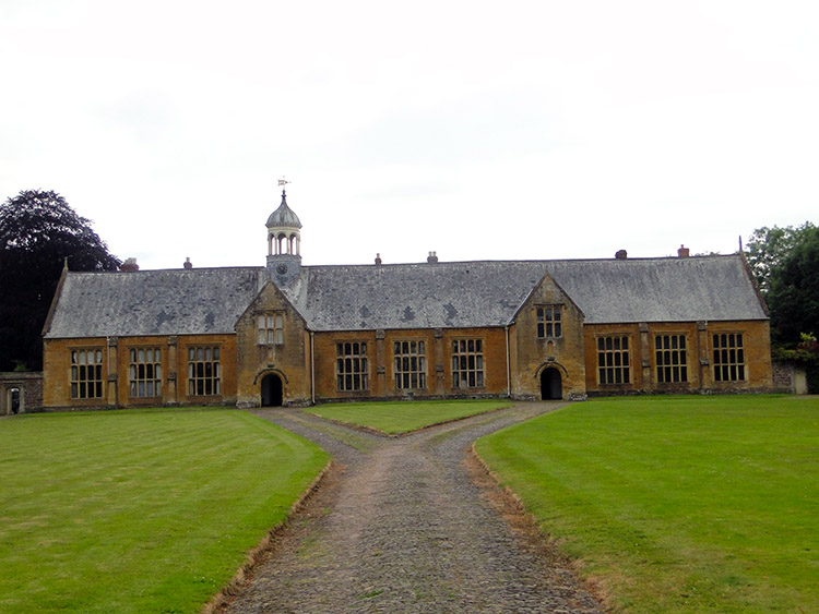 Old Blundell's School
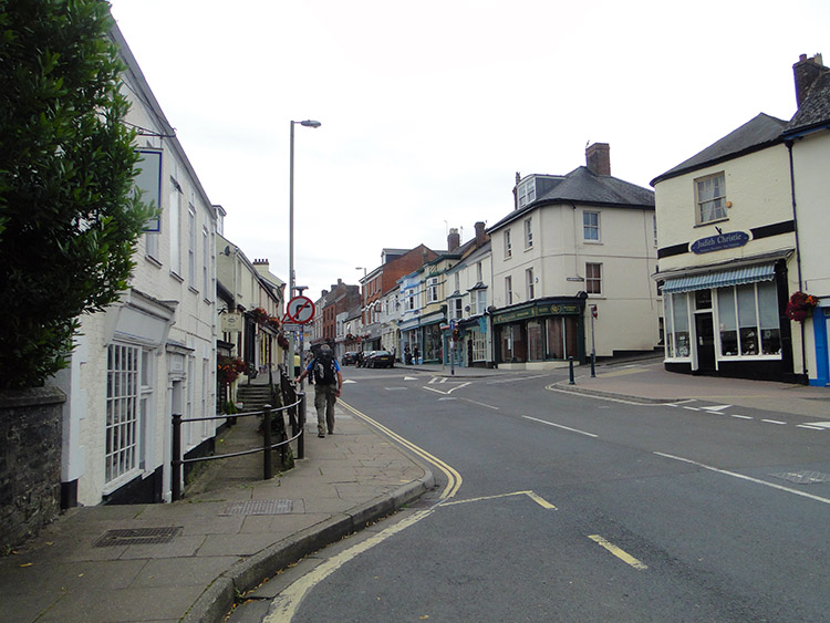 Tiverton
With a tinge of sadness on leaving the canal behind I walked into Tiverton. Still I was optimistic on what could this Devon town had to offer and after the initial dreariness of crossing the commuter roads to get into the heart of the old town I spotted the first piece of interest. An iron plaque told me we were on the Tiverton Merchant's Trail, a Civic Society enterprise. The trail is a themed walk around the town which explores its association with the cloth industry. We followed it during our afternoon and night in the town. we also passed Old Blundell's School which was formed by one of those wealthy cloth industry merchants in the 1600's. It was a stunning sight, built of pink Cotswold Stone and unlike any other building in the town. From the school we continued into Tiverton and after a quick look around the town to work out where to go in the evening we found our accommodation. When settled in I laid back on my bed and thought "I am going to like Devon".


