The Great British Walk
A personal record of my three month walk of the full length of Great Britain from north to south with written journal and photographs. Tracklogs for GPS units and for use with Google Earth are available for download for each stage.
Stage 20: Lochan Lunn Da-Bhra to Kinlochleven
Google Maps Open Source Maps| Statistics and Files | ||
|---|---|---|
| Start: Lochan Lunn Da-Bhra | Finish: Kinlochleven | Distance: 7.5 miles (12.1 km) |
| Time: 3-4 hours | Climbing: 282 metres | Total Distance: 235.1 miles |
| GPX Route File | Google Earth File | About Kinlochleven |
| Statistics | |
|---|---|
| Start: Lochan Lunn Da-Bhra | Finish: Kinlochleven |
| Distance: 7.5 miles (12.1 km) | Time: 3-4 hours |
| Climbing: 282 metres | Total Distance: 235.1 miles |
| GPX Route File | Google Earth File |
Ordnance Survey Explorer Map (1:25,000)
Summary
I was committed to doing 7.5 miles across country today but after yesterday's 5.3 miles which I did with tentatively taken steps on my recovering feet I felt confident I would make it. I simply had to make it to Kinlochleven or my great walk of Great Britain was over and I would have failed. Failing was not an option I considered. As a spur I had a tremendous journey in beautiful scenery in the highlands of Scotland to enjoy. Surely it would not be a problem.(Note: My walk of the West Highland Way was a part of my Great British Walk from the north coast of Scotland to the south coast of England)
Stage Report
After spending my first night on my Great British walk with my wife Lil at the Tarbet Hotel she drove me all the way back to Fort William and then up the Old Military Road to where I had finished yesterday's stage of the walk near Lochan Lunn Da-Bhra. After kitting me up with refreshments and equipment I bid her goodbye for the few hours it would take me to reach Kinlochleven. She would drive to my destination by road via Ballachulish Bridge and Glencoe while I walked the route of the West Highland Way on the Old Military Road through the pass between Mullach nan Coirean to the north and Mam na Gualainn to the south.
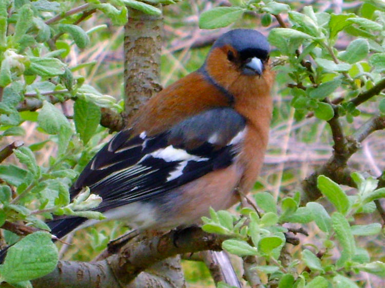 Friendly Chaffinch near Blar a Chaorainn
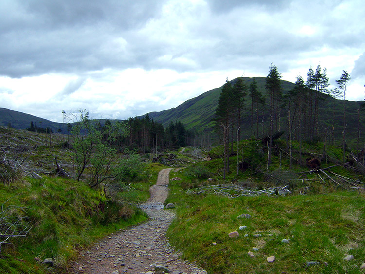 The way ahead to Old Shielings
It had been a careful procedure taking my boots off after yesterdays short stage and it was a hobbling Walking Englishman who scuttled around the Tarbet Hotel last night. There was a cabaret and dancing in the hotel but there was not a hope of me quick stepping or even taking part in a slow dance. Even if I were skilled enough to do so which I am not. It was also a careful procedure putting the boots back on to start this stage of my journey to Cornwall but once I had prepared and set off along the West Highland Way from Blar a Chaorainn on a course due south towards Old Shielings I soon got up to a respectable pace. It was not long though before I was stopped in my tracks by a small flock of very friendly Chaffinches, all of them being used to people. They had clearly become accustomed and welcoming of the West Highland Way walkers benevolence. They stayed down on the path as I walked by and also watched attentively in trees as I stood and looked at them. It was lovely to experience the meeting with these pretty birds at first hand. I was cheered as I walked on and up the road through the devastation of a plantation which had recently been felled.
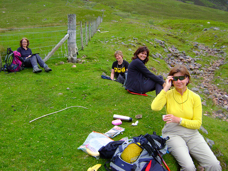 Thanks for the encouragement ladies
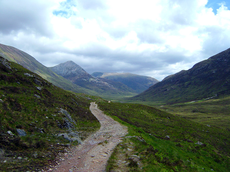 Looking east to Lairigmor and Tigh-na-sleubhaich
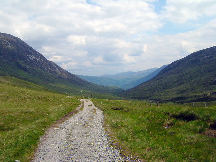
I continued to walk confidently towards Old Shielings and once I passed that landmark the path turned from a south to east course. As I walked further walkers past me going in the other direction, all following the traditional course of walking the West Highland Way from south to north. Some would celebrate the achievement and take an extra day to climb Ben Nevis which I believe is a new tradition. Most walkers were courteous as they walked by. Then I came across four delightful ladies who were taking a break. On being greeted by them I sat down and we chatted. They were a group of Scottish ladies taking a weeks holiday to complete the West Highland Way. They had thoroughly enjoyed the walk and their time together. On hearing my story of the adventure and tribulations on Cape Wrath Trail and my ambition to reach the south coast of England they all wished me well. One even urged me to take a Banana from her to keep up my strength which I accepted gratefully. It was the second Banana I had been given; remember the ladies in the lay-by at Loch Loyne? After talking some more I wished them well, they wished me the same and then I went on my way. Very soon after I rounded the bend in the track which took me on the east course. On doing so I was struck by the fantastic sight of the pass stretching out ahead of me with the marvellous ranges of mountains to my left and right.
 Stob Ban
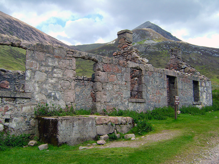 Ruins at Tigh-na-sleubhaich
I continued to pass groups of walkers as I made my way along the route of the Military Road. On one occasion a group of four young lads stopped to chat with me and one asked why I was limping. I told him how I got it while completing the Cape Wrath Trail and he wished me well and for a speedy recovery on my continuing journey. He then said "At least you are managing to hobble along with a smile. Look out for two of our friends further down the road. You will know who they are because one is limping a lot worse than you and the other is offering him his shoulder for support". He went on to say none of them had ever done a serious walk before so they would all be pleased to reach Fort William. Should they feel able, they would celebrate riotously. Looking at their fatigue I doubted any would last long before calling it a night but I wished then a good time of celebration anyway.
As I walked further along the track my eyes were drawn to the mountains to either side and one took my particular attention. Stob Ban which in Gaelic means 'White Peak' is most appropriately named, the white angular summit of the mountain will have drawn many eyes to it over the years. I looked at it again and again as I drew closer. At the ruins of Tigh-na-sleubhaich I stopped and gazed on Stob Ban some more before I turned and sat on a low wall beside the ruins which probably once had served the purpose for leaving out milk and provisions for travellers.
 The view after crossing the bealach
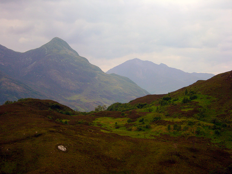 Pap of Glencoe and Sgorr Dhearg
After my welcome break at the ruined croft of Tigh-na-sleubhaich I walked on and soon crossed the highest point of the bealach which afforded me long distance views down the other side of the pass towards Kinlochmore and Kinlochleven. I could not see either of the places which were my destination, both facing each other on opposite banks of the River Leven. Still, as I drew nearer and started to lose height I could see an impressively peaked mountain in the distance to the right. I was looking at Sgorr na Ciche, also known as Pap of Glencoe. Beyond it I could see Sgorr Dhearg on the other side of the Glencoe Pass. I carried on, walking good and somewhat pacy, the best speed for a week since the stretch of walking along Loch Cluanie which led to my stressed heel damage.
 Beginning the descent from Mam Beag
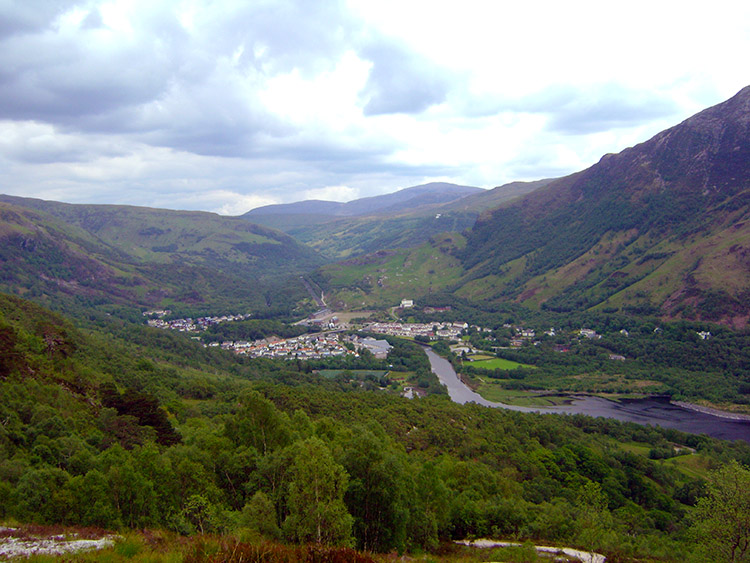 Kinlochmore and Kinlochleven
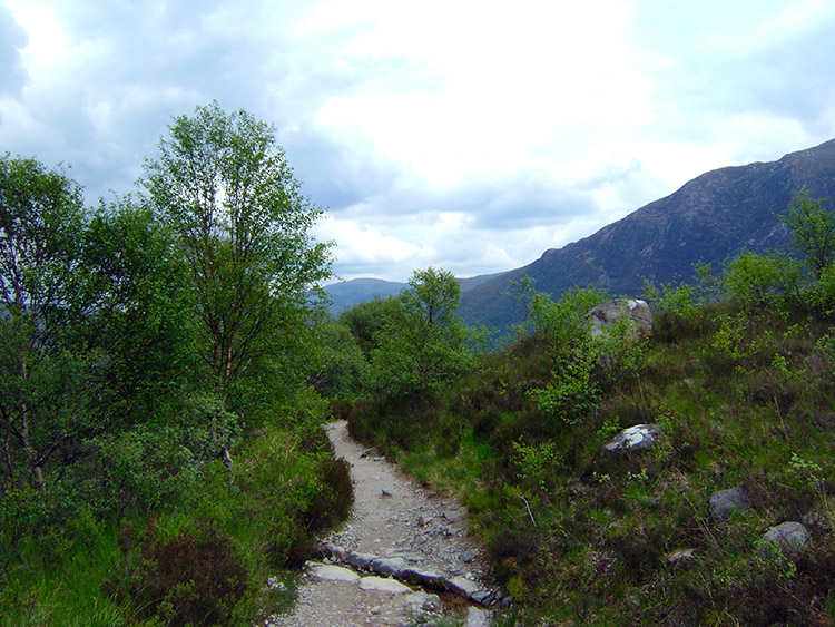
After walking on a very steady descent in which I lost just 80 metres in two miles I reached the rocky outcrop of Mam Beag. From here the surroundings changed from open moor to scrub and as I descended further scrub turned to to woodland. The descent became more pronounced so I slowed myself down, not wanting to put undue stress and strain on my heels. The steep descent was tempered by the path becoming a zig-zag course with regular switchbacks. Often there were clear paths bisecting the track by walkers in a hurry to shorted their course but I stuck to the true path. No time for adventurous challenges.
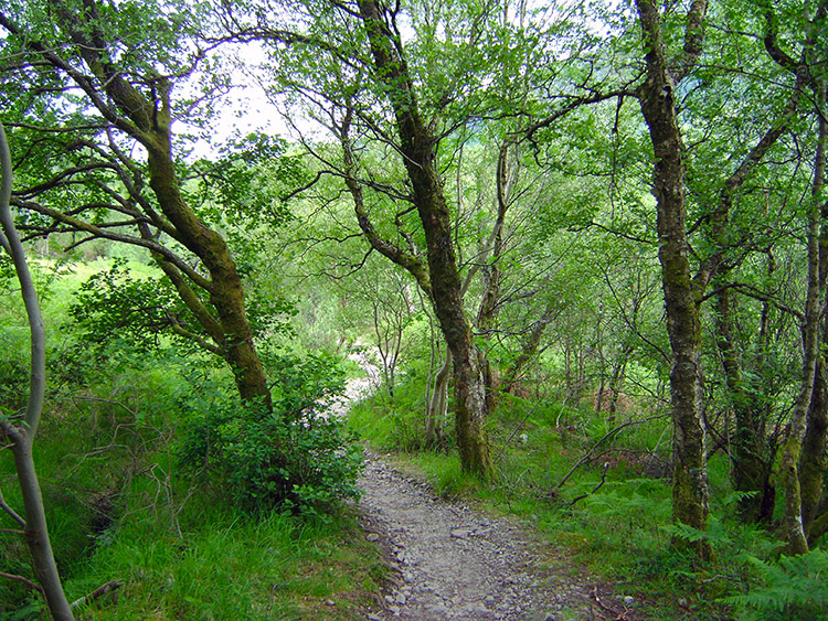 Through the woodland to Loch Leven
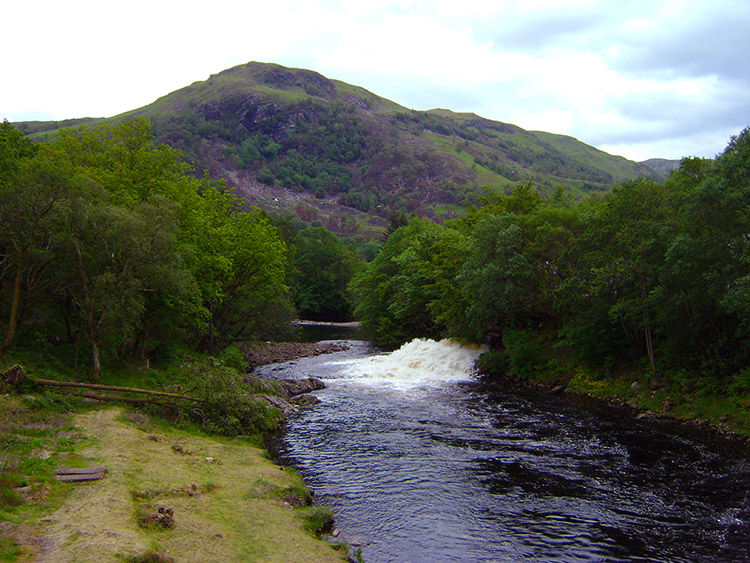 River Leven
After half an hour of steady descent through lovely woodland I walked into urban surroundings by Kinlochmore School and then I walked along the footpath beside the B863 and over the bridge crossing the River Leven into Kinlochleven. Soon on crossing the bridge I spotted a familiar car and inside it was my wife Lil who was waiting for me patiently. I had managed 7.5 miles of walking and did not feel too bad. However I was a full three days behind my schedule now and with Lil being able to support for just eight more days I would have to extend myself soon.


