The Great British Walk
A personal record of my three month walk of the full length of Great Britain from north to south with written journal and photographs. Tracklogs for GPS units and for use with Google Earth are available for download for each stage.
Stage 23: Auchtertyre to Inversnaid Hotel
Google Maps Open Source Maps| Statistics and Files | ||
|---|---|---|
| Start: Auchtertyre | Finish: Inversnaid Hotel | Distance: 16.5 miles (26.6 km) |
| Time: 7-9 hours | Climbing: 762 metres | Total Distance: 281.2 miles |
| GPX Route File | Google Earth File | About Tyndrum |
| Statistics | |
|---|---|
| Start: Auchtertyre | Finish: Inversnaid Hotel |
| Distance: 16.5 miles (26.6 km) | Time: 7-9 hours |
| Climbing: 762 metres | Total Distance: 281.2 miles |
| GPX Route File | Google Earth File |
Ordnance Survey Explorer Map (1:25,000)
Summary
As with yesterdays extraordinary stage from Glencoe across Rannoch Moor this one which took me to the northern edge of Loch Lomond and beyond to Inversnaid Hotel was full of delightful surprises. Despite setting off in overcast conditions, a slight disappointment after the glory of yesterday, the weather actually created a moody landscape of eye catching delight. Later on, as I approached the waters of Loch Lomond the weather improved and I finished in sunshine which created a scene of glinting enchantment while I walked on a roller coaster of a path through loch hugging woodland. It was superb and what was also heartening was that I took another five miles off my deficit. By the end of this stage I was only 22 miles behind schedule and still feeling good.(Note: My walk of the West Highland Way was a part of my Great British Walk from the north coast of Scotland to the south coast of England)
Stage Report
After a good night at the Buchanan Arms in Drymen Lil did her usual good Samaritan act by driving all the way around Loch Lomond via Balloch and Tarbet to drop me off at my starting point at Auchtertyre, a distance of 45 miles. At least she was now relieved of driving the west road along Loch Lomond again, something she had done for the last four days. And at least the return journey from my planned finish at the Inversnaid Hotel would be only 24 miles; a relief to us both. We were both stressed by the extra burden of all the driving and thankfully the long distances along Loch Lomond and through the Pass of Glencoe were now behind us. We could look ahead, and now I was finding it better to walk on my feet I was looking ahead to cutting more miles from my deficit. After Lil dropped me off on a morning of low cloud and light rain I set off in good heart.
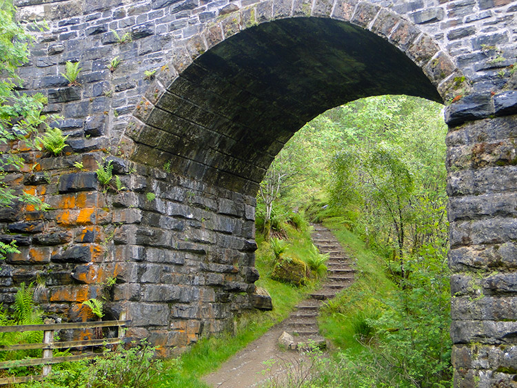 Railway bridge near Crianlarich
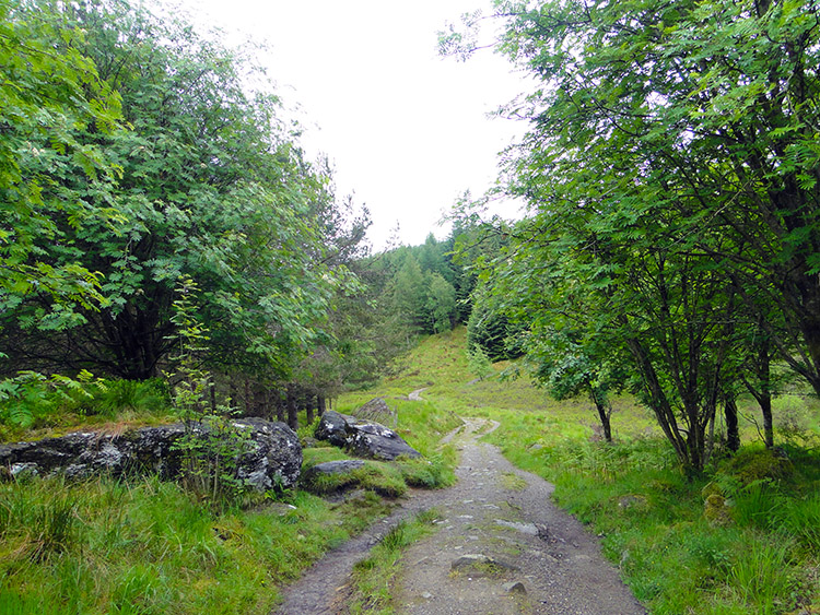 Woodland near Crianlarich
I spent the first few miles of walking on a slight incline through a pine plantation to the west of Crianlarich. The light rain persisted but it did not get any heavier. There was a consequence of the rain though which was falling with little to no breeze. Add to those conditions the warming temperature of the morning and the result was midges flying around in their element. While there were no swarms of the nippers there was always one or two trying to take a snack on my face and I was constantly swatting them away as I made my way up through the avenues of trees.
 Creag a' Bheannain
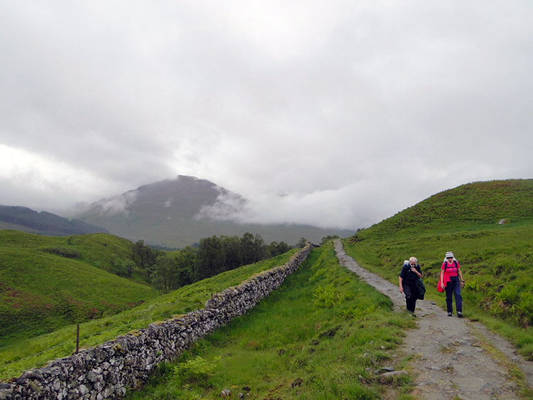 Highland Way walkers near Keilator
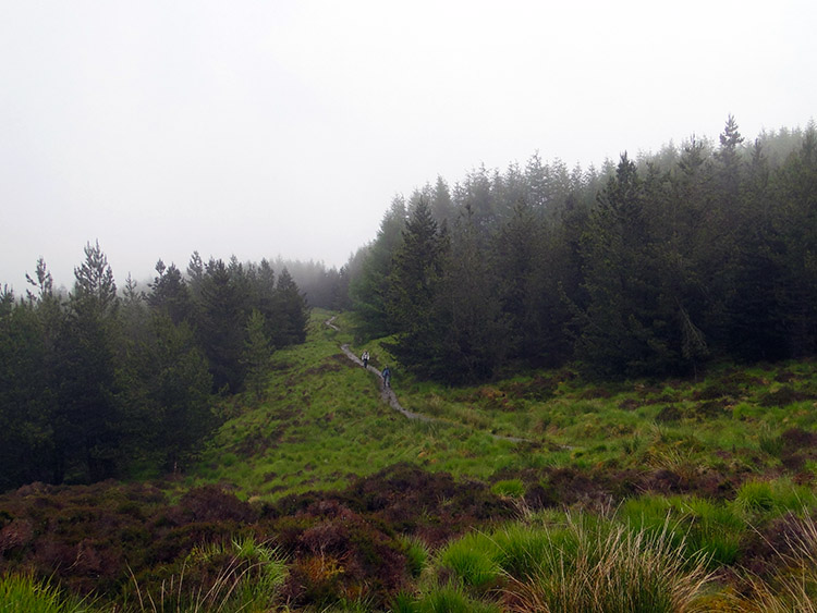
Only when I reached the highest point of the climb near Creag a' Bheannain where I found an open area near a small stone outcrop did I get a respite from the midges aerial attacks. The little breeze there was wafted over the open spot and was sufficient to keep them at bay. I took advantage to take a short break. It was now around mid morning and for the first time in the day I began to pass walkers of the West Highland Way going from south to north. Most of the walkers I encountered passed pleasantries with me as we crossed, only the odd walkers, usually the young, keeping their heads down to avoid verbal communication. Then I came out of the plantation near Caisteal Ghriogair and set my sights on some small hills in my near distance and just to my left. They drew my attention as the form of them kept changing due to low cloud breezing past them from east to west. The hills formed the south and east side of Glen Falloch which I was now walking towards.
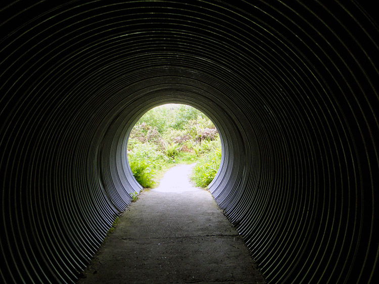 Tunnel under the A82 near Carmyle Cottage
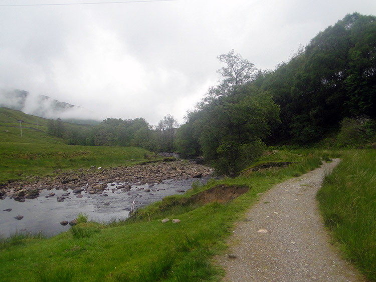 River Falloch
The first part of my walk into Glen Falloch was along a track running parallel to the A82 road from Glasgow to Crianlarich. I followed it for a mile and a half past Caisteal Ghriogair, Keilator and Carmyle Cottage before descending to a corrugated tubular tunnel which forced me to stoop as I walked through it. Soon after emerging from the dark of the road tunnel I passed through gates which allowed me to cross the Glasgow to Fort William railway line. After the railway crossing I walked a few more yards to the western bank of the River Falloch.
 Birch woodland in Glen Falloch
 The long track through Glen Falloch
The next few miles of walking were dead easy. I was walking on level ground following the river downstream which at first descended the valley at a gentle canter. I passed buildings at Derrydaroch and here I crossed a substantial wooden bridge suitable for both foot and traffic. A metal sign set in a stone surround informed me it was Derrydaroch Bridge constructed by 3 Troop 49 Field Squadron (EOD) Royal Engineers July 1997. The wording was flanked to left and right by two drawings of bombs. The significance of bombs representing a bridge were lost on me. Up until Derrydaroch I had been close to the river but on crossing the bridge I left its side for a short while by keeping left of Leum an t-Searraich. Half a mile later I was back beside the river.
 Falls of Falloch
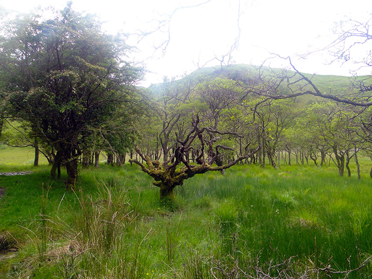 Wetland just north of Loch Lomond
The drizzle which had been falling during the earlier part of the day had now ceased but low cloud persisted blocking out any chance of sun. The low cloud kept conditions humid and the stillness of the day or little breeze there was let the midges continue to play out. As earlier in the plantation at the start of the day though they were never really intimidating, just annoying. Forgetting the midges, my next point of interest was the Falls of Falloch, a waterfall and local beauty spot which is advertised to motorists by a sign beside the A82. I watched people viewing the waterfall from the opposite bank to me as I passed. They were probably enjoying the scenery while taking a break out of their journeys. After the waterfall I followed the track south west for one mile and then due south for another mile before reaching Inverarnan where I found the camping village of Beinglas Farm. I noticed a few people milling about around the mix of wooden huts and wigwams as I passed by. Then with Inverarnan behind me I focused my attention on my next great milestone of my journey, the reaching of Loch Lomond.
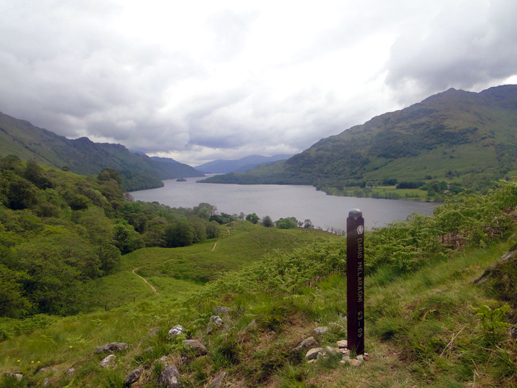 Loch Lomond
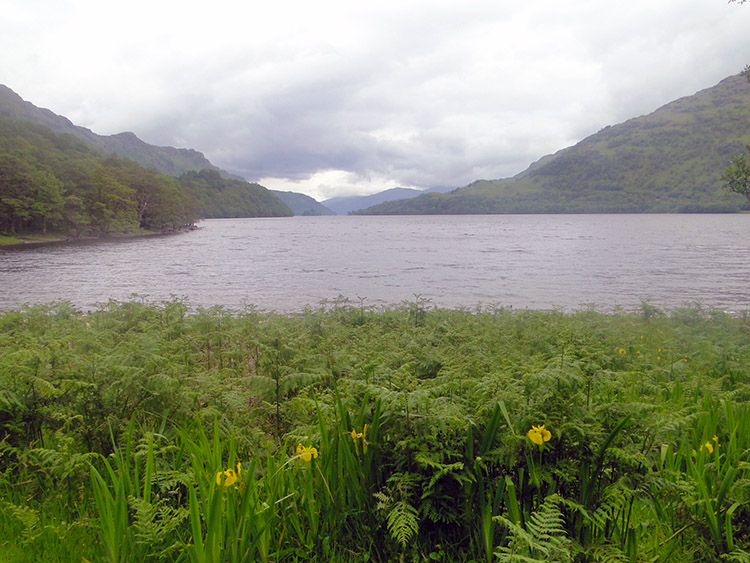 It was special to reach Loch Lomond
I had covered 10 miles and I was feeling great. My feet were not bothering me at all and I was full of energy too. Not surprising really, apart from the early short climb through the plantation near Crianlarich there had been no climbing, just good walking on good paths. Now at 10 miles I had a short climb to make, one of 100 metres ascent on the eastern shoulder of Cnap Mor until I reached the delightful small Dubh Lochan. From the lochan it was downhill to Loch Lomond at Ardleish and I now had a beaming smile on my face, I could see the magnificent waters of Loch Lomond stretching for miles to the south. I positively bounded down to the shoreline.
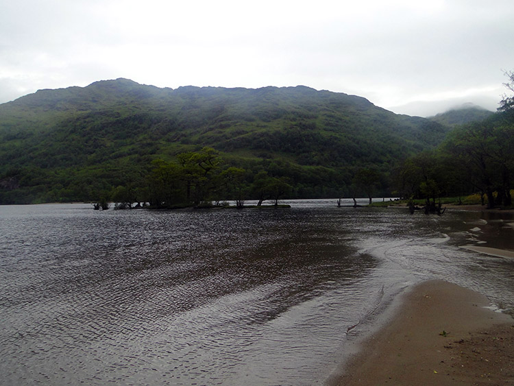 Sandy north shore of Loch Lomond
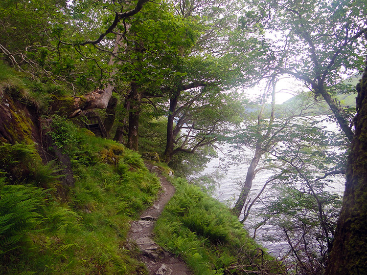 The narrow winding path beside Loch Lomond
I was surprised to find a lovely sandy shore on the northern extreme of Loch Lomond. Taking time out from my walk I chose to walk on the sand and put my transient footprints on the sand. I really enjoyed standing still and musing as I looked out to the south and the direction of my journey. I thought of how I was closing in on 300 miles done with only another 800 miles to go! The though did not phase me at all, in fact it excited me. I had overcome the dark thoughts on recovering my walking over the last few days and thought well of the immediate future. It was a good job I did because there was an unexpected obstacle just ahead.
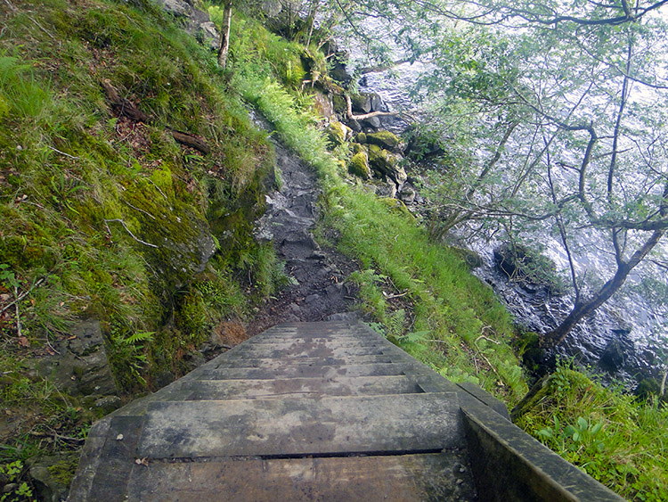 Steps were required on the tightest angles and gradients
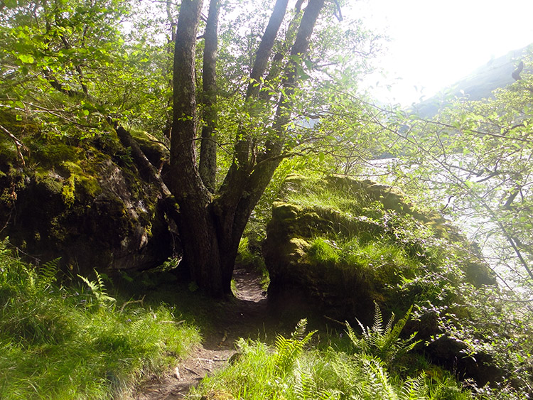 There were a few tight gaps to get through
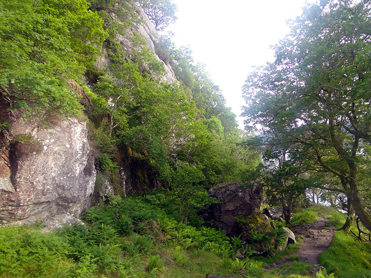
On reaching the northern end of Loch Lomond I had four miles to go. As I started the final four miles I was full of walking, full of energy and exuberant. By the time I finished the stage at Inversnaid Hotel I was glad it was all over for the day. How could four miles of walking near to the edge of Loch Lomond cause so much change? Here is how. Soon after beginning my walk along the loch side path, surrounded by shrubs and trees I noticed the geology of the terrain changing. The path was no longer wide and gentle but now it was winding its way into a narrow pass, hemmed in by cliffs to the east and the loch to the west. The path narrowed to one that would only take a single walker and squeezed its way between boulders - some of them huge, between trees, past cliff faces and sometimes on such a steep gradient that steps had to be provided to allow passage. I was never allowed to walk far before having to force my way through a narrow gap or step up and over rocks or over tree roots finding a way to supplant themselves. It became very hard work.
 The path near Rob Roy's Cave
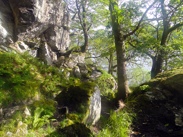 Another steep climb beside Loch Lomond
The difficult walking continued and now the weather decided to do its level best to make things even more difficult. The sun broke through the thinning cloud and immediately sent the temperature in the confined space of the narrow pass soaring. Soon I was sweating profusely and having to take the last of my reserves of water to replace the copious amounts of sweat evaporating from my body. I was not the only one struggling on this section of the West Highland Way which I profess is the hardest 4 miles of the walk. The Devils Staircase in Glencoe was child's play compared to this. As I walked and staggered along the path I met others who were finding it hard work too. They were going in the other direction and when we met neither of us wanted to make the move first. Each party was conceding ground to the other in the hope of gaining a breather. This was a section of walking that most unexpectedly required hands as well as feet to negotiate the frequent sharp ups and downs on the meandering course from Inverarnan to Inversnaid. After what seemed an eternity I finally reached Rob Roy's Cave which I wanted to explore. Hauling myself from the track I followed a sign towards the cave but on reaching the shoreline and not finding it I gave up. If you get the chance, try harder than I did.
 Near the Boat House at Cladachbeag
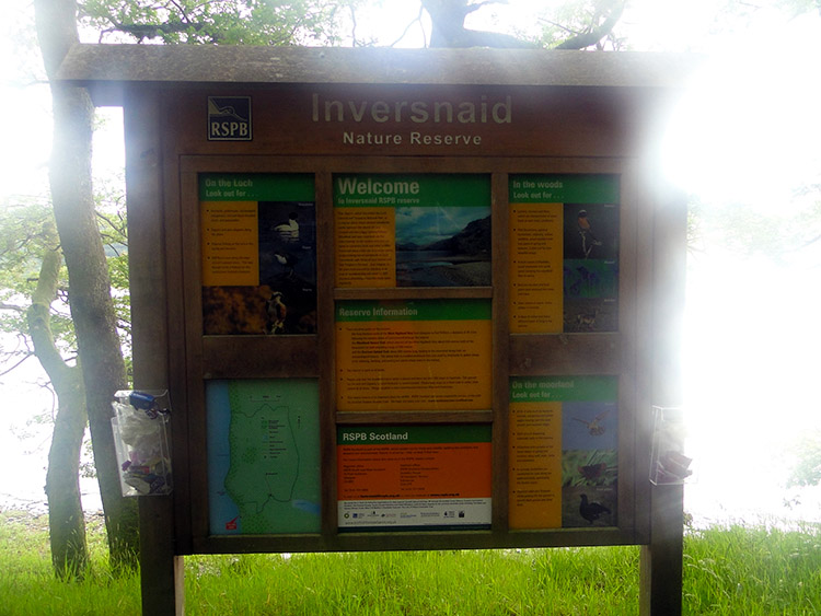 Information board for Inversnaid Nature Reserve
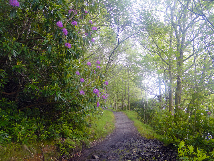
After Rob Roy's Cave there was one more climb of the narrow path by a sheer cliff before the walk finally and most welcomely levelled off. I was mightily relieved as in the four miles of toil I had markedly tired. I had also used up my supplies of water and feeling a little dehydrated as I walked past Boat House, the first habitation I had seen since Inverarnan. The final half mile of my walk was in Inversnaid Nature Reserve but I was in no mood to look out for unusual Fauna or Flora. I walked straight on through the reserve and I was mightily relieved when I reached the hotel to see Lil waiting for me. I went immediately to the car and rummaged for water. I needed a drink.
Footnote: If the final four miles had been the first four miles I would have really enjoyed it and I would certainly recommend it. I love walking in such terrain. There was beauty abounding everywhere on the difficult section and had I the time to take the walk at leisure I would have thrived in doing so. It is a magical section of walking. I just needed to get home and cut further into my deficit for the whole journey. I did cut the deficit by a further five further miles which made me feel brilliant. Yes I was tired and needed a good rest but I still felt superb in the fact that I was continuing to recover lost ground.


