Rhine Castles Trail (Rheinburgenweg)
A personal record of my walk of the Rhine Castles Trail (Rheinburgenweg) with a written journal and with photographs. Tracklogs for GPS units and for use with Google Earth are available for download for each stage.
Journal, Photographs and Download Files
Stage Eight - Rhens to Bad Salzig
Google Maps Open Source Maps| Statistics and Files | ||
|---|---|---|
| Start: Rhens | Finish: Bad Salzig | Distance: 9.7 miles (15.6 km) |
| Time: 4-5 hours | Climbing: 384 metres | Rating: Hard |
| GPX Route File | Google Earth File | About the Rheinburgenweg |
| Statistics | |
|---|---|
| Start: Rhens | Finish: Bad Salzig |
| Distance: 9.7 miles (15.6 km) | Time: 4-5 hours |
| Climbing: 384 metres | Rating: Hard |
| GPX Route File | Google Earth File |
The Walk: What appeared to be a straightforward day of walking on the Rheinburgenweg turned out to be rather extraordinary. We were surprised twice. First, by a section of the official route path being impassable and second, due to a daft decision by me. If I had been walking solo these two hitches would not have been too much of a problem. But, as with everything I decided upon on this two week long walk I had Lil's abilities to consider. How would she cope? And how would she feel at the end of the day. Let us see.
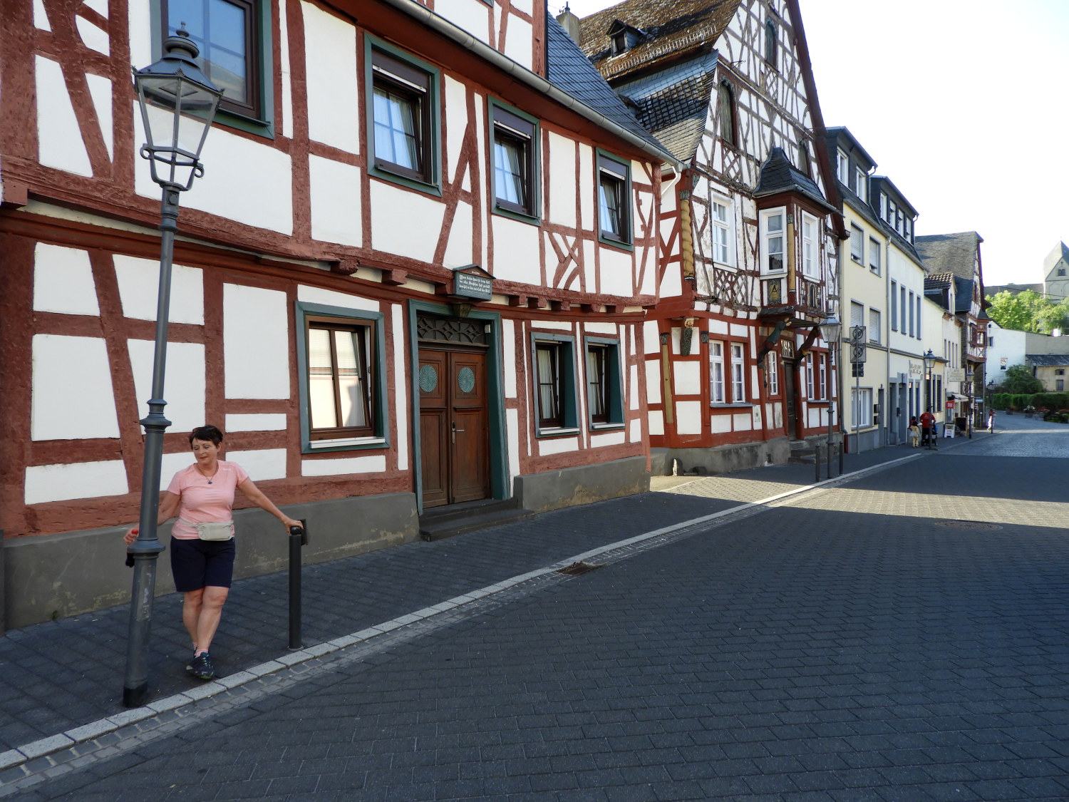 The leaning lamp post of Rhens
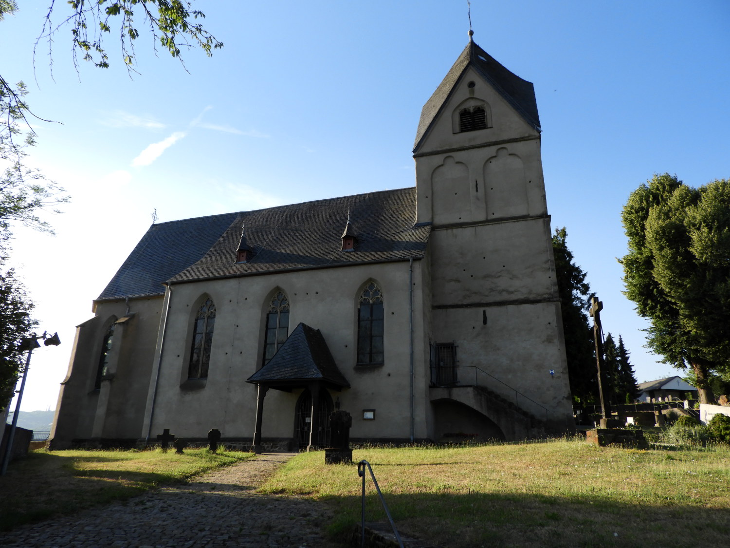 St Dionysius Kirche, Rhens
The day started well. After a lovely night's sleep, followed by delicious Frühstück (Breakfast) at the excellent Hotel Roter Ochse in Rhens we set off on the ten mile walk to Bad Salzig at a quarter to eight in the morning. It was already hot, the sun rising into a clear blue sky. Yesterday, on our day off sightseeing in Koblenz it had fried in the mid forties around lunchtime, so much so that on our tour of the Ehrenbreitstein Fortress I had ran into a mobile cold water spray shower to avoid overheating. Today did promise to be a little less hot; but not much. Anyway, now as we climbed from the pretty centre of Rhens, past St Dionysius Kirche and up through the south side of the municipality it was not so bad. We followed the directions of the Hotel Roter Ochse manager to find Rhen's natural spring well on the south edge of the built up area. "Das Quellwasser ist das Beste. Lieblich, cool und funkelnd." he had said. And he was right. We filled up our bottles with the lovely, cool and sparkling natural spring water. Further up we passed a sign pointing to the well saying 'Sauerbrunnen' - translated to acid well which is common in Germany for natural spring water sources.
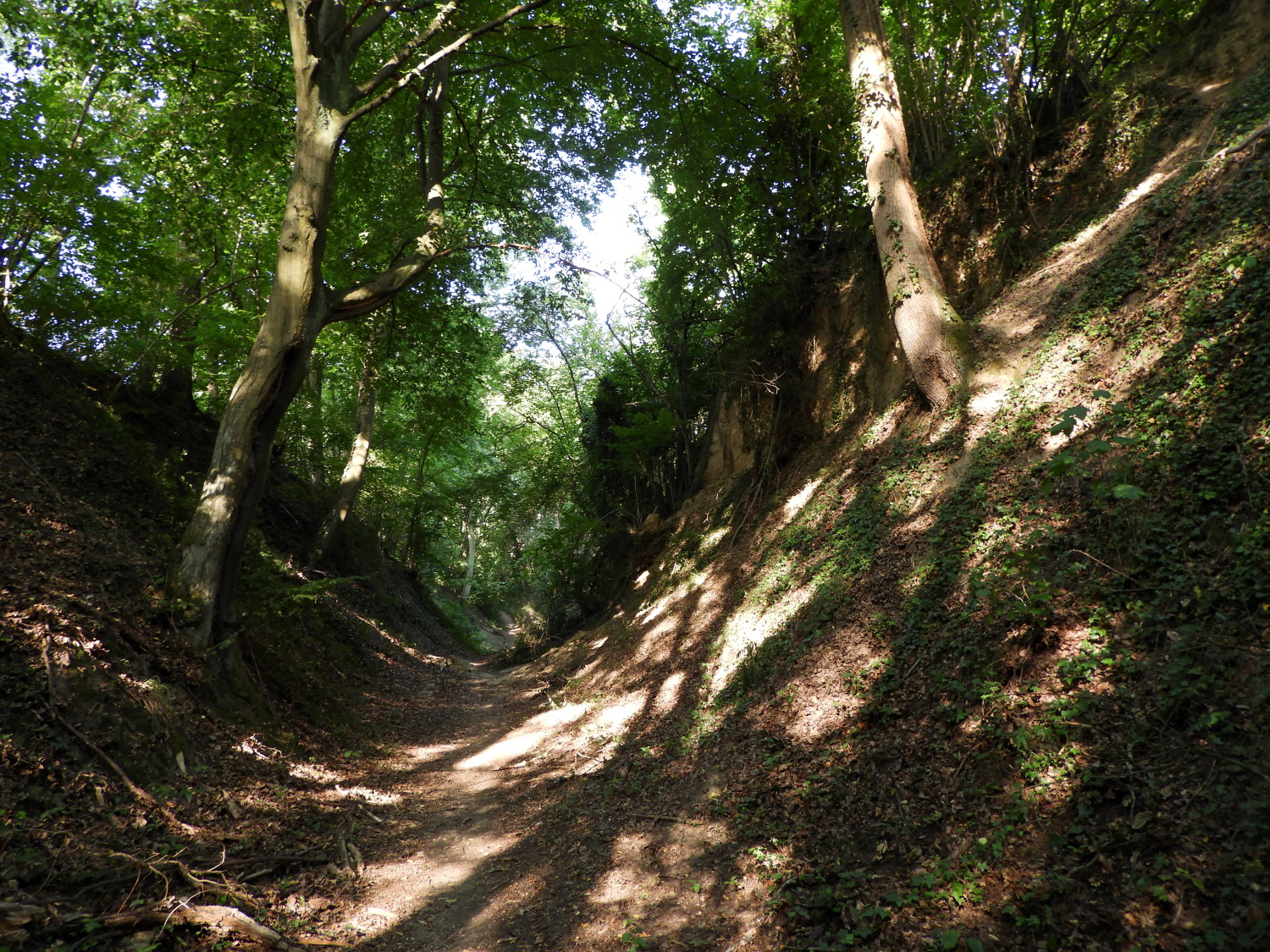 The holloway of midges
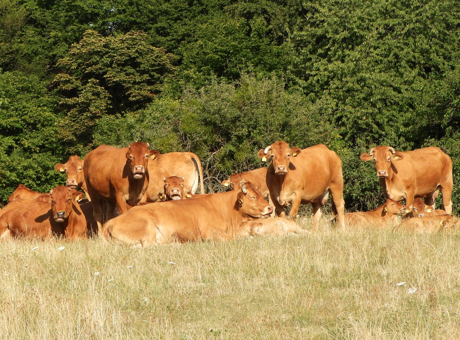 Good morning
As was normal on our Rhine Castles Trail walk, we were soon climbing from the Rhine valley to the surrounding hills. Today's particular first hill was Konigsberg, at around 200 metres high not too much of an effort to ascend. Or so we though, not realising we had to walk through the holloway of midges which was very unpleasant. The holloway looked to be fashioned over centuries but an information board told us different. It was part of a defensive bunkers structure, cut out of the ground during the Second World War. The information board reads "As a reaction to the air raids by the allied forces, a bunker was built in 'Brucker Hohl' in the summer of 1944. Three tunnels were driven into the mud wall of the ravine, which were connected to each other. The length of the tunnel was about 100 m, with a width of about 1.20 m and a height of about 2.00 m. About 250 m3 of clay had to be hewn by hand, loaded onto a wheelbarrow and transported outside. Up to 200 people found shelter here and sometimes lived for weeks in the cold corridors of the bunker". Now, thankfully, the bunkers are redundant, but the legacy of their construction in the hollow depression in the land is a sanctuary come breeding ground for the pesky biting insects which never gave us a moment's relief until we climbed out of the depression and into the shine of the morning sun. As soon as we had climbed out of the insect fog into the sunshine we spotted a herd of cows in the field to our right curiously watching us waving our arms around our heads. It must have been an amusing sight for them.
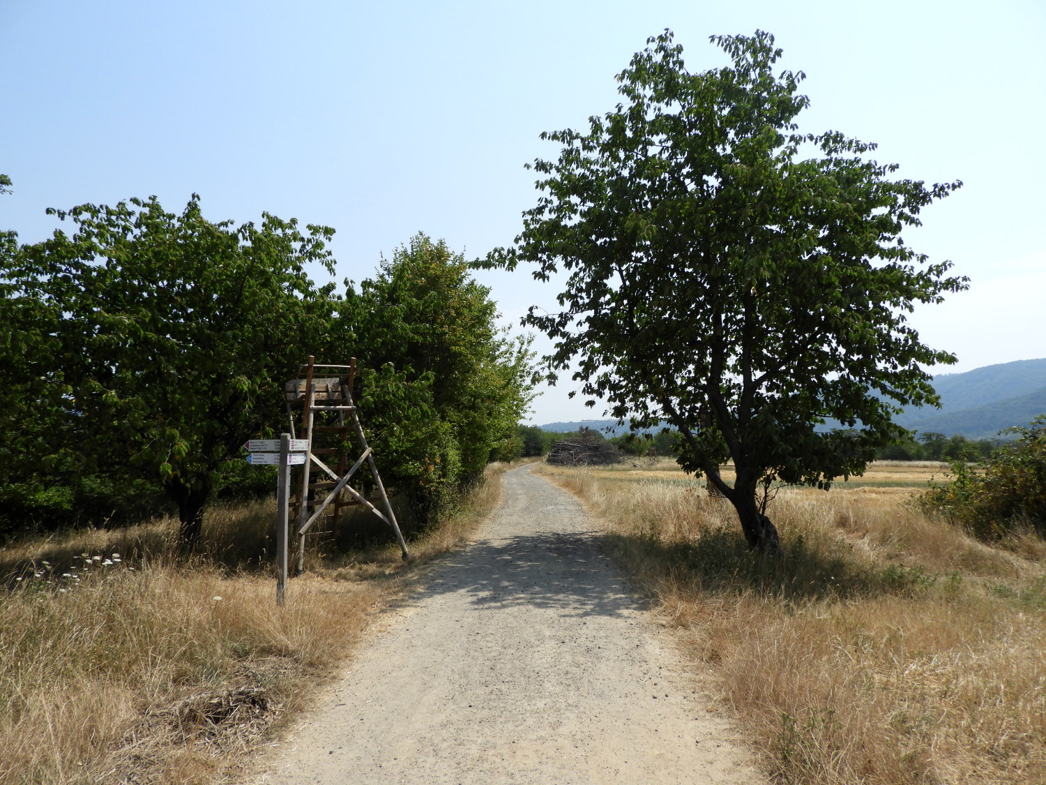
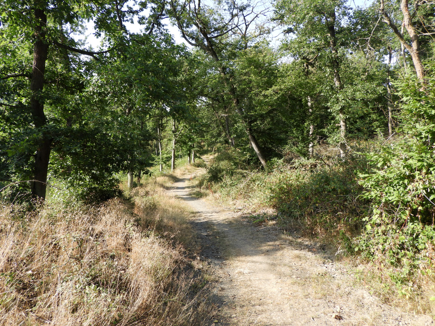 The path from Konigsberg to Vogel
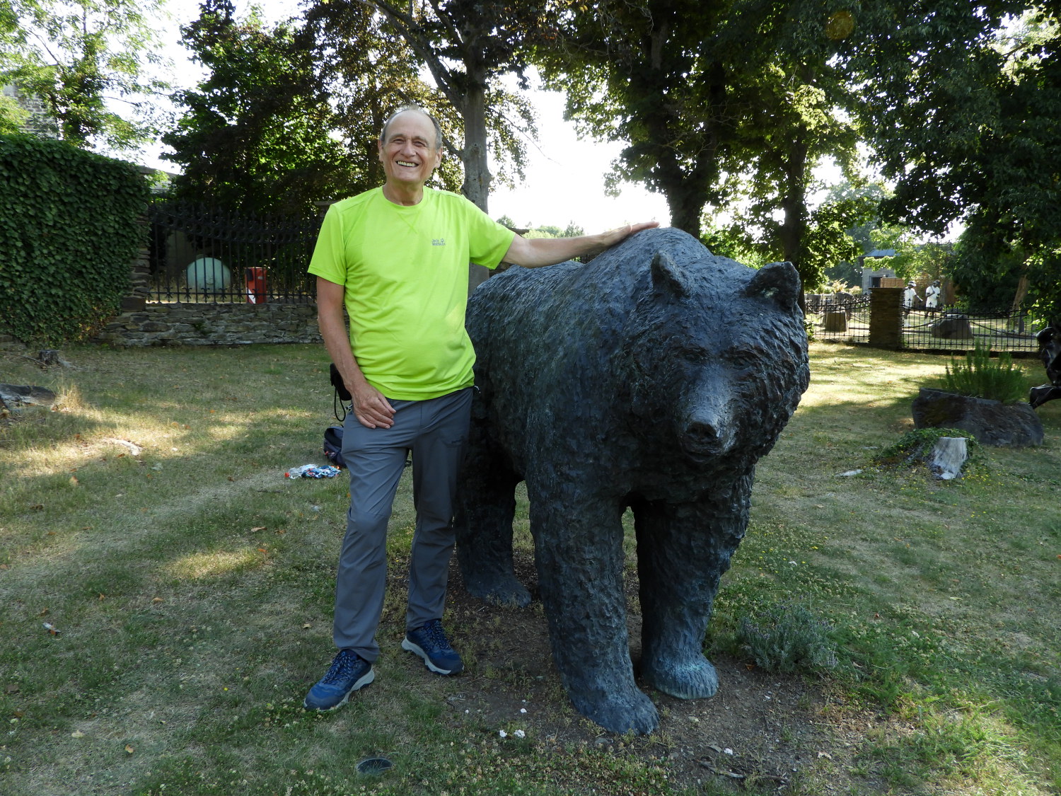 Brock and Bear at Jakobsberg
Once up on the Konigsberg hill and in the fresh air we followed a lovely midge free 'niederwald' coppiced trail through elevated woodland, sustained at between 200 metres and 220 metres to Vogel, on the way reading boards telling us which wildlife to look out for. These included 'Der Waschbar' and 'Der Dachs', Raccoon and Badger. Interesting, we had never seen a Raccoon in the wild. We still haven't, the elusive critters. Soon after our vain animal spotting we arrived at the site of the former 12th century monastery at Jakobsberg. Now converted to a Hotel, Spa and Golf resort we took a break in the grounds to enjoy some refreshment, including the refreshing Rhens spring water, and to enjoy life-size wood carvings of more animals which roamed these parts during the time of monastery life. These included Deer, Bear and Wild Boar.
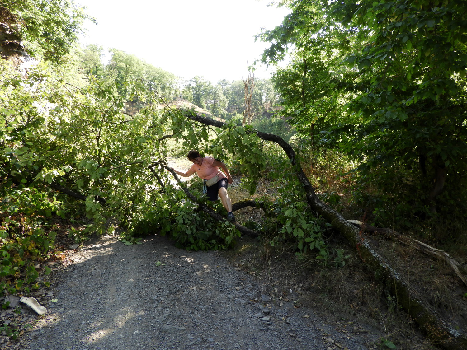 Negotiable blockage on the path
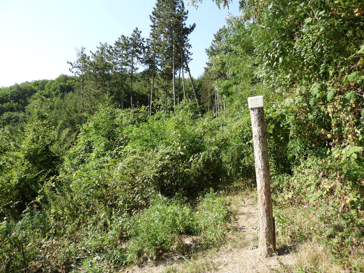 No way through
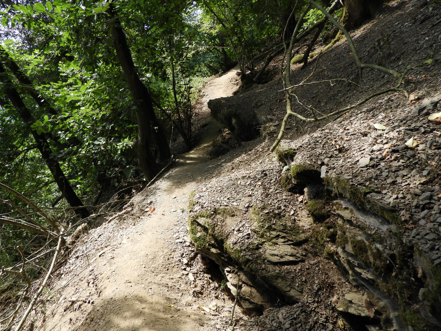
As I have mentioned in stage two of the walk, when we were diverted due to a bridge collapse over Ahr Fluss near Salzig, this wonderful summer of 2022 we were enjoying was in direct contrast to the disruptive tempestuous summer of 2021. Then, torrential rain storms had caused much damage in Europe and Central Germany was badly affected by the storms. Apart from that time along the Ahr we had not seen much evidence but now from Jakobsberg through the Friedrichloch valley, on the Rheinburgenweg path falling and rising between 200 metres and 300 metres altitude, we found out the damage caused for a second time. We had no warning, apart from a few dropped branches from trees, that the path was impassable. No warning had been given, no signs stating the way ahead blocked. No diversion offered. Just a post driven into the middle of the path with a square white disc on the top of it. We knew it meant 'Turn back'. I studied the map and fortunately due to there being an access track up to Jakobsberg from the Rhine valley we could avail ourselves of that. It was good enough, we had only vainly walked 300 metres or so in the impassable direction.
 View to Boppard from Peternach
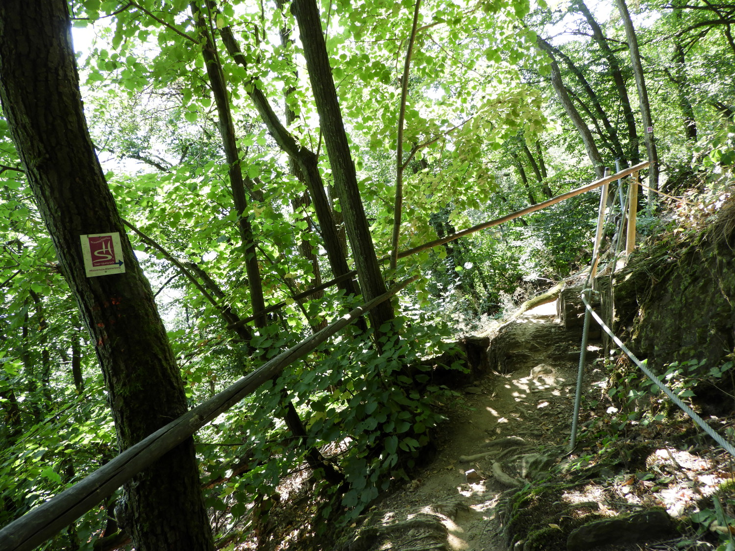 On the Klettervariante path
What the forced detour caused though, was to send us downhill towards Peternach and into the full sun exposure of the Rhine valley. Despite being only around 10.30 in the morning it was insufferably hot. The temperature was already well into the thirties and not ideally suited to walking. Especially now, as we were walking along unforgiving tarmac running parallel to the Rhine. At least we had a couple of diversions from cooking in the valley. Firstly, a welcoming view of the Rhineside town of Boppard growing closer. "We shall have a long break for lunch when we get there" I promised Lil. Secondly, the entertainment of watching Crickets leaping across the tarmac road as we stepped along, the acrobatic insects travelling from one side to the other and sunbathing between jumps.
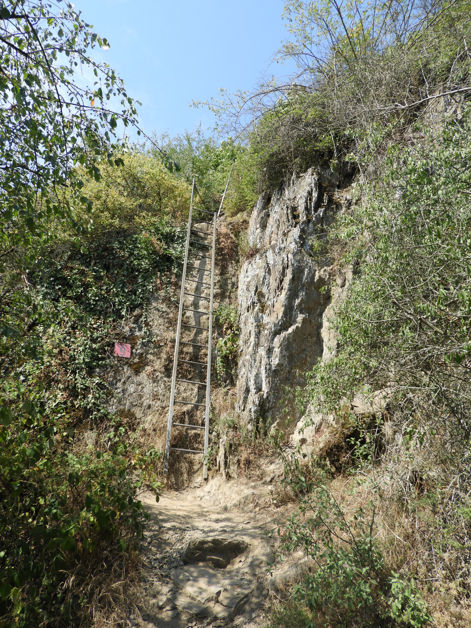 The first ladder on the Klettervariante
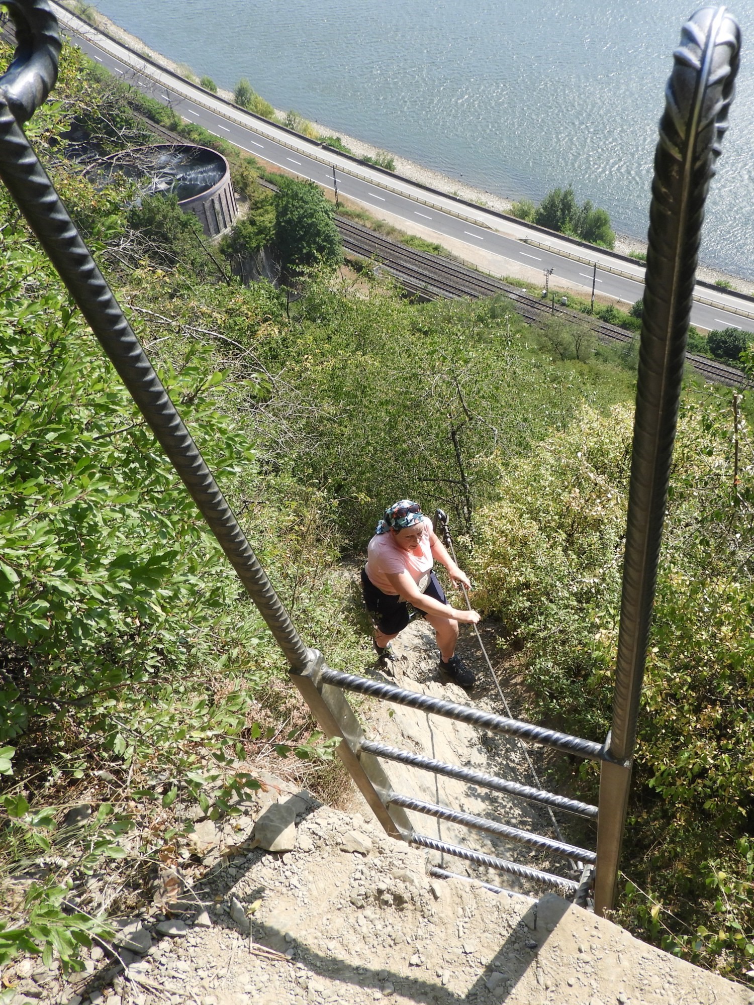 Lil heads from first to second ladder climb
Still, despite the distractions, being exposed to full sunshine was not good for us and I knew some cover was required, either temporary for us to rest and cool down or better still to walk. Also, the minor road we were on was slowly dropping us down to the busy trafficked road running beside the Rhine into Boppard and, with still a couple of kilometers to go before reaching the heart of the town, walking along the roadside would not only be uncomfortable but also we would have fried. Fortunately, where the Ewig Bach flowed into the Rhine some vehicles were parked and signs pointed to paths leading up the stream side into the cover of woodland. As we climbed up in the relief of shade a group of youngsters with team leaders were heading down. We exchanged a few words and their smiles showed us they had enjoyed fun up there. A little way after passing the joyful youngsters a junction in the path showed us two options. The one climbing higher read 'Wandervariante'. The one on our level and leading on a seemingly direct line towards Boppard read 'Klettervariante'. I will remind you now, I have been learning German and until now knowing the basics had been very useful. However, while I knew Wandervariante meant 'Hiking Variant' I wish I had understood what Kletter meant. So off we went, totally unawares, on the 'Climbing Variant'. At first the path was easy, a few narrow stretches with wooden posts and barriers protecting us from vertiginous drops causing the odd exclamation from Lil. But, with care taken no problem. And then we rounded a corner, me first. "Oh flipping heck!". I said.. or stronger unprintable words to that effect.
Lil came around the corner and saw the reason for my exclamation. We were facing a sheer wall of rock. And the only way up was by climbing a ladder fixed to the vertical rock face in front of us "Blooming heck, we will have to go back" I said. "You what, I am not going all that way back down. We will just have to do it" replied Lil. I was surprised and a little heartened by her response as I did not fancy turning back either. But in truth I do not know who was quaking the more at the prospect of the climb. Me or her. I was not entirely comfortable. Still, it did not take long for us to agree that we had to go on. "Just do it. I will kill you afterwards!" she said. "Okay, I will go first, here is my phone and camera, make sure to take some pictures for the record. No one will believe us otherwise" I said. And with them handed over, off I went, climbing the ladder first. Once up the ladder I beckoned Lil up, not telling her what we faced after the climb. Another cliff face and another ladder climb. Yes, we had two in a row. Oh what fun we had.
Lil's important comment from the ladder climb: A few details my darling hubby failed to mention about the ladder climb : Firstly I am not comfortable with heights at all and I needed all my concentration to get up safely without any other thought. No chance of that with Michael, he had passed his phone to me to take a photograph of him climbing. But he had not thought about where I would put the phone when It was my turn to climb up. I did not have a backpack that day and I did not have a pocket to put it in. So I had to improvise by putting it down my bra! It is a good job I am not flat chested!
 The narrow path along the Klettervariante
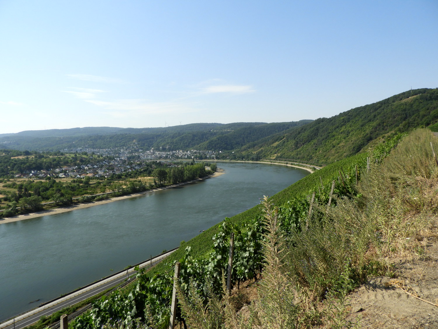
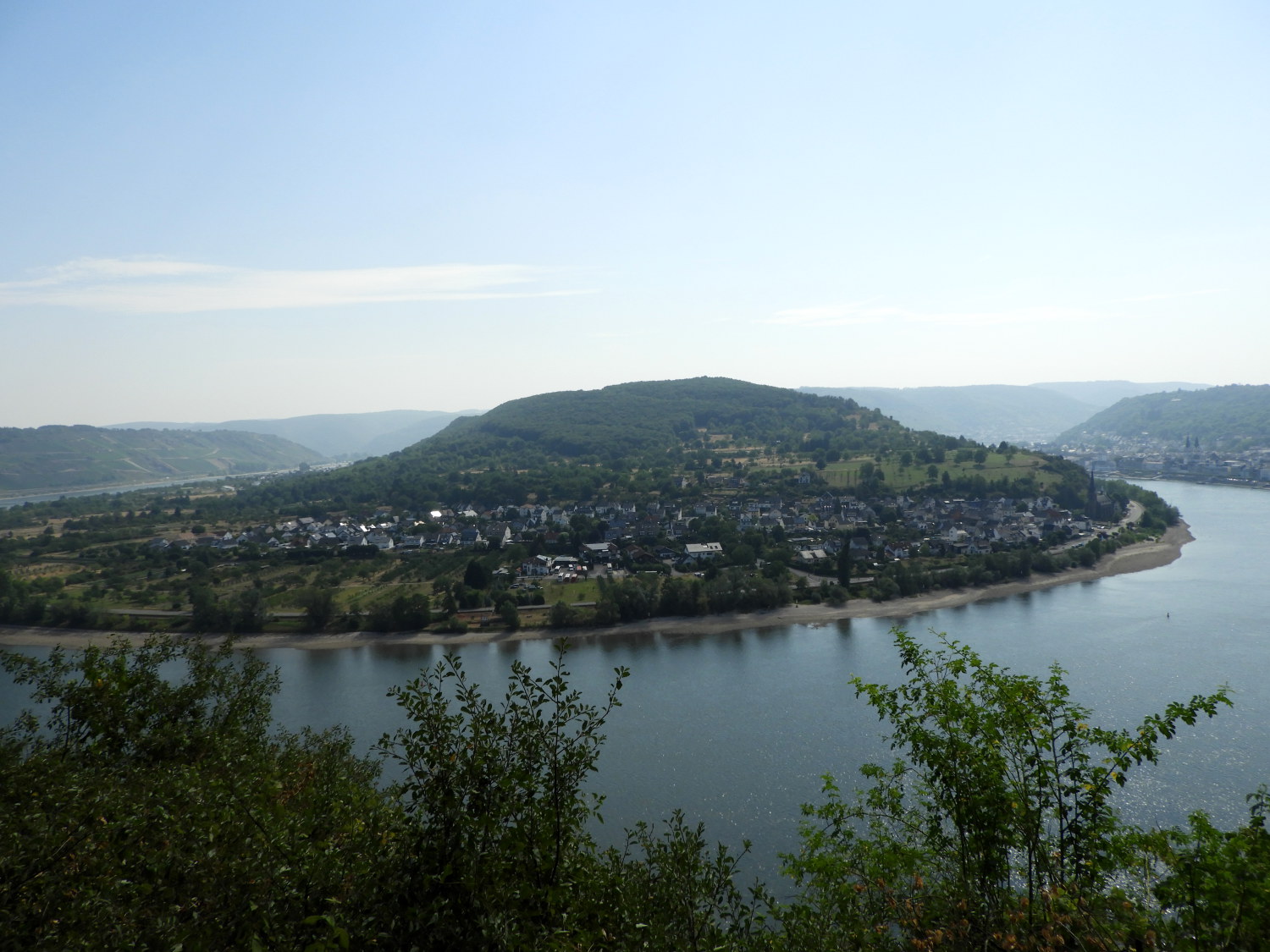 The 180 degree bend of the Rhine at Filsen
There was still quite a stretch of walking along the Klettervariante climb path to be contended with after the ladders but nothing quite as intimidating. Except that is for a descent into fresh air which we didn't quite fancy. That came just after meeting a mother and teenage son who were roped and hitched up for a cliff face adventure. I actually asked "Are you seriously doing that?" to which I received an affirmative answer. As, following his mum, the youngster descended from view I said "Good luck. Tschuss". He smiled while waving back before disappearing. Thereafter we found the Wandervariante again and stuck with it. The regained ease of walking on the hiking path gave us more opportunity to look beyond the path and enjoy the views. Including the spectacular one of the half circle bend in the Rhine around the municipality of Filsen.
 Easy walking at last when approaching Boppard
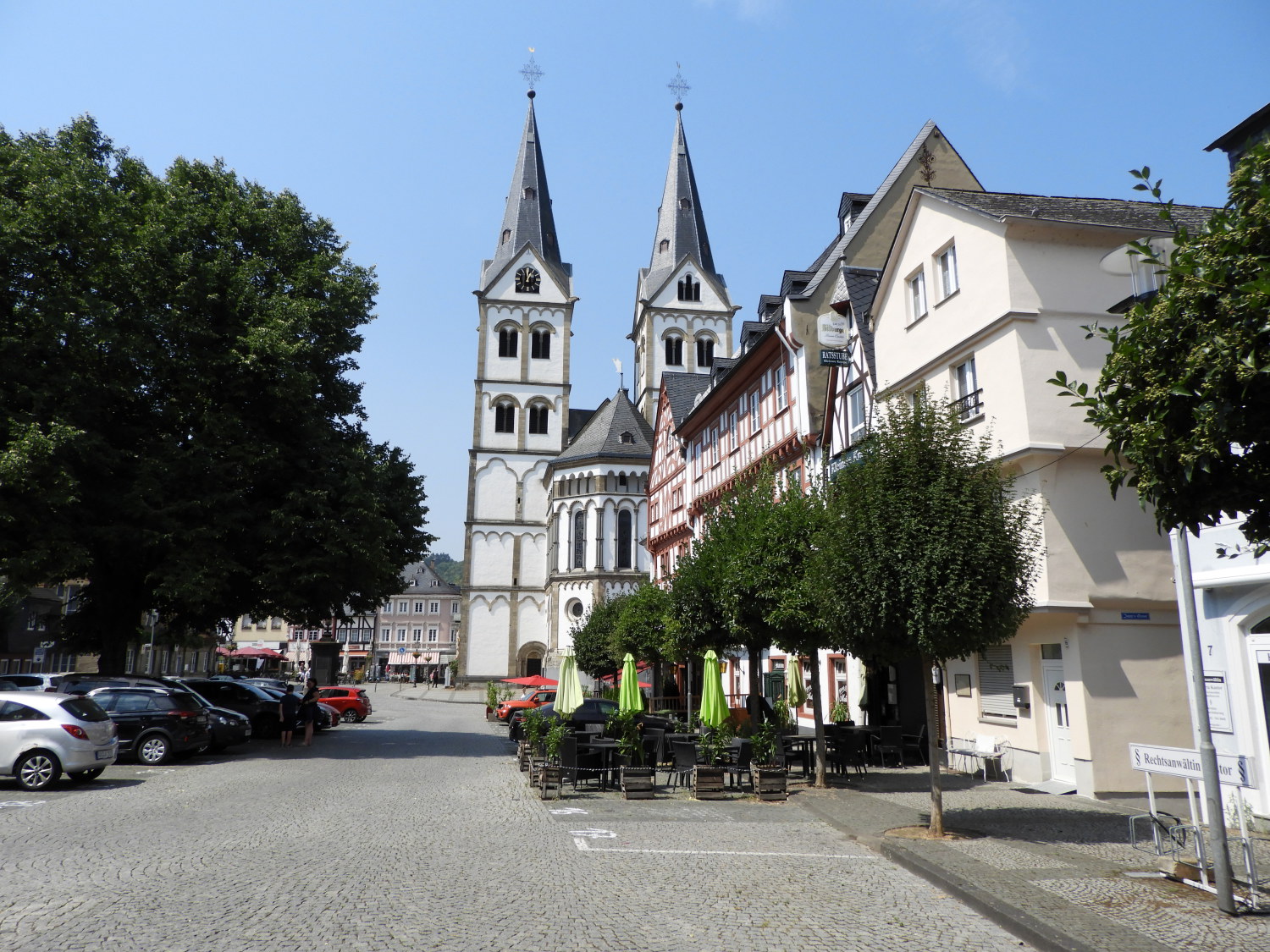 Boppard
We next descended through the middle of a pretty wildflower meadow into the northern extremity of Boppard. After the effort and some stress of the previous hour of walking, scrambling and climbing we were now pretty fatigued. And as it was now around noon we very much looked forward to stopping for lunch. First though we had to rejoin the Rhine Castles Trail which we had been forced to leave at the trail blockage beyond Jakobsberg. That proved to be easy, the Sesselbahn Chairlift up Gedeonseck running parallel with the path pointing us directly to it. Once reunited with the Rheinburgenweg we ambled into the town of Boppard by way of a riverside path. Then it was time for lunch in the town centre square, a lovely setting indeed. The only problem we had over lunch though was another aerial assault, this time not by midges, but by wasps. They fancied my cold lemonade so I spilled a drop on the floor to distract them which helped us while we relaxed and took lunch. During our break I asked Lil how she was feeling. We were booked into a hotel in Boppard for this evening and could easily have stopped now. And with the effort of the forced diversion and climbing trail I would not have blamed her for cutting today short. But she would have none of it. "It is still only around lunch time and I am good to go" she said. "Okay, that's great" I replied.
 Steep climb to Eisenbolz
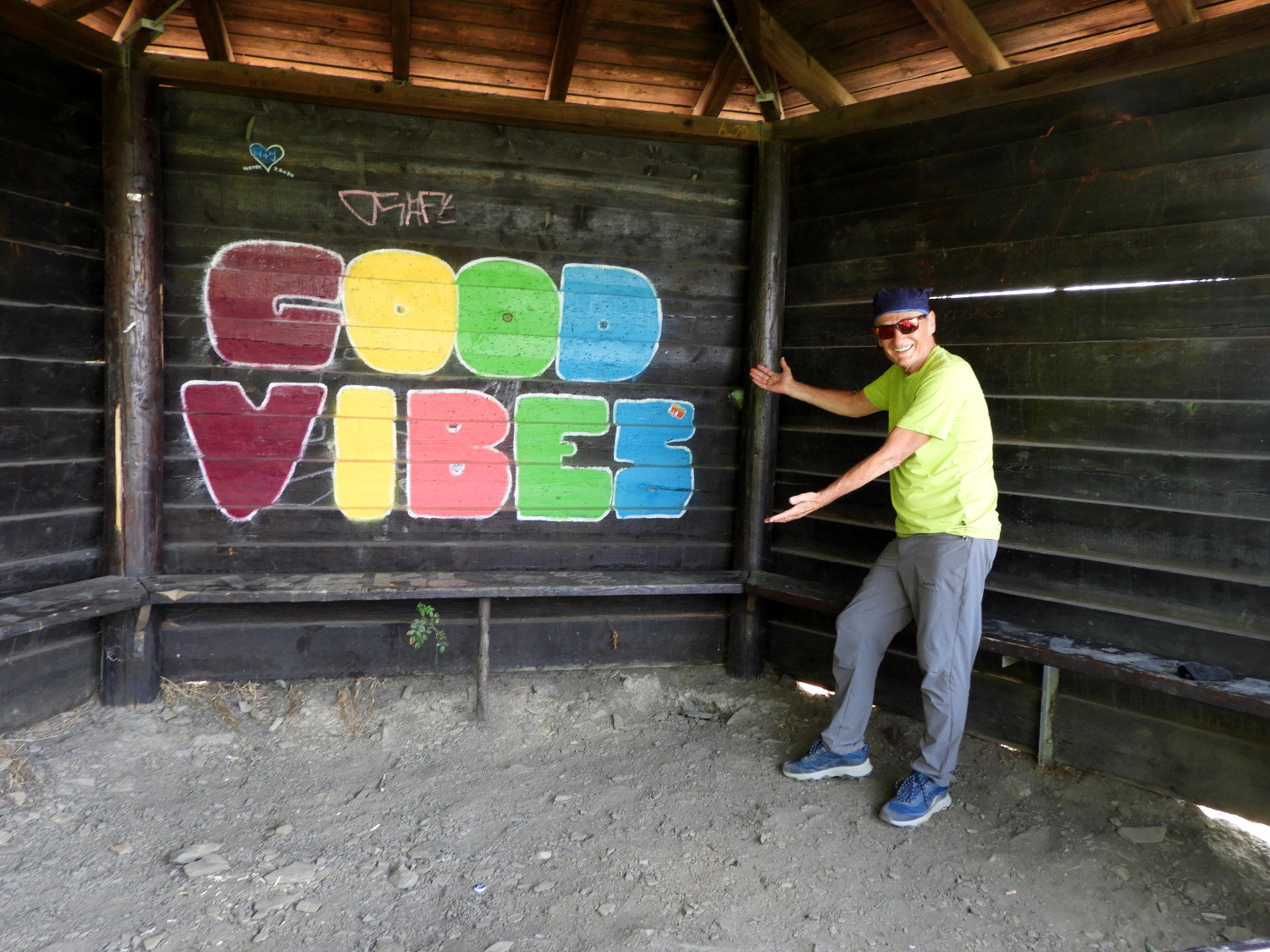 Chilled out in the Eisenbolzkopf hut
It was a good job we had an extended break of nearly an hour for lunch and for picking up a few refreshments in Boppard because on leaving town it was straight back up hill again for us. We followed the Rheinburgenweg through Marienberger Park and Garden which led us to the very steep zigzag climb up to Eisenbolz. The climb was a full on 100 metres which we made in several stops and starts, the regular breaks necessary to stop our engines overheating. Suffice to say we were both extremely chuffed to reach the panoramic viewing hut which marked the end of the seriously steep part of the climb. Here we rested for ten minutes before on the final mile and a half of our Rhine Castles Trail walking day.
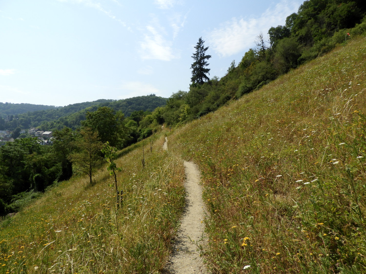
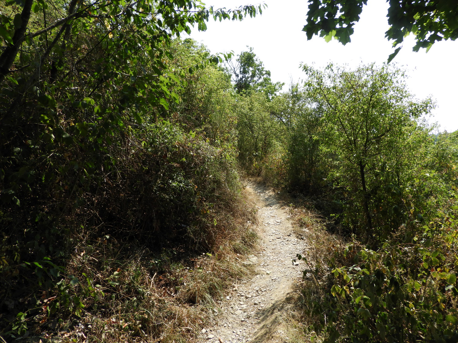
 The track from Eisenbolz to Bad Salzig
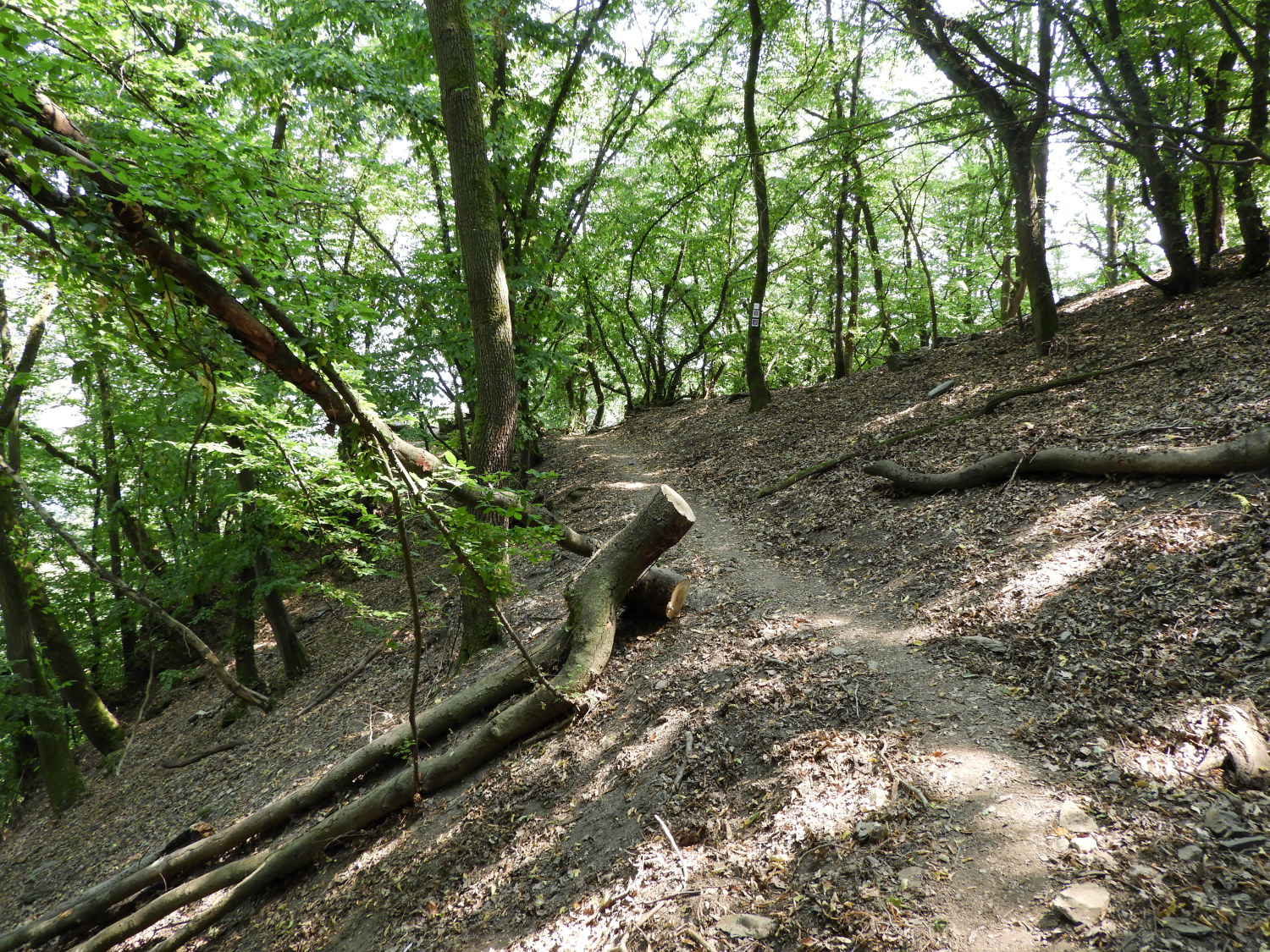 The path leading down to Bad Salzig
The only problem with this last phase of the walk from the heights of Eisenbolz to Bad Salzig was that most of it was walked out in the open, fully exposed to the high noon heat of the sun. Now the temperature was touching into the forties and we flagged. We were now getting grumpy; Lil in particular, and it took all my coaxing and encouragement to keep her going. Look at the track in the first picture above. Had I cracked an egg and dropped it on the path, it would have fried immediately. Fortunately for us, with just less than a mile left to go, we left the high wide path, following a narrower single file path through woodland, leading down towards Bad Salzig. Alas, the relief of cover from the sun and the gradual decline put Lil into a sense of relaxation which caused her to slip and fall a few metres down the banking. Just about where the above picture shows. Though just scrubbed a bit and not at all bloodied she was not amused. It was a good job we were nearly home. And ten minutes later Lil was smiling at the Mittelrhein Alpakas of Bad Salzig which grazed in the Animal Park along Salzbornstraße. After the diversion of fun all that was left for us to do was amble into Bad Salzig, work out the time of the next train to Boppard, and find a cafe for a coffee and cake to enjoy waiting for it. Job done.
Wow, what a day. Running a gauntlet of midges, walking to a dead end, climbing ladders up cliff faces, contesting the wasps attempting to steal our lunch, making the steepest of ascents after lunch, Lil's fall from grace, the joy of the Alpaca's. And all in the heat of a very very hot summer's day. Fantastic. Neither of us could wait for tomorrow adventures. Oh, and one more point of note; addressed to my wife Lil. "Well done sweetheart. You were absolutely brilliant in overcoming all the hurdles we encountered today. All faced without complaint. I always knew were the Walking Englishwoman!"


