The Great British Walk
A personal record of my three month walk of the full length of Great Britain from north to south with written journal and photographs. Tracklogs for GPS units and for use with Google Earth are available for download for each stage.
Stage 3: Rhiconich to Loch Stack
Google Maps Open Source Maps| Statistics and Files | ||
|---|---|---|
| Start: Rhiconich Hotel | Finish: Loch Stack | Distance: 8.0 miles (12.8 km) |
| Time: 6-8 hours | Climbing: 441 metres | Total Distance: 25.5 miles |
| GPX Route File | Google Earth File | About Rhiconich |
| Statistics | |
|---|---|
| Start: Rhiconich Hotel | Finish: Loch Stack |
| Distance: 8.0 miles (12.8 km) | Time: 6-8 hours |
| Climbing: 441 metres | Total Distance: 25.5 miles |
| GPX Route File | Google Earth File |
Ordnance Survey Explorer Map (1:25,000)
Summary
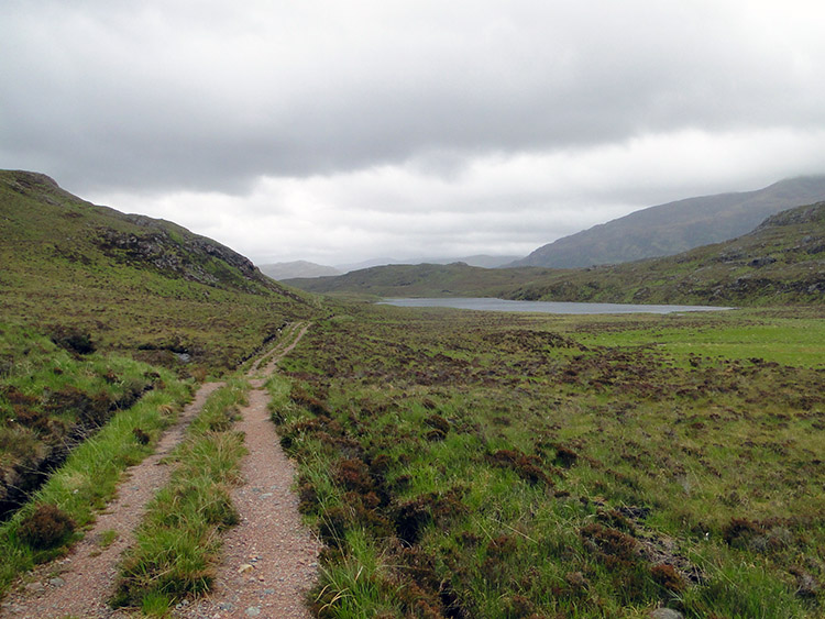
This was the first true wilderness day of the walk as I left the A838 road behind and tracked across the wild lands of north west Scotland. During the walk, which due to the terrrain and difficulties of crossing water took seven hours to cover just eight miles felt for the first time that I was really alone on the walk. I never met a single soul on the stage and whist walking over the bleak but fascinating landscape I considered my first ever wild camp at the end of the stage. And on a night which was forecast to be a very stormy one indeed. The stage itself took me from Rhiconich Hotel on a course south east through a valley following the Rhiconich River upstream and past a number of lochs to the western edge of Arkle mountain before I turned course to south east to Loch Stack.(Note: My walk of the Cape Wrath Trail was a part of my Great British Walk from the north coast of Scotland to the south coast of England)
Stage Report
This stage of the 1,000 Mile Walk was one of the most awesome days in my entire walking life. I set off on an overcast but dry morning from the Rhiconich Hotel by following the Rhiconich River upstream to Loch a Gharbh bhaid Beag on a well defined path. Immediately in setting off I had a feeling of complete solitude as I walked from the hotel and away from the A838 road which had been my companion yesterday. It was dead quiet from the start, apart from the rushing waters of Rhiconich River which vigorously made their way north west toward Loch Inchard and then to mix with the salt water of the sea. I had two mishaps on the first stretch. First my map dropped from my pocket and I walked a half mile before stopping to read it and realising it was not there. I had to back track almost all the way back to the hotel, finding it laid on the path side just after I had descended steps from the road bridge near the hotel car park. Recovering the map I worked out a safer place to store it. Then on reaching the spot where I had originally stopped and walked back for the map I broke my walking pole. I attempted to make a temporary repair but to no avail, I would now have to walk without it while carrying my 16 kilo backpack for the time being. I had no choice but to see how I would cope. A little irked by my misfortune I continued on to Loch a Gharbh bhaid Beag.
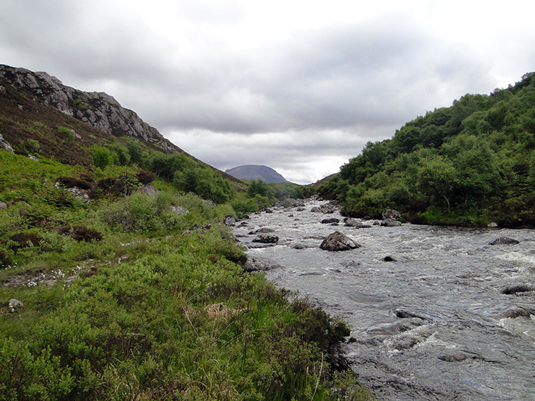 Rhiconich River
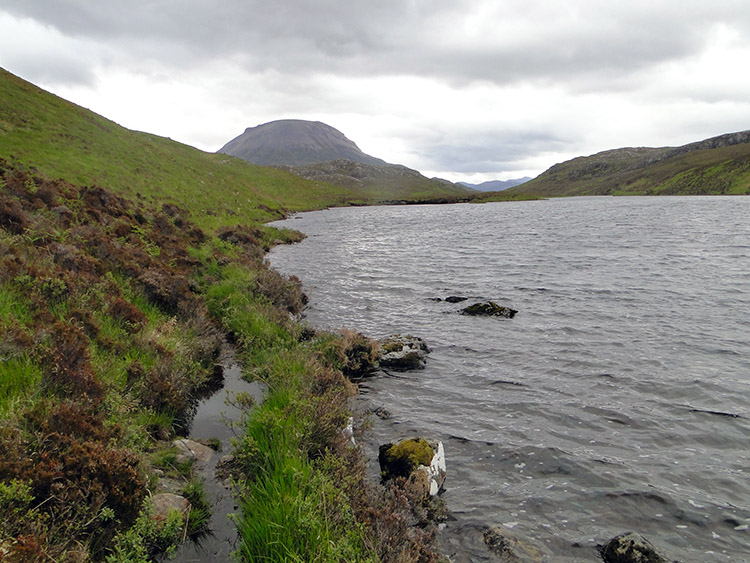 Loch a Gharbh bhaid Beag
Having reached the loch I stood in wonder at the stupendous scenery all around. Scotland is a wonderful place and north west Scotland in particular for on any path and around any corner there is always a new spectacle in sight. If it's not a river flowing fast with cascading waterfalls and if not a loch, which there are many of all shapes and sizes with there own characteristics, then it's a hill or a mountain, many not named on the map but with fabulous character, aloft high and proud. North west Scotland is a wonderful land and the perfect place to spend the first week of my 1,000 mile walk. On my previous stage I had marvelled at the sight of Beinn Spionnaidh. Now I was awestruck by the sight of Foinaven and Arkle, two majestic mountains that I was walking near to. Continuing the walk past the loch the path petered out and it got very wet under foot. The Cape Wrath trail is obviously not a well walked route.
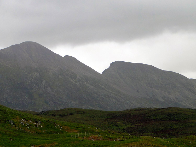 The west face of Foinaven
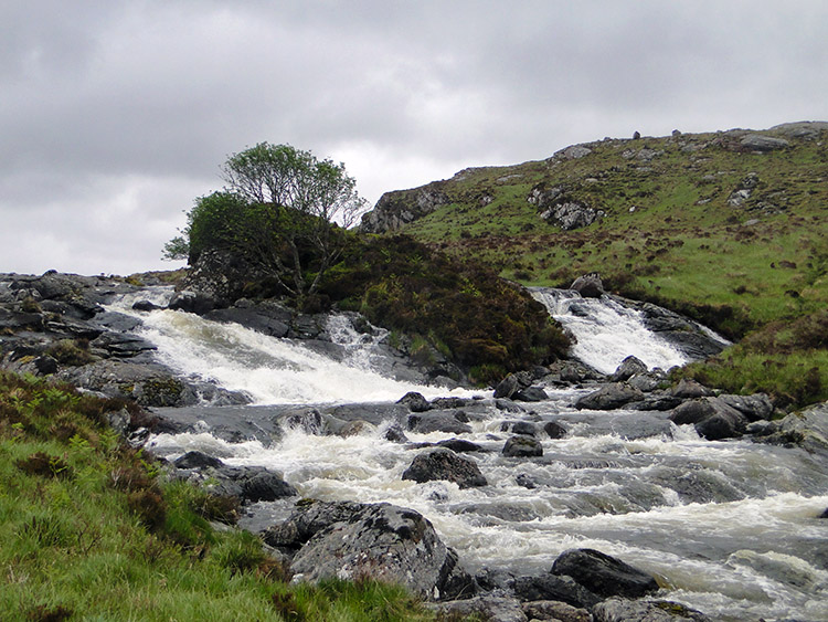 Garbh Allt was not safe to cross here
Without a path to guide me I had to make my own way from Loch a Gharbh bhaid Beag towards Loch Agarbh-Bhaid Mor and this is when I met an uncrossable barrier. Between the two lochs there was the Garbh Allt right in front of me, a river crossing far too wide for me to negotiate and running far too fast after the recent rain. Although the guide book I was following advised me to wade across I was not going to do so. I followed the river upstream for about one mile past raging waterfalls, beautiful but too dangerous to attempt to cross until I eventually reached a wide flat section of water.
At the place I deemed safe to cross I stepped onto stones until I was half way over but they were not easy to negotiate. The last thing I wanted was to stumble and get my backpack, GPS or camera wet so I decided to step off the stones and into the river. I stepped in and continued to cross slowly and carefully. Better wet and safe than trying to stay dry I thought. On a couple of occasions I was in water up to my knees but at least my backpack and equipment were kept safe. Eventually I waded across to the east side of Garbh Allt. After the drama of the river crossing I tracked up to a rock outcrop where I sheltered from the wind and took out my stove to make a hot drink. As I did so I dried off my socks and mused on the excitement already enjoyed for despite the events so far I was highly motivated about the walk. After wringing out the socks, putting my boots back on and on enjoying my hot chocolate drink I tracked south back to my original course and to the shore of Loch a Gharbh bhaid Mhor.
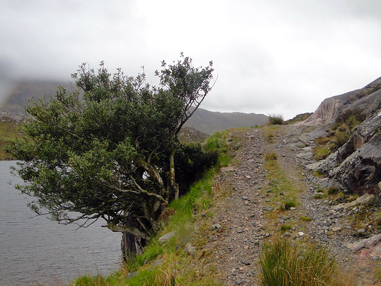
 The track to Loch Airigh a Bhaird
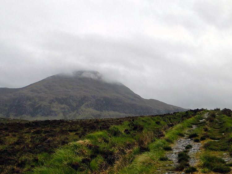 Cloud tops Arkle
The walk along the loch side was not as easy as I expected. There was evidence of a path but it was not well used and often disappeared. Also there were many streams cascading off Cnoc an Lochain Duibh which I had to leap or wade over. I could never get into my stride because of the frequent hurdles until I had completed my walk around the edge of the loch. After Loch a Gharbh bhaid Mhor I reached a flat stretch of walking alongside Alltan Riabhach but this proved to be difficult walking too. It was all wet uneven peaty and tussocky ground with streams everywhere. I searched for evidence of a path indicated by the guidebook but to no avail but there was a more prominent track promised by the lower slopes of Arkle so I made a beeline for it and after a further difficult 400 metres I reached it. I was overjoyed to do so for I had been wading through bog and crossing river and stream for about an hour. My feet were drenched. Such is the life of an explorer.
 Loch a Cham Alltain
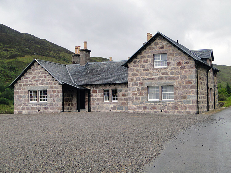 Loch Stack Lodge
Despite the wet feet I walked easily now on a good hard track towards Loch Aurigh a Bhaird and around the northern slopes of Arkle. It is an awesome white mountain which I had used as a navigation reference for the stage. As I walked past Arkle I continuously looked towards it and its cloud shrouded rounded peak as I had hoped to take a photograph of the summit. Alas the cloud stayed in close acquaintance to the mountain top and denied me the pleasure. Without the hoped for snapshot I walked on easily and soon reached Loch Aurigh a Bhaird. I skirted it on it's north east side with the spectacular massif of Arkle close to my left. I had been heading south east since Rhiconich and now I made a turn right to head south west for the remaining mile to Lochstack Lodge and my campsite for the night.
On the final stretch from Loch Airigh a Bhaird I passed yet another loch. This one, Loch a Cham Alltain a beautiful small loch was surrounded by trees making it an idyllic setting. I was now getting near to the end of my exhilarating day and I began to be overcome by the days walking. What surprised me most of all was that I had never saw another soul all day; I expected at least one or two people on the Cape Wrath Trail but I had seen none. However I was in my own beautiful world. From Loch a Cham Alltain I continued on along the good track and descended toward Loch Stack. Ahead of me I could see Ben Stack towering above the loch with a series of rock buttresses protecting its north east face. On the approach to the Loch I looked around Loch Stack Lodge to see if there were signs of life. Perhaps I could get a room for the night I mused. But no, the place was deserted and I looked through the windows of the lodge to see tidy well furnished rooms with an envious eye.
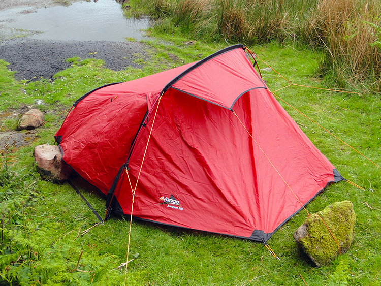 My camp pitch
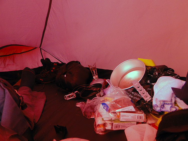 Inside the tent
With no chance of accommodation at the lodge I walked past Loch Stack to renew my acquaintance with the A838 and having walked on a 100 metres along the road I made camp near an old building which sheltered me from the buffeting winds which had been promised and which were starting to rage. As I pitched the tent I looked up to Ben Stack and watched clouds racing over from the south west at a hell of a rate. On completing my pitch I took an energy bar from the rucksack and stood up against the wall of the building, looking out to Loch Stack and Ben Stack while eating it. I felt warm and contented, a good day's walking was done and I could retire to the tent, snuggle up in the sleeping bag and look at the next days walk. And so I did, hoping that it would be near as exciting as this brilliant day.
And so I retired to my tent, protected by the building, well pinned down and consolidated with heavy rocks. Anything to stop me blowing away in the evening. Tomorrow I was to make my way around the west foot slopes of Ben Stack to Kylesku. Oh, before I did I was woken in the night by a right old roar, a Stag must have passed close by the tent and sensed the Walking Englishman was close by. He certainly let me know he knew, I missed a heartbeat!


