The Great British Walk
A personal record of my three month walk of the full length of Great Britain from north to south with written journal and photographs. Tracklogs for GPS units and for use with Google Earth are available for download for each stage.
Stage 10: Ullapool to Corrie Hallie
Google Maps Open Source Maps| Statistics and Files | ||
|---|---|---|
| Start: Ullapool | Finish: Corrie Hallie | Distance: 14.3 miles (23.2 km) |
| Time: 7-8 hours | Climbing: 810 metres | Total Distance: 99.6 miles |
| GPX Route File | Google Earth File | About Ullapool |
| Statistics | |
|---|---|
| Start: Ullapool | Finish: Corrie Hallie |
| Distance: 14.3 miles (23.2 km) | Time: 7-8 hours |
| Climbing: 810 metres | Total Distance: 99.6 miles |
| GPX Route File | Google Earth File |
Ordnance Survey Explorer Map (1:25,000)
Summary
A difficult stage following two relatively easy ones. The first part following the road south of Ullapool is not too taxing. It is 13 long kilometers of the same with only the occasional glances to Loch Broom and the mountains south and east providing a diversion. Once the road is left at Inverbroom Lodge the change is dramatic. It is a completely different walk altogether. After the short beguiling avenue of mature trees to Croftown the climb to the high ground is steep and quite tortuous, especially if trees have fallen over the only path available as when I climbed the hill. Once the climbing is done the next section is thorough delight with magnificent An Teallach coming into view which drew me towards Dundonnell. After Dundonnell it was then a simple case of finding a pitch for my tent to recover from the exertion of the day.(Note: My walk of the Cape Wrath Trail was a part of my Great British Walk from the north coast of Scotland to the south coast of England)
Stage Report
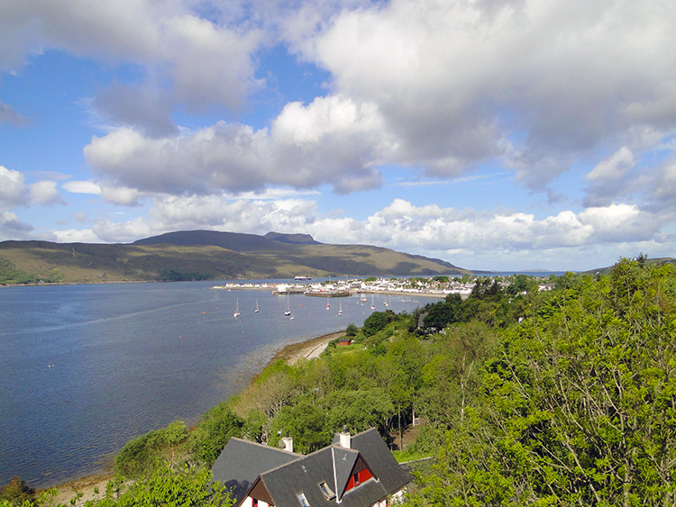 As I leave Ullapool the sun come out
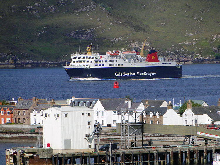 The Ullapool Ferry
What an amazing day this was. After enjoying a full cooked breakfast which I would not get again for a few days I checked out of my accommodation in Ullapool and set off walking. The walk began ordinarily along the roadside on the east side of Loch Broom but by a miracle I was walking in sunshine on a warm day. Unbelieving I set off with a smile as wide as the proverbial Cheshire Cat.
 Loch Broom looks much nicer in sunshine
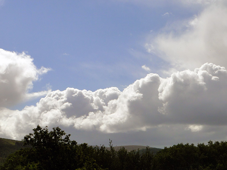 Blue sky
I looked across Loch Broom and back to Ullapool as I climbed with the road as it headed south. Not long into the walk I stopped for a while to watch a ferry roll into Ullapool. Had it come from the Shetland Isles. Or perhaps Oban or Mallaig I wondered. Then I turned my attention from Ullapool for the last time and walked on. Thoughts of the recent weather returned. I had suffered day on day of rain, high winds and cold since beginning this journey of Great Britain. True there had been interludes of dry weather and of lovely sunshine but recent inclement days had damped my spirits somewhat. I looked up at blue sky and wished it to stay.
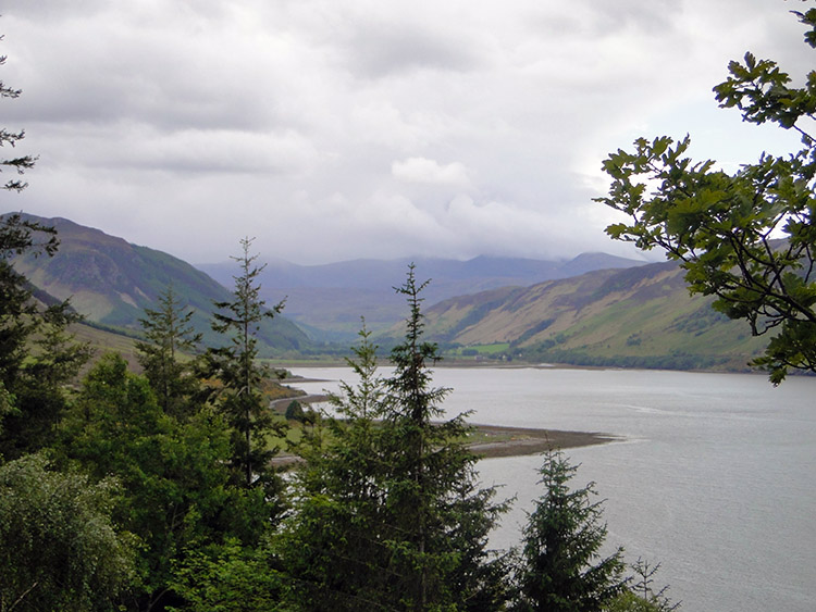 The south end of Loch Broom
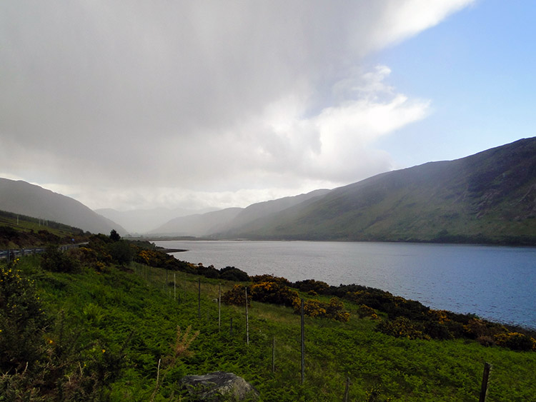 Storm coming
Despite setting off on a long section of tarmac the sun beaming down from the blue sky meant I enjoyed the walking immensely. Even my raincoat was shed for the first time. There is nothing better than walking in sunshine is there? Even in the grip of icy winter sunshine paints a lovely picture on the snow laden ground. Now it put a glisten on the waters of Loch Broom and it cast sculpted shadows on the trees as I passed them on the roadside. There were some marvellous examples at Leckmelm Shrubbery and Arboretum which I walked past. The Victorian woodland garden was planted in 1870, restored in 1984 and is full of splendid and rare trees. Apart from the trees it has lots of rhododendrons which would have been in full colourful display as I walked by. I would have liked to have called in but I did not have the time.
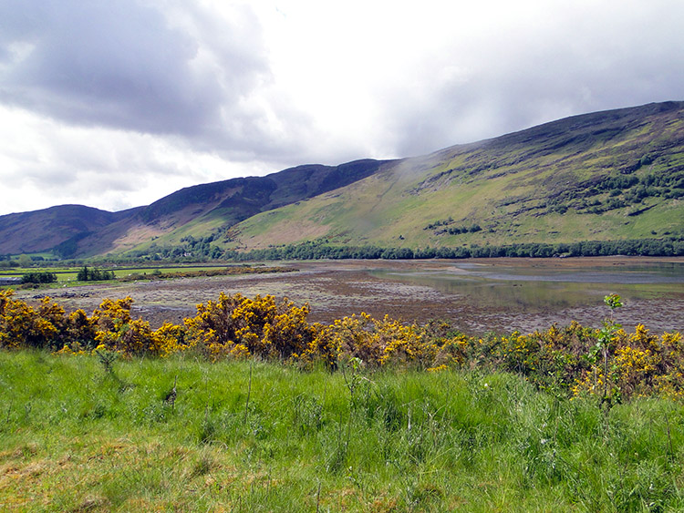 The tide was out at the south end of Loch Broom
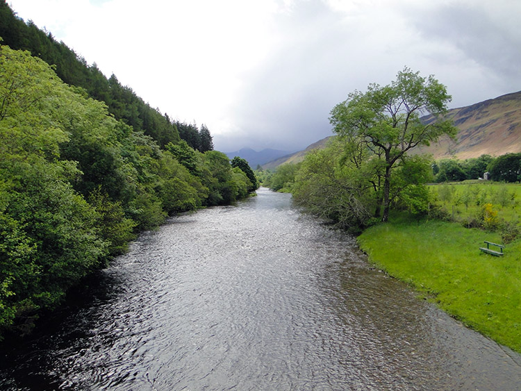 River Broom at Inverbroom Bridge
I cracked on to the southern end of Loch Broom and as I did so I noticed an ominous sky filling with rising cloud. I knew it would result in the inevitable downpour. My day of sunshine and blue sky was about to be broken. Temporarily I hoped. Quickly the cloud rushed northwards towards me. It was so fast in approaching that I had not the time to prepare properly. It was already pouring down when the raincoat make an appearance. I put on the waterproof cover as quick as I could while squalls of wind blew the heavy rain shower across my face. I sought out cover and took a forced refreshment break while hidden under a canopy of trees. The accompanying wind was a blessing though as it scuttled the water laden clouds along. The shower lasted just long enough for me to finish my refreshments. I resumed on a dry walk.
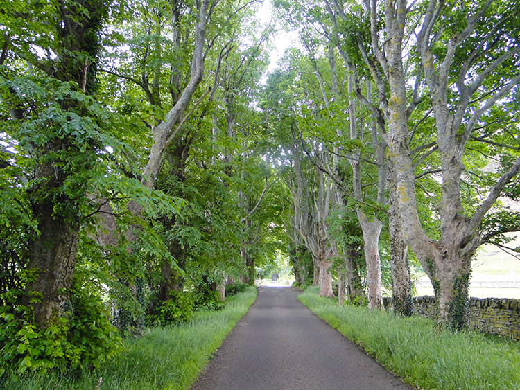 Avenue of mature trees leading to Croftown
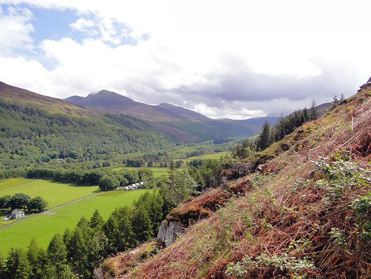 View of Beinn Enaiglair and Meall Doire Faid
Loch Broom was behind me now so with weather fair I decided to head for high ground and cross Meall a Chairn to take me to Dundonnell. Now the fun started. Do not imagine the Cape Wrath Trail has signs. Do not imagine it has defined tracks either. it is often a guessing game finding your way. Following the ‘North to the Cape’ book directions I reached the hamlet of Croftown and ended up in someone’s garden. A gentleman came out and told me I was on the right track but for some reason it had been fenced off and now walkers were forced to go round the houses. He never minded before, it was a natural access to the fell but he was not given a say. More frustrating for him the people who developed the diversion did not put signs up so he was forever having to tell errant walkers. I was the latest of many.
 On the level at last, a relief for sure
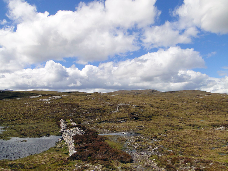
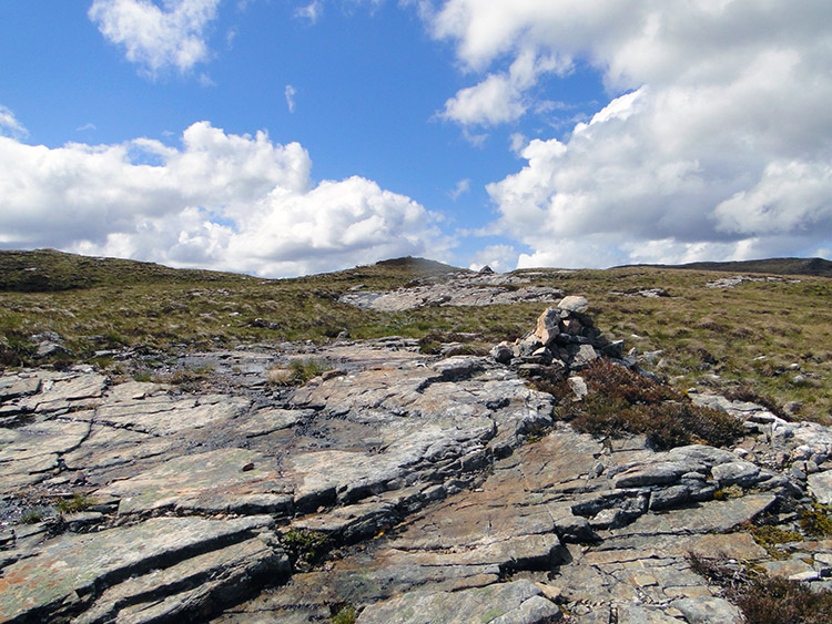 Near Loch an Tiompain
When I did find the new route it was unmanaged and through gorse. I tumbled in the thick stuff and ended up with my right hand like a sieve, sprouting blood through half a dozen perforations. I was not amused. Then it got worse, the track was blocked by numerous felled trees which forced me to scramble up the fell at an acute angle. I ended up on more or less a straight course up and when I regained the defined track after 250 metres of steep ascent with my heavy backpack I was really knackered. I struggled for the rest of the day because of that fiasco.
 A wonderful mountain range captures my imagination
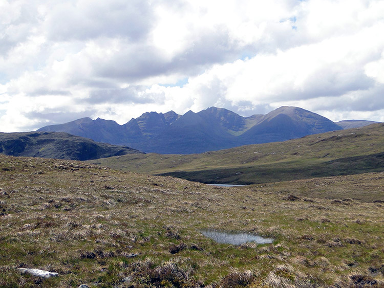
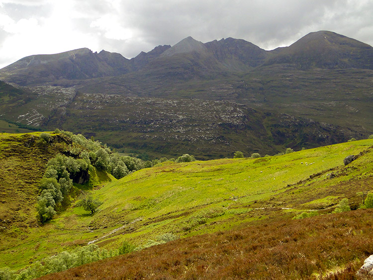 An Teallach looking formidable, a WOW mountain
Fortunately most of my height was gained and I trudged slowly to my high point of the day and then spent the next hour negotiating a high pass between several lochans and by forming many streams. Then came another of those WOW moments. A wonderful mountain range came into view, a mountain to grab the attention with a row of jagged high edges. I had centered my eyes on An Teallach for the first time. The beguiling view drew me forward and although my lethargy was complete An Teallach inspired me to keep going.
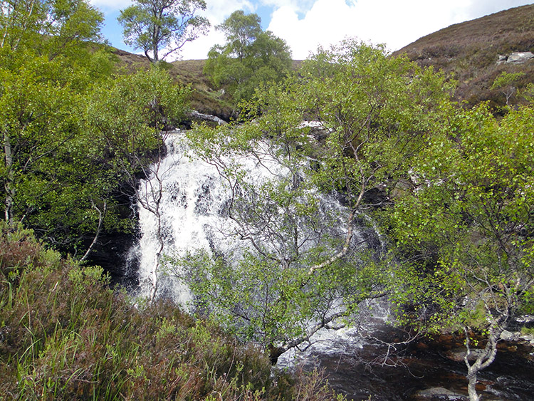 Waterfall on Allt a Chairn
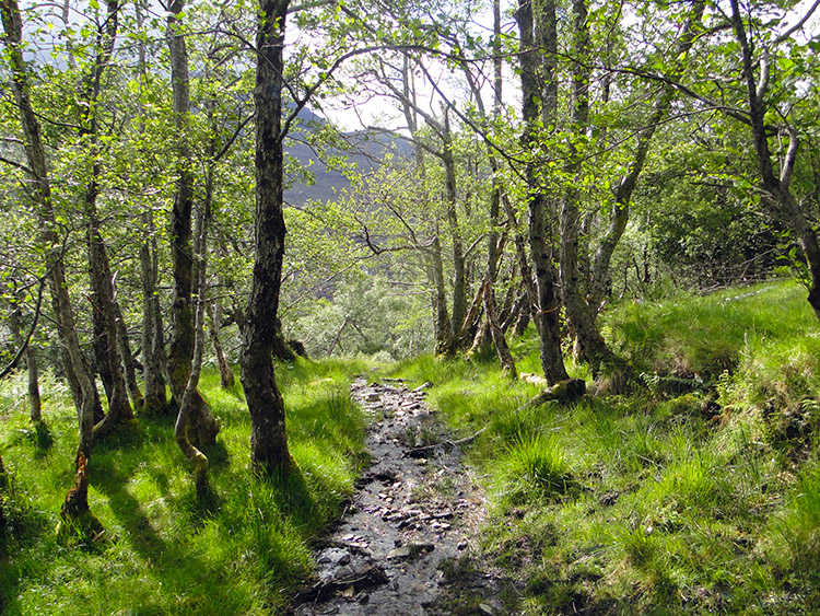 Descending through Birch Wood to Dundonnell
As I drew closer to the fantastic mountain, it is another I will now class as a great along with Suilven, Stac Pollaidh and others, I had began my slow long descent to Dundonnell. As is the norm for this walk though, the descent was not straightforward. About 500 metres from reaching the valley floor I came to another stream, only this time it was not negotiable by a hop, jump or across stones. It was another wading job. Too tired to remove my socks I just stepped straight in and waded knee high. I did not’t care and so I squelched out the other side and for a couple of hundred yards until I found a rock to sit on, remove my boots and wring the socks out. Oh well, some laundry done.
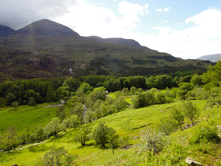 Corrie Hallie
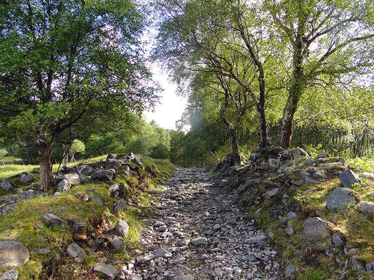 Looking for a pitch
Finally and after eight hours I reached Dundonnell. Down on the roadside on the A832 I followed it around a corner to some woodland marked on the map. I hoped to put my campsite in the woods but everywhere was too wet. From a distance it had looked welcoming, a mass of lush grass. But it was deceiving. The grass was set in swampy ground. There was no chance to camp here so I trudged back on the road to the path I would follow in the morning. I had to find higher ground.
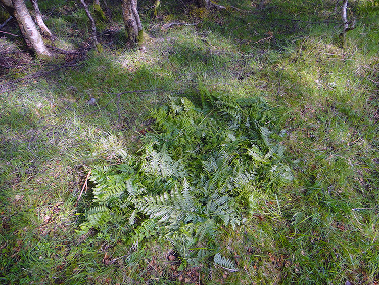 Bed of Ferns
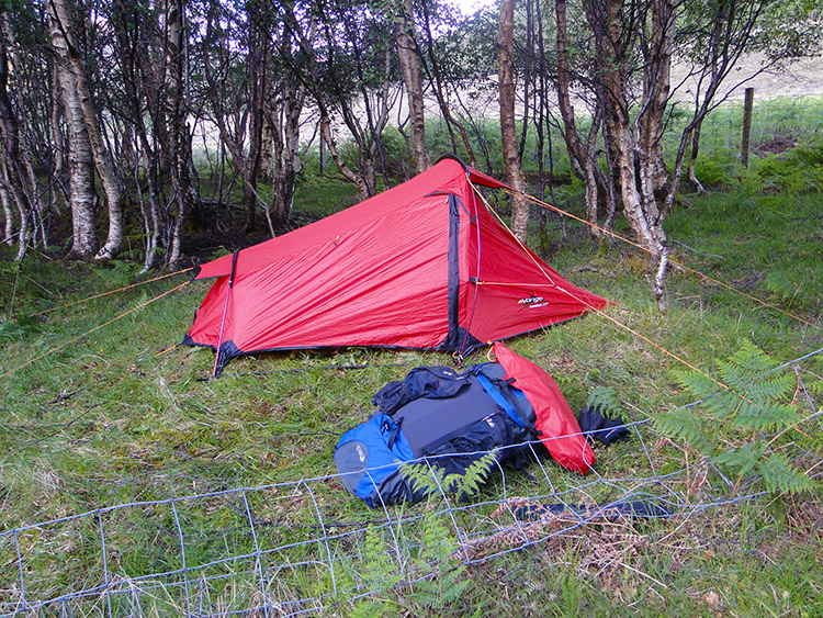 Goodnight
I followed the path alongside Allt Gleann Chaorachain and followed it upstream. I spent an hour walking up and down the path trying to find a suitable camp pitch. I was tired and with choices limited I settled on a small patch of dry ground next to the trail path. It was slightly uneven so I spent half an hour picking ferns to lay a soft bed for the tent. It worked well, I had availed myself of a natural soft mattress. When finished pitching the tent and settled in I relaxed in satisfaction with myself. I was in close quarters with An Teallach and while the light lasted I gazed out of the tent to the mountain. I imagined that after a good nights rest I would enjoy the mountain again. Despite the hard toil the day it has been spectacular. I would sleep well pleased with myself.


